Old-Maps

Vermont
Massachusetts
New Hampshire
Maine
Connecticut
New York
Rhode Island
New England
Background
News Coverage
Contact Us
Order Form
FAQ

Vermont:
State Maps
Counties:
Addison
Bennington
Caledonia
Chittenden
Franklin & Grand Isle
Orleans
Lamoille
Essex
Orange
Rutland
Washington
Windham
Windsor

Town/County Index

Bookstores
Press Releases
Articles/Research

 
Fire Insurance Maps
Click here to view the online checklist of these maps at the Library of Congress
Click here to see how to use the online checklist!

Click here to view and purchase Fire Insurance Maps of Vermont Cities!

Click here to view and purchase Fire Insurance Maps of Shelburne Falls, MA!

Click here to view and purchase Fire Insurance maps of Nantucket!
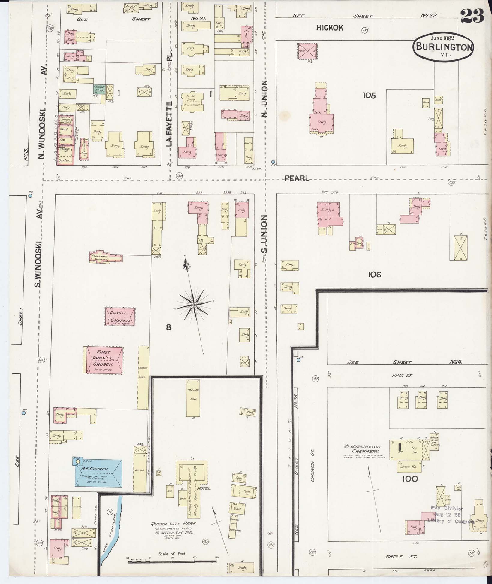
Above is a close-up of a typical fire insurance map. The colors indicate the building material. The shapes of the buildings are very accurate. We know this because the house on Lafayette Place marked "Being Built" was the college home of one of our employees!

Below is the full map of the area of Burlington, Vremont in 1889.   Click to enlarge.
To order a print from the online checklist:

Enter your print's:   
 

State:

City:

Year:

Image Number(s):

Size:


Total Price ($) Including shipping:

($28 is for one 16"x20" map + shipping,
change as needed for different sizes).

Additional description or instruction:

Prices

11"x14"   -     $12 per map + $4 s/h
16"x20"   -     $20 per map + $8 s/h
22"x26" (Approx. Original Size)  -  $30 per map + $8 s/h
38"x44"   -     $60 per map + $8 s/h

For more than one map, shipping is 1/2 extra ($2 or $4) for each additional map.

Large prints are shipped in a tube, Priority Mail. Small prints are shipped 1st Class Mail.


Revised: 03/19/19
Copyright © 2005 [Old Maps]. All rights reserved.