Historical Nautical Charts of New York
1:15,000 Scale Chart
s 113-117
St. Lawrence River
NY Nautical Home
St. Lawrence 1:30,000
Great Lakes Nautical Charts
Click here to browse our expanded collection of these charts at shop.old-maps.com!
Chart 113 - Morristown NY to Butternut Bay Ontario - 1965
Original size: 39" x 50"
click on the index above for an enlarged view
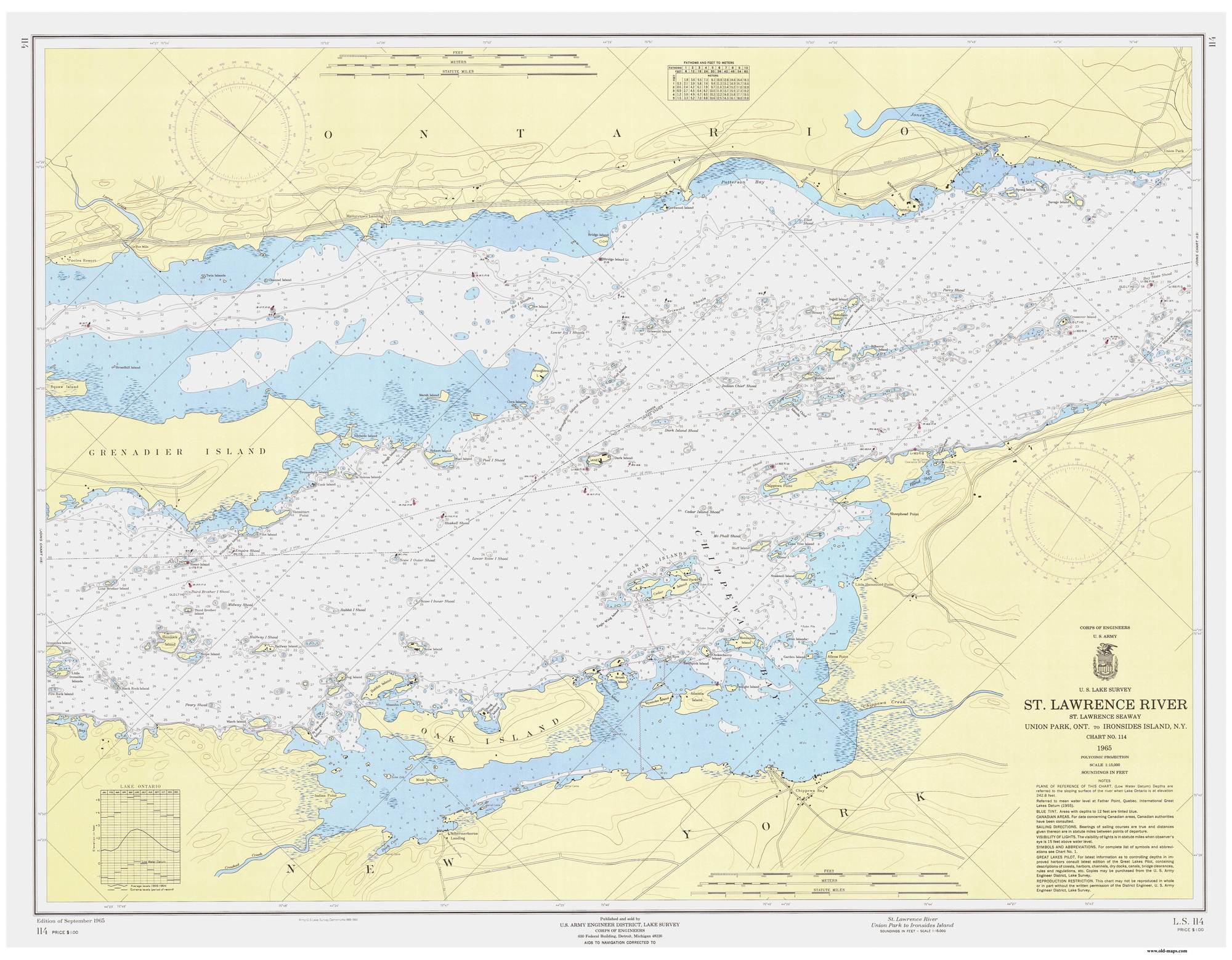
Chart 114 - Union Park Ontario to Ironsides Island NY - 1965
Original size: 39" x 50"
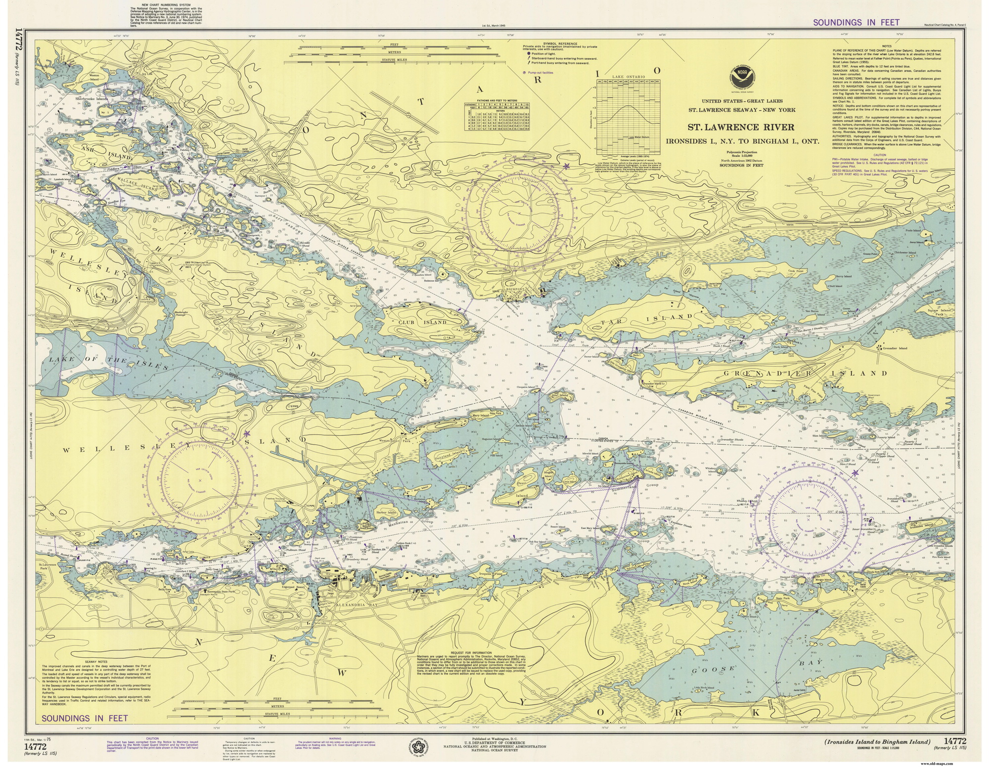
Chart 115 - Ironsides Island NY to Bingham Island Ontario - 1975
Original size: 39" x 50"
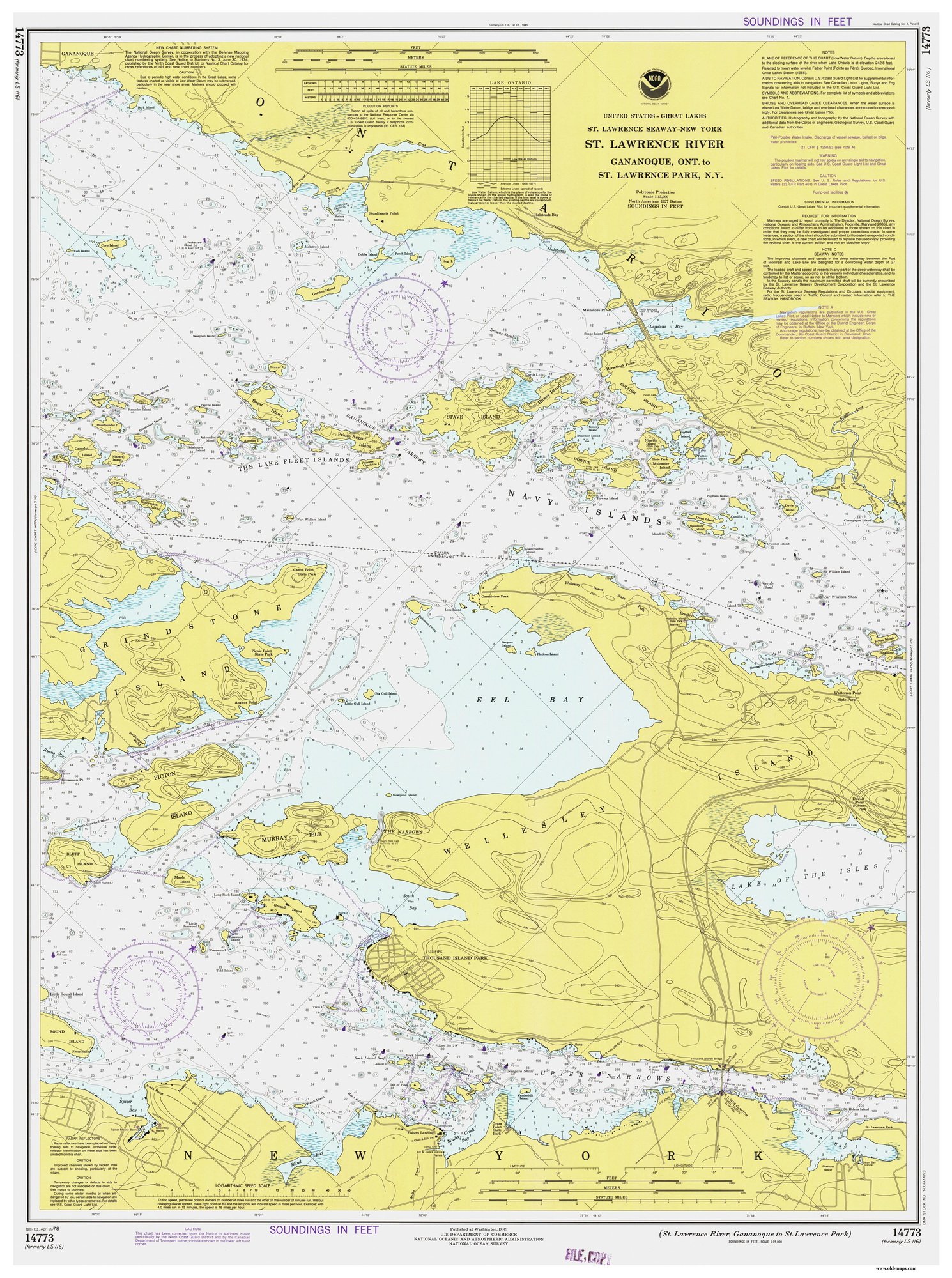
Chart 116 - Gananoque Ontario to St Lawrence Park NY - 1978
Original size: 38" x 51"
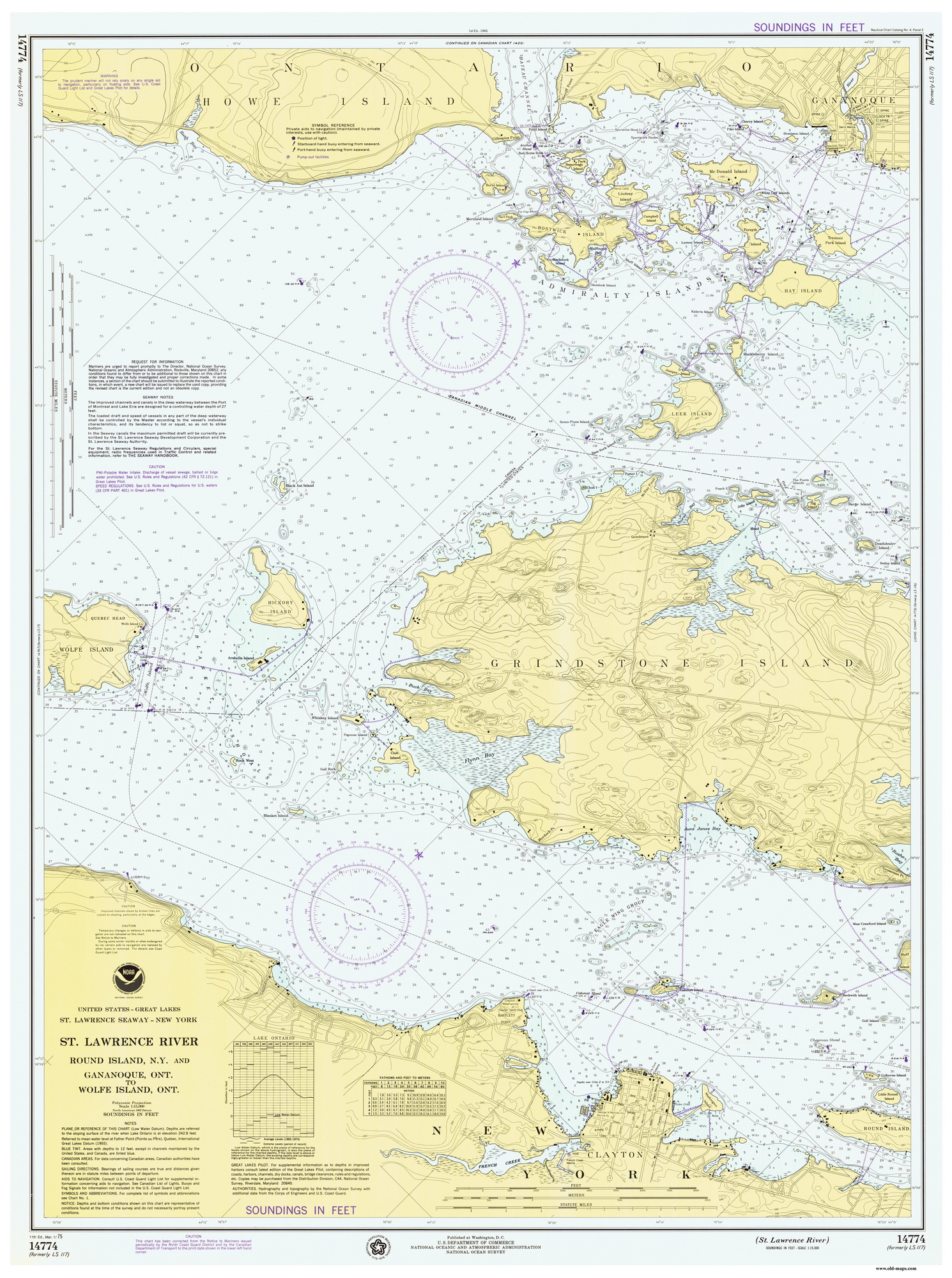
Chart 117 - Round Island NY to Wolfe Island Ontario - 1975
Original size: 38" x 51"
Revised:
Copyright © 2005 [Old Maps]. All rights reserved.