RI:
State Maps
Birds Eye Views
Counties:
Newport
Providence
|
|
|
|
Nautical Charts
of Rhode Island
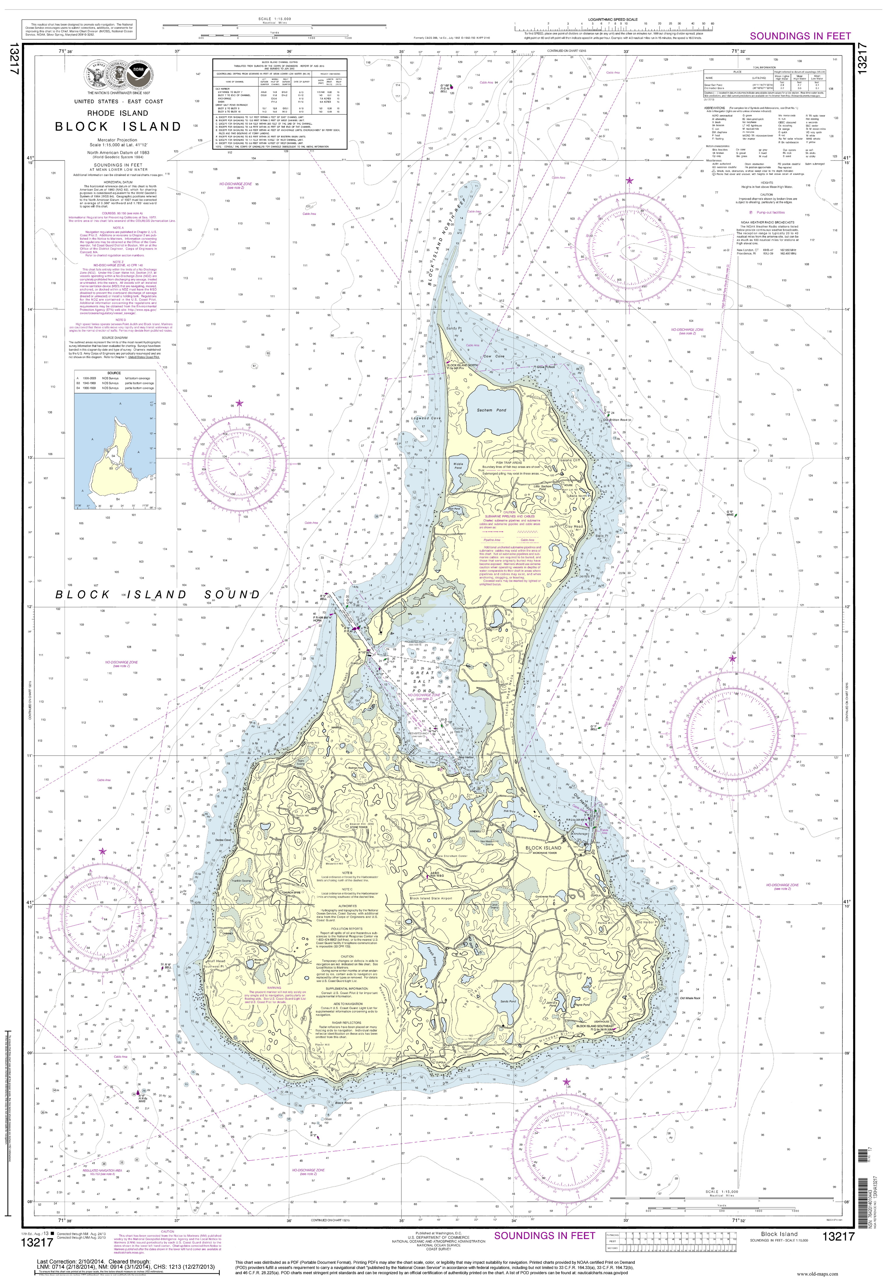
Nautical Charts of Block Island
Home
Rhode Island Nautical
Nautical Maps (Small)
|
|
All of our Rhode Island Nautical Charts are available
for viewing and purchase through our new store at
shop.old-maps.com!
|
|

|
 |
|
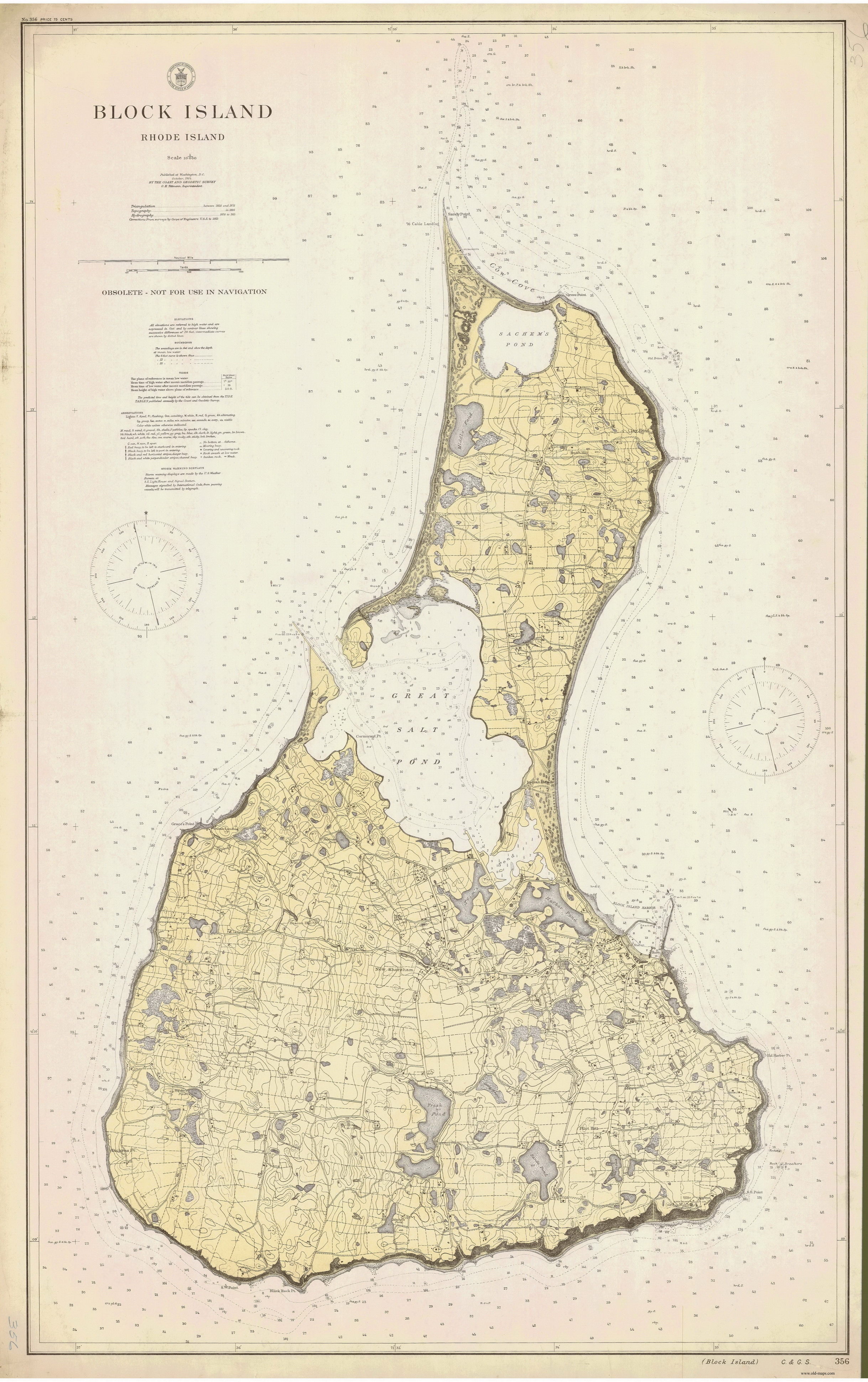
1914 - Original size 31" x 49" |
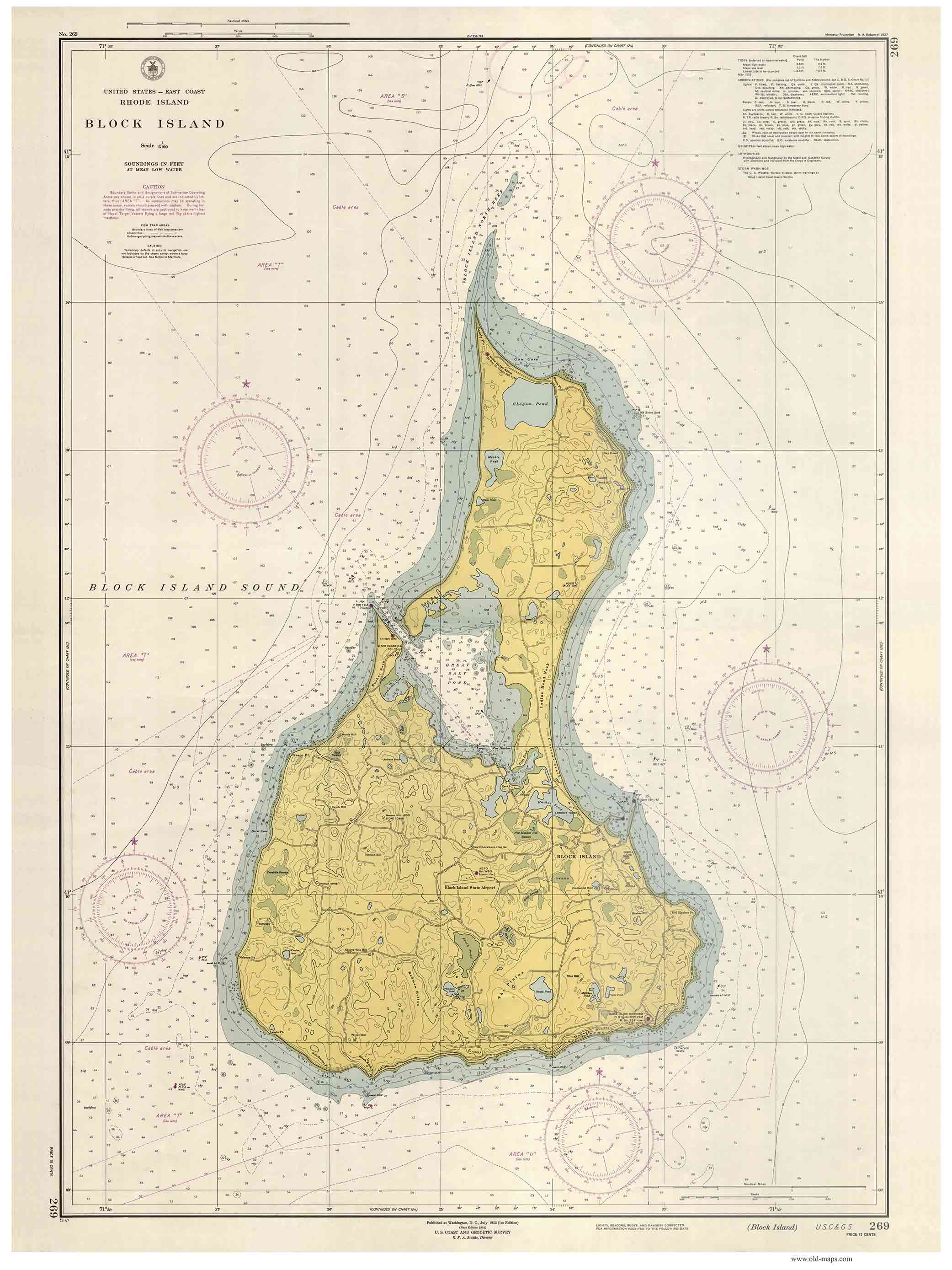
1952 - Original size 20" x 28" |
|
|
|
 |
 |
 |
|
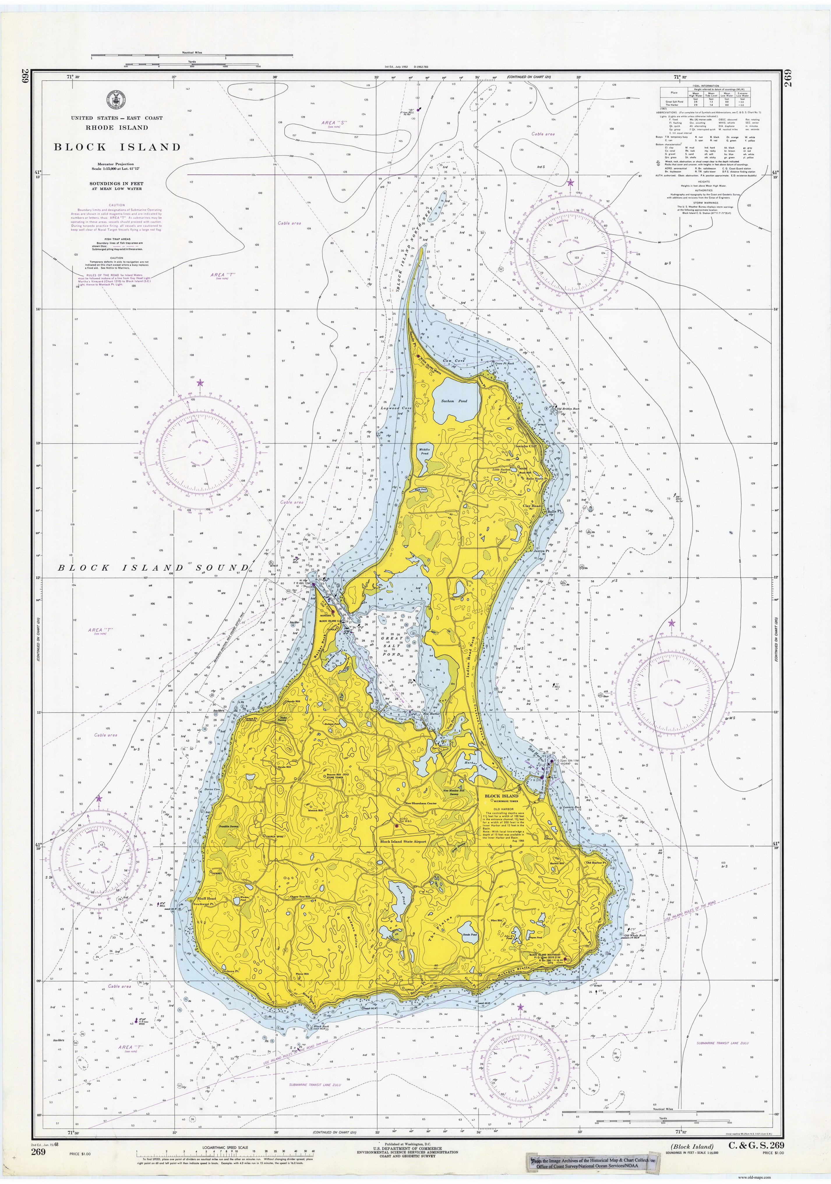
1968 - Original size 29" x 42" |
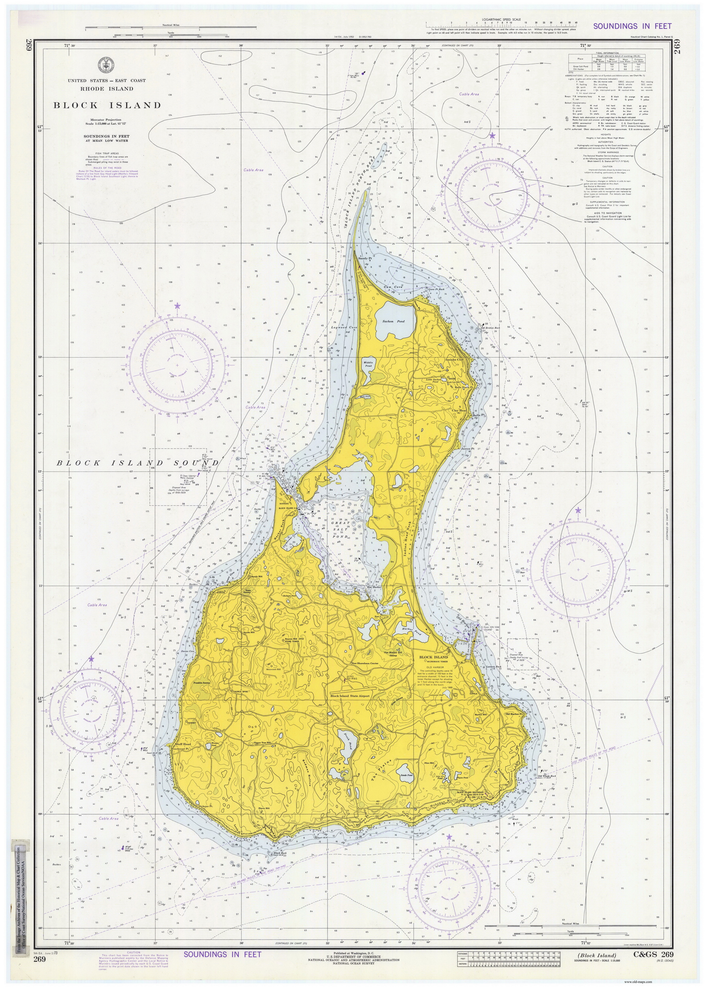
1973 - Original size 29" x 42" |
2013 Modern - Original size 29" x 42" |
|
|
|
|
|