1500 New York Town Maps now available as reprints
Reprints of more than 1500 old New York Town and village maps are now available in convenient format. These maps, taken from the large county wall maps of the 1850s, can be purchased on the web site www.old-maps.com.

“We took the county map scans from the Library of Congress, cleaned them up a bit in Photoshop, and then chopped them into separate town and village maps.” said David Allen of Chesterfield, New Hampshire, owner of the Old Maps business. “These county maps were the first detailed road maps for most of rural New York. Their special value is the locations of all the houses – with the homeowners names. But they are huge – typically 5’ x 5’ in size on wooden rollers. We are making them much easier to access.”

“We added a border and a title to each town map to make them nicer for wall-hanging.
I think these maps will be very popular once the word gets out what we have done. All the maps can be seen on-line but the town maps are “fuzzy” as I don’t want to give away my work. The village detail maps are more legible ”
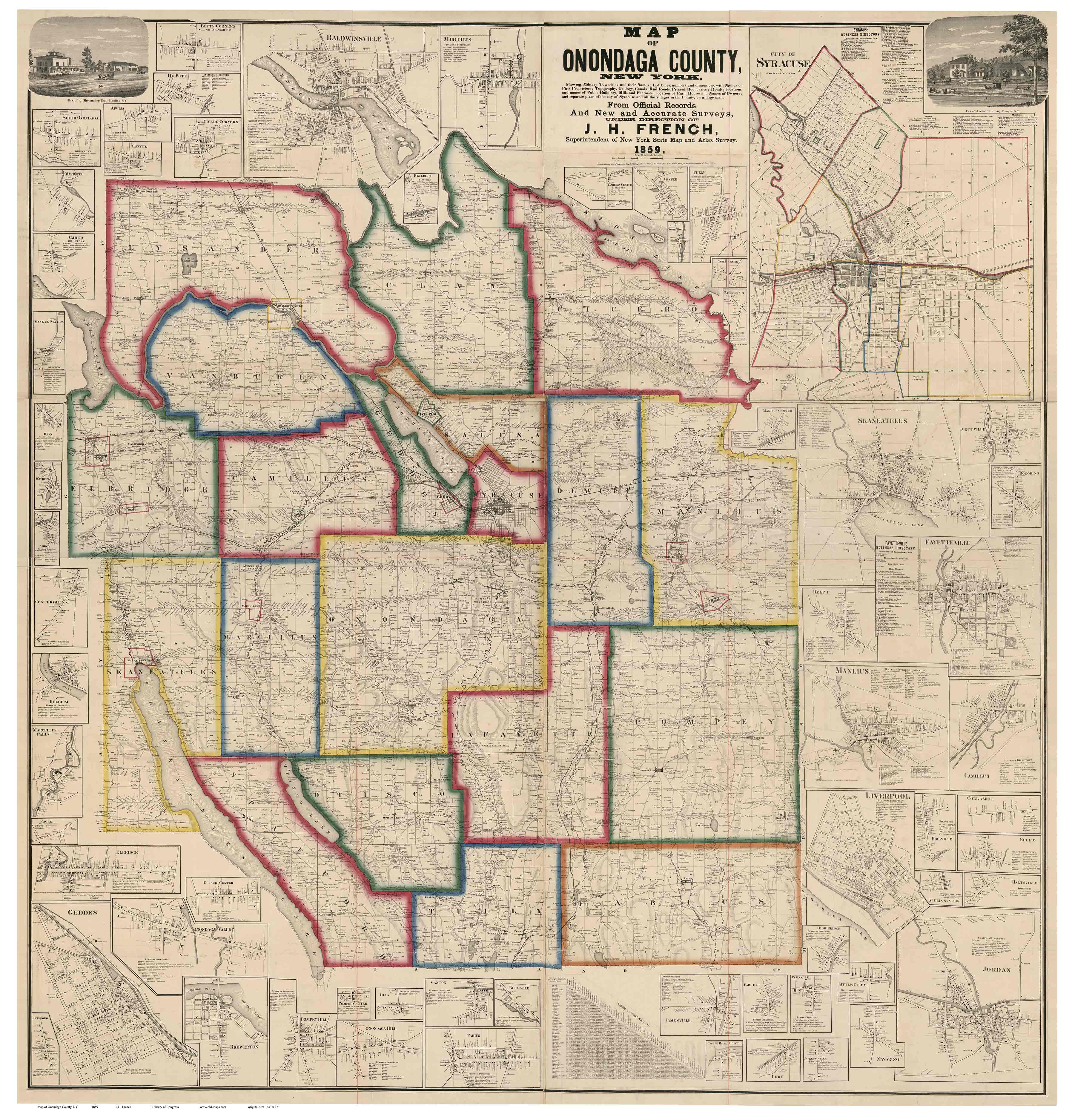
The county maps are also available for researchers in a book-like PDF format on CDROM. Large size reprints can be purchased as well.