Lake Minnetonka Minnesota – USGS Maps – 2 “New” Old maps 1907 and 1958
We have just created two “new” old topographic maps of Lake Minnetonka in Minnesota. It’s a beautiful lake, enjoyed as a summer playground for many years. It’s a short distance from the cities of St. Paul and Minneapolis.
We took portions of two original USGS sheets, matched them together and added a border and title to make attractive wall decorations.

The oldest is the 1907 map, made in the steamboat and railroad era. While older USGS maps don’t have much detail, their simplicity and “clean” look makes them quite attractive.
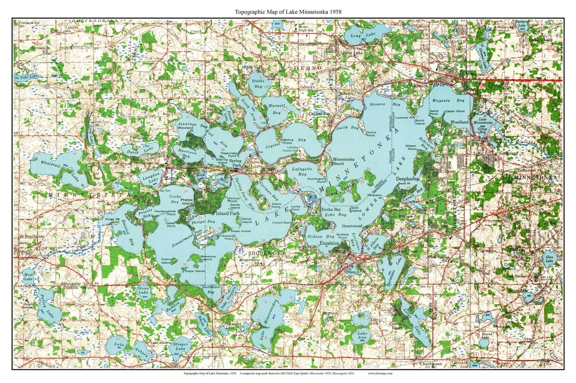
The 1958 map is much more accurate and detailed, and is richly colored.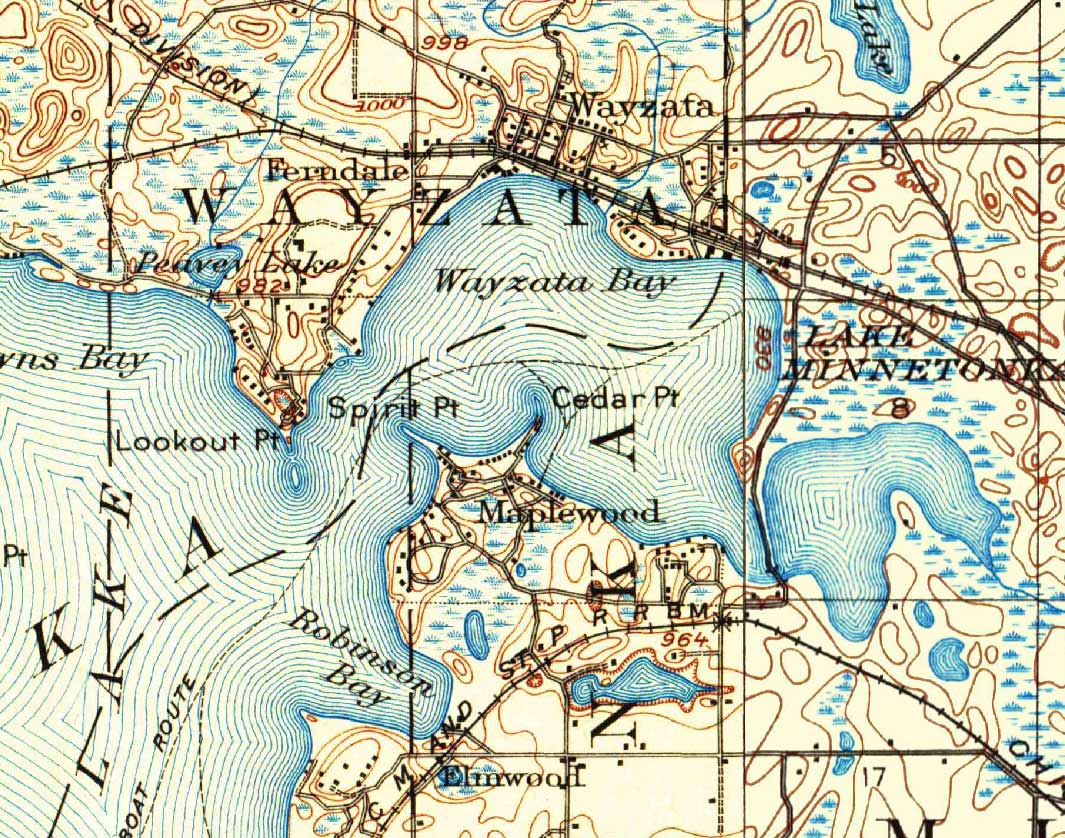
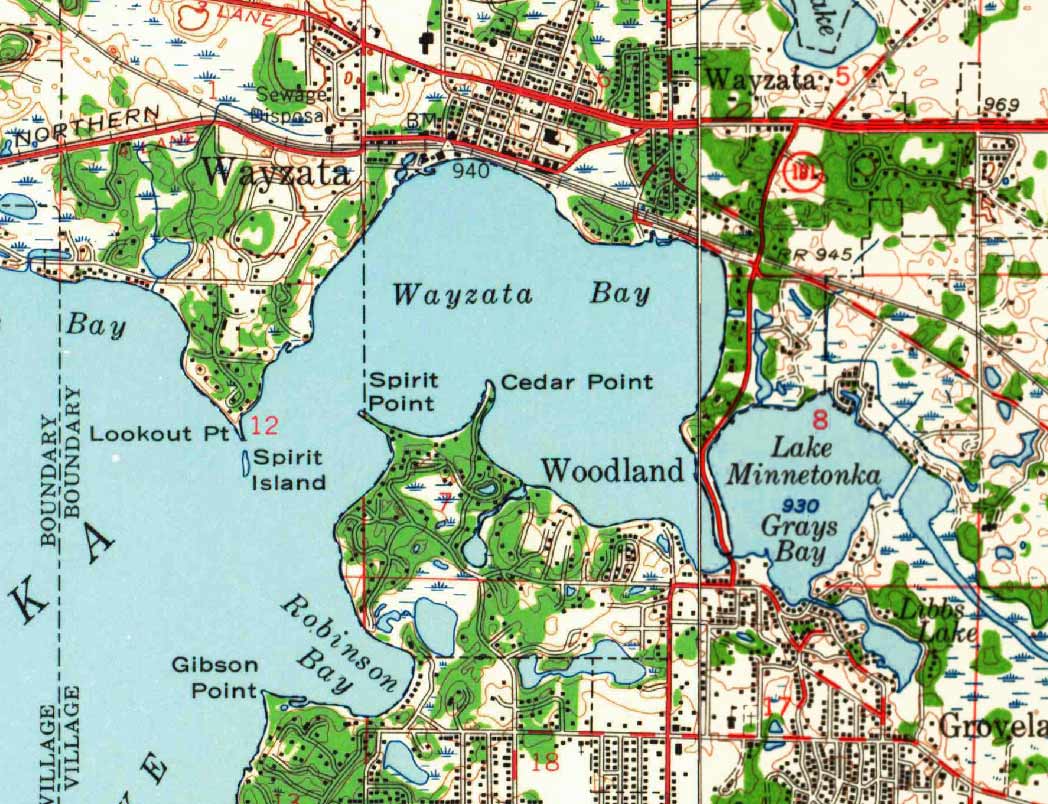
Here are 1907 and 1958 views of Wayzata Bay, the large settlement on the main road from Minneapolis.


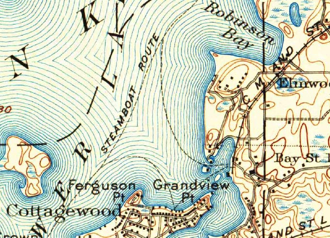
These two closeups show how a swampy lowland in 1907 has been filled and drained to make waterways for boat slips by 1958.


“Island Park” is a busy development by 1958, while in 1907 it had one barely passable dirt road an a few cottages on the lakeshore. Note that, except for Island Park, most place names are unchanged.

The busy settlement of Deephaven was just beginning in 1907. In fact it did not have its modern name when our oldest map was made. But it was a “deep haven” for steamboat visits.
Prints of these maps and other Minnesota lake topo maps can be purchased at our website shop.old-maps.com.
We also have several other historical maps of Lake Minnetonka.