Hawaii Volcano Eruptions on an Old Map
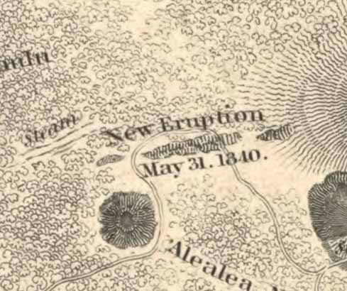
Volcanoes in Hawaii erupted in 1840 just before an United States “Exploring Expedition” was to map the islands.

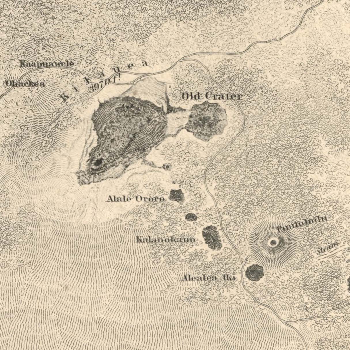
An 1841 map “shewing the craters and eruption” was the result. Note that Hawaii was part of the Sandwich Islands at the time.

Mt. Kilauea is shown with nearby craters labeled; it just exploded again in 2018,
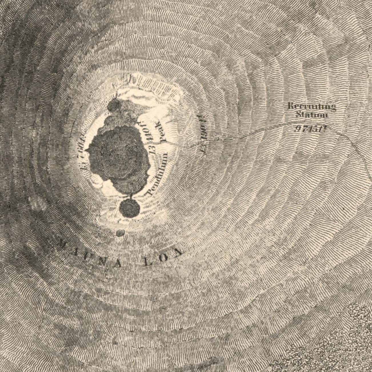
The crater of Mauna Loa is shown with its elevations of over 13,000 ft. Note the “Recruiting Station” which is a camp for climbers to recover from altitude sickness halfway up the mountain.

We offer prints of this map and the other maps from the 1841 Exploring Expedition at shop.old-maps.com.