CT stateRevised: 02/22/17

Old-Maps


Vermont
New Hampshire
Massachusetts
Maine
Connecticut
Rhode Island
New England

New York
New Jersey
Pennsylvania
Delaware
Maryland
Washington DC


Background
News Coverage
Contact Us
Order Form
FAQ


Map of Fairfield County
Connecticut
1856   WALL MAP REPRINT
Home        Town Maps       CDROM

Click here to purchase this map through our store at shop.old-maps.com
Map of Fairfield County 1856

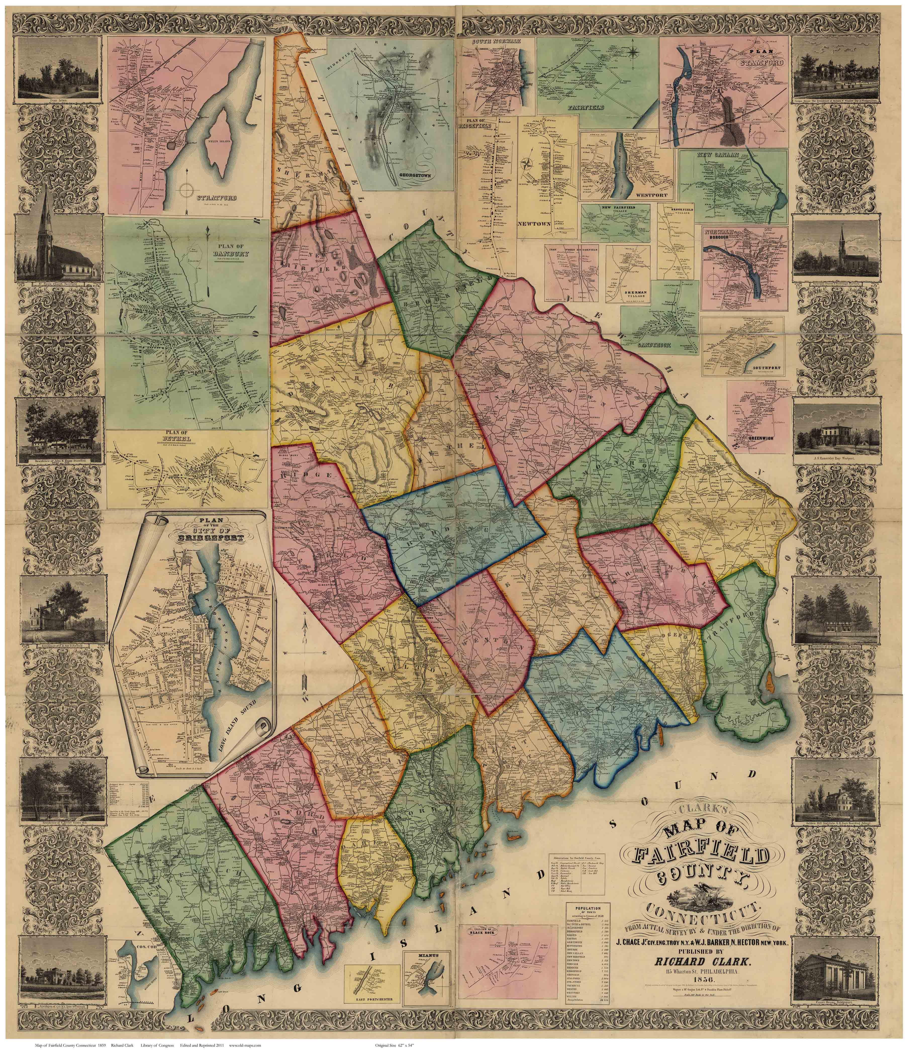
Featuring these Fairfield County Towns:  
BETHEL FAIRFIELD NEWTOWN STRATFORD
BRIDGEPORT GREENWICH NORWALK TRUMBULL
BROOKFIELD HUNTINGTON REDDING WESTON
DANBURY MONROE RIDGEFIELD WESTPORT
DARIEN NEW CANAAN SHERMAN WILTON
EASTON NEW FAIRFIELD STAMFORD  


Contents of the Wall Map
Wall Map of Fairfield County 1856
Click the above image to see it enlarged.
(Original from Library of Congress, Geography and Map Division)
The 1856 "Map of Fairfield County, Connecticut" is available as a reproduction print in multiple sizes.

Original size: 54"x 63"   Some text will be hard to read or illegible at the smaller sizes.


Copyright © 2010 [Old Maps]. All rights reserved.