|
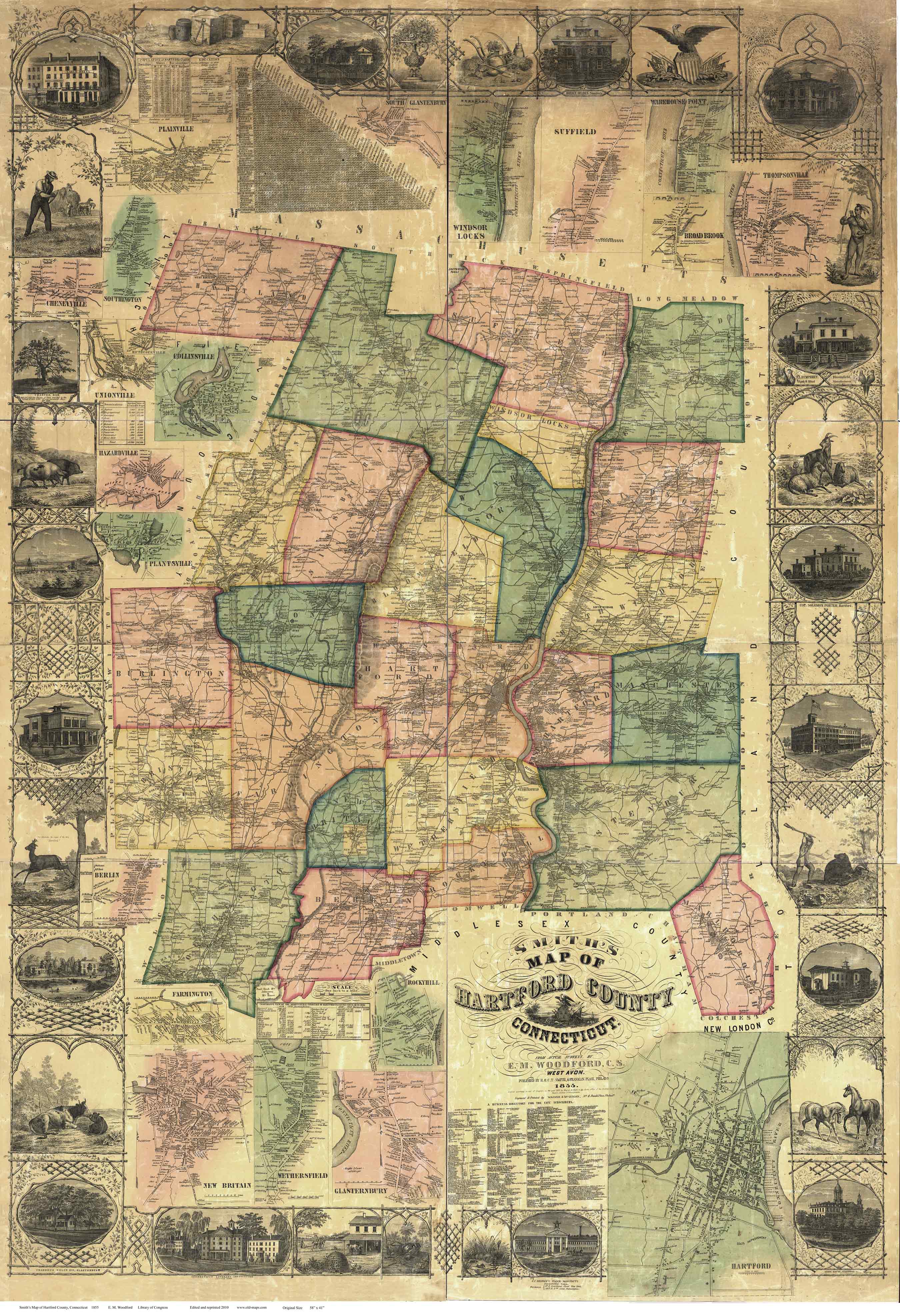
Map of Hartford County
Connecticut
1855 WALL MAP REPRINT
Home
Town Maps
CDROM |
This map
is available as a reproduction print in mulitple sizes.
Original size: 42" x 59" |
|
Click here
to purchase this map through our store at shop.old-maps.com |
Click the image to see a larger view.
(Original from Library of Congress, Geography
and Map Division. We have edited the image to improve the appearance)
Contents of the Wall Map
Background Info |
 |
Towns in 1855:
|
|
AVON |
FARMINGTON |
ROCKY HILL |
|
BERLIN |
GLASTENBURY |
SIMSBURY |
|
BLOOMFIELD |
GRANBY |
SOUTH WINDSOR |
|
BRISTOL |
HARTFORD |
SOUTHINGTON |
|
BURLINGTON |
HARTLAND |
SUFFIELD |
|
CANTON |
MANCHESTER |
WEST HARTFORD |
|
EAST HARTFORD |
MARLBOROUGH |
WETHERSFIELD |
|
EAST WINDSOR |
NEW BRITAIN |
WINDSOR |
|
ENFIELD |
|
WINDSOR LOCKS |
|
 Revised:
02/22/17
Revised:
02/22/17