|
Old Topographical Maps
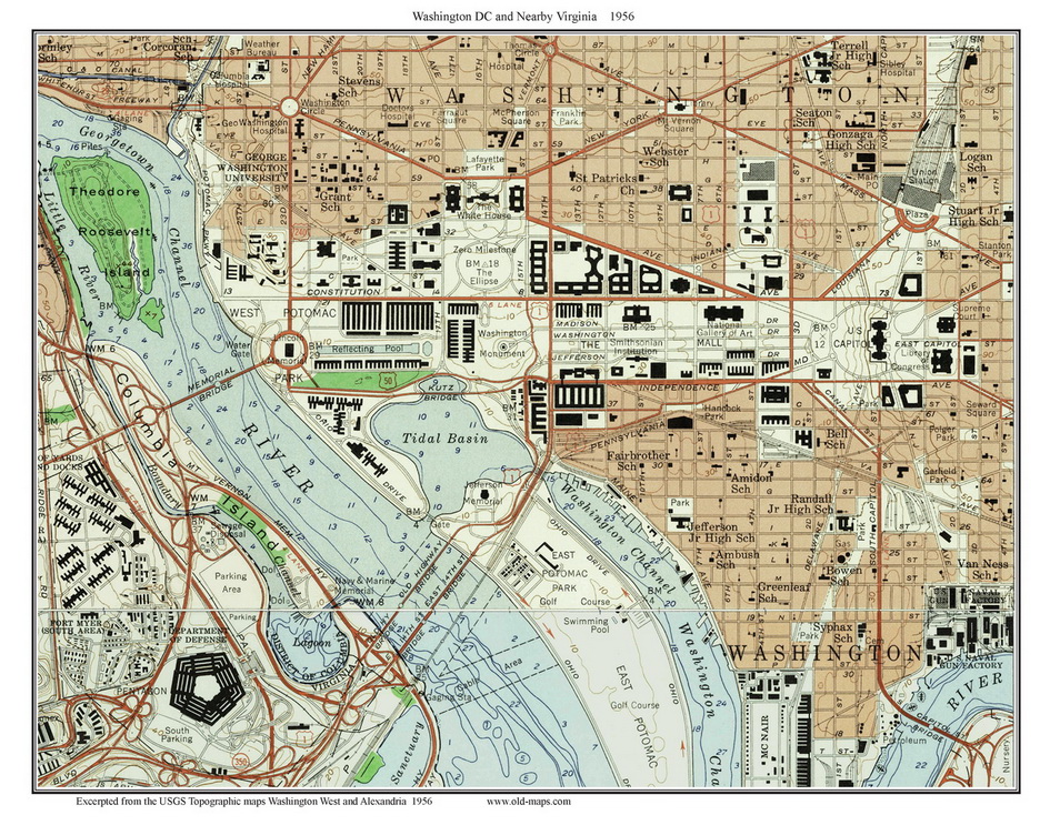
Downtown Washington D.C.
1965 - 1956 - 1951 - 1945 - 1900
A set of same-size views of downtown Washington DC and nearby
Virginia.
The maps cover from the Pentagon and the
Washington Navy Yard on the south to the White House and Union
Station on the north.
To see more, click on a map.
We have
added these and many more Custom Topo Maps of DC and Maryland to
our new store at shop.old-maps.com
Click here to browse the collection!
Home DC
Topos main page
Contact
us by email if you
need help. |