Vermont: State Maps Counties: Addison Bennington Caledonia Chittenden Franklin & Grand Isle Orleans Lamoille Essex Orange Rutland Washington Windham Windsor Town/County Index Bookstores Press Releases Articles/Research
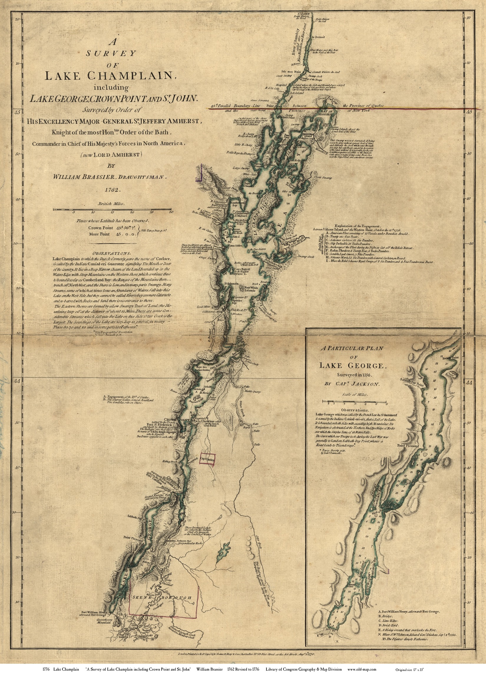
Lake Champlain & Lake George 1776 "Brassier" Map, with Lake George Inset
Back to more maps of Lake Champlain
This map was originally an 18" by 24" wall map, and we are offering it as an inkjet reproduction on heavy matte paper in multiple sizes.
Revised: 08/21/17 Copyright © 2005 [Old Maps]. All rights reserved.