Old-Maps

Vermont
Massachusetts
New Hampshire
Maine
Connecticut
New York
Rhode Island
New England
About Us
News Coverage
Contact Us
Order Form
FAQ

Masschusetts:
State Maps
Counties:
Barnstable, Dukes & Nantucket
Berkshire
Bristol
Essex
Franklin

Hampden
Hampshire
Middlesex
Norfolk
Suffolk
Plymouth
Worcester


Barnstable, Dukes & Nantucket Counties    
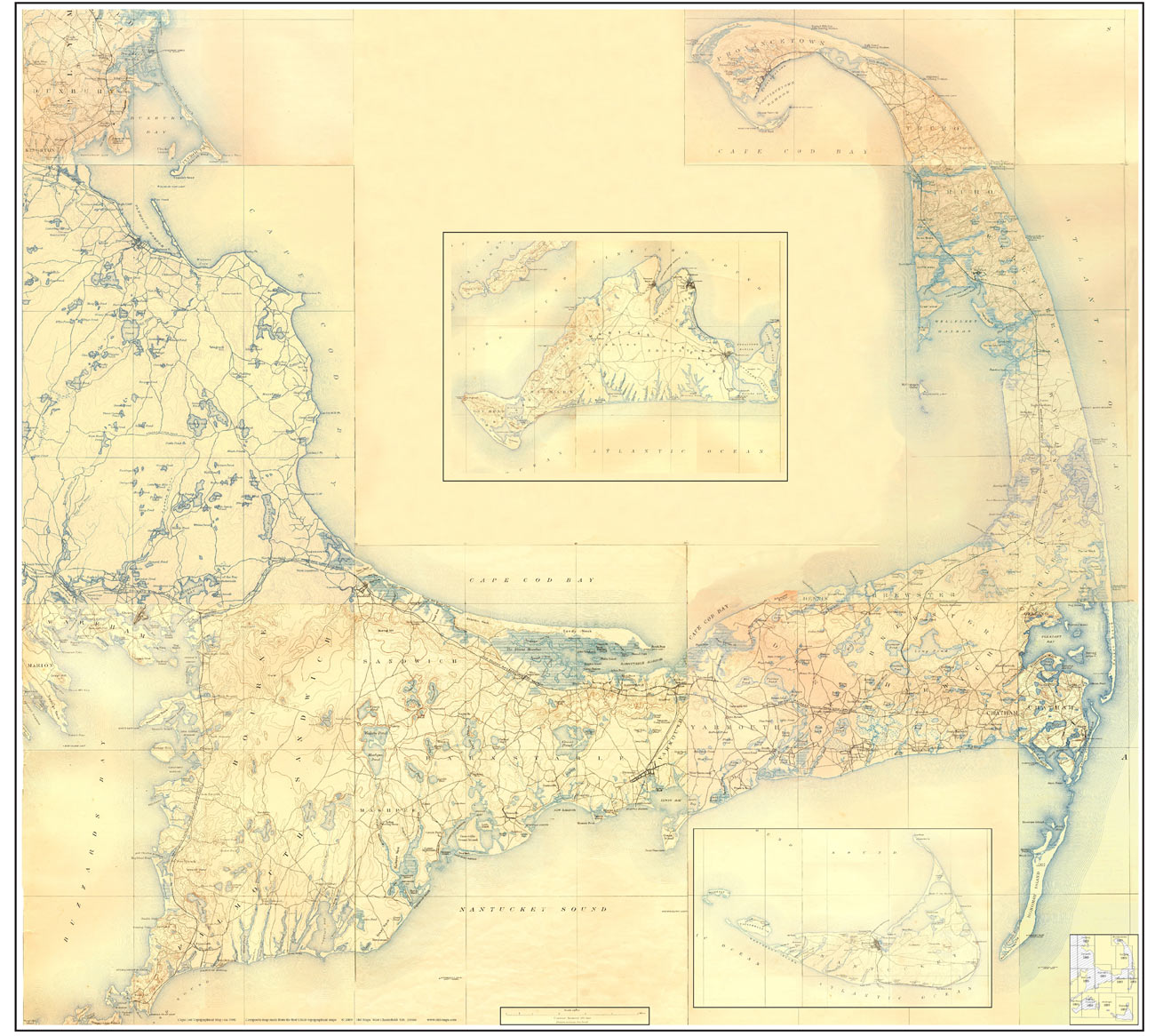
1890s Topographic Map of Cape Cod
and the Islands
A composite map made from 12 old USGS Topographic Maps

Available in 2 sizes:        24" x 27" - $30                 36" x 40" - $40
The laminated maps will not need framing-great for summer cottages.
To see a low-res copy of this map, click here.
The old topo maps show every road and all principal buildings, as well as lakes, rivers, railroads and elevations.  These maps were made before the Cape Cod Canal, as seen in the excerpt below.

These wall map reprints are made from 12 original old USGS topographical maps.  8 maps make up Cape Cod, and 2 maps each comprise Nantucket and Martha's Vineyard.

Separate Prints of the old USGS Maps are available here
 

1890s Cape Cod Topographical Map    Small 24" x 27"       $30.00  +  $8  s/h
Lettering is very small. You will not be able to read the smallest text

==========================================================

1890s Cape Cod Topographical Map LAMINATED  Small 24" x 27"       $60.00  +  $8  s/h
Lettering is very small. You will not be able to read the smallest text

==========================================================

1890s Cape Cod Topo Map LARGE    36" x 40"       $40.00  +  $8  s/h
 

==========================================================

1890s Cape Cod Topo Map LAMINATED LARGE    36" x 40"       $80.00  +  $8  s/h
 

==========================================================


Revised: 09/23/11
Copyright © 2005 [Old Maps]. All rights reserved.