|


Masschusetts:
State Maps
Counties:
Barnstable, Dukes & Nantucket
Berkshire
Bristol
Essex
Franklin
Hampden
Hampshire
Middlesex
Norfolk
Suffolk
Plymouth
Worcester
|
|
|
|
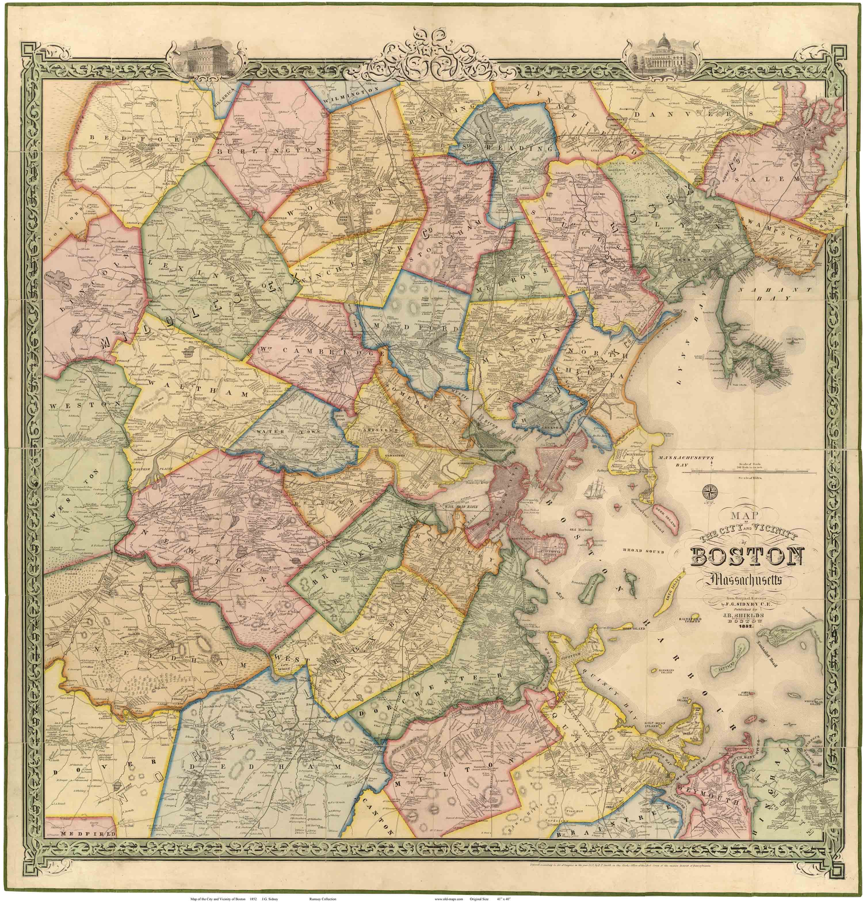
Boston Vicinity 1852
Wall Map Reprint
Boston 1852 CDROM |
|
Map
of City & Vicinity of Boston,
Massachusetts, 1852, is available
here
as a paper reprint. This magnificent wall map shows roads and identifies each house and business
by name. |
|
Click here
to purchase this map through our store at shop.old-maps.com |
|

click on image for a more detailed view original
size 40" x 41"
We have edited the original map
from the
Rumsey Collection by removing the large seams to make a
very
attractive map of the Boston area 160 years ago.
|
|
|
|
|
|