|


Masschusetts:
State Maps
Counties:
Barnstable, Dukes & Nantucket
Berkshire
Bristol
Essex
Franklin
Hampden
Hampshire
Middlesex
Norfolk
Suffolk
Plymouth
Worcester
|
|
|
|
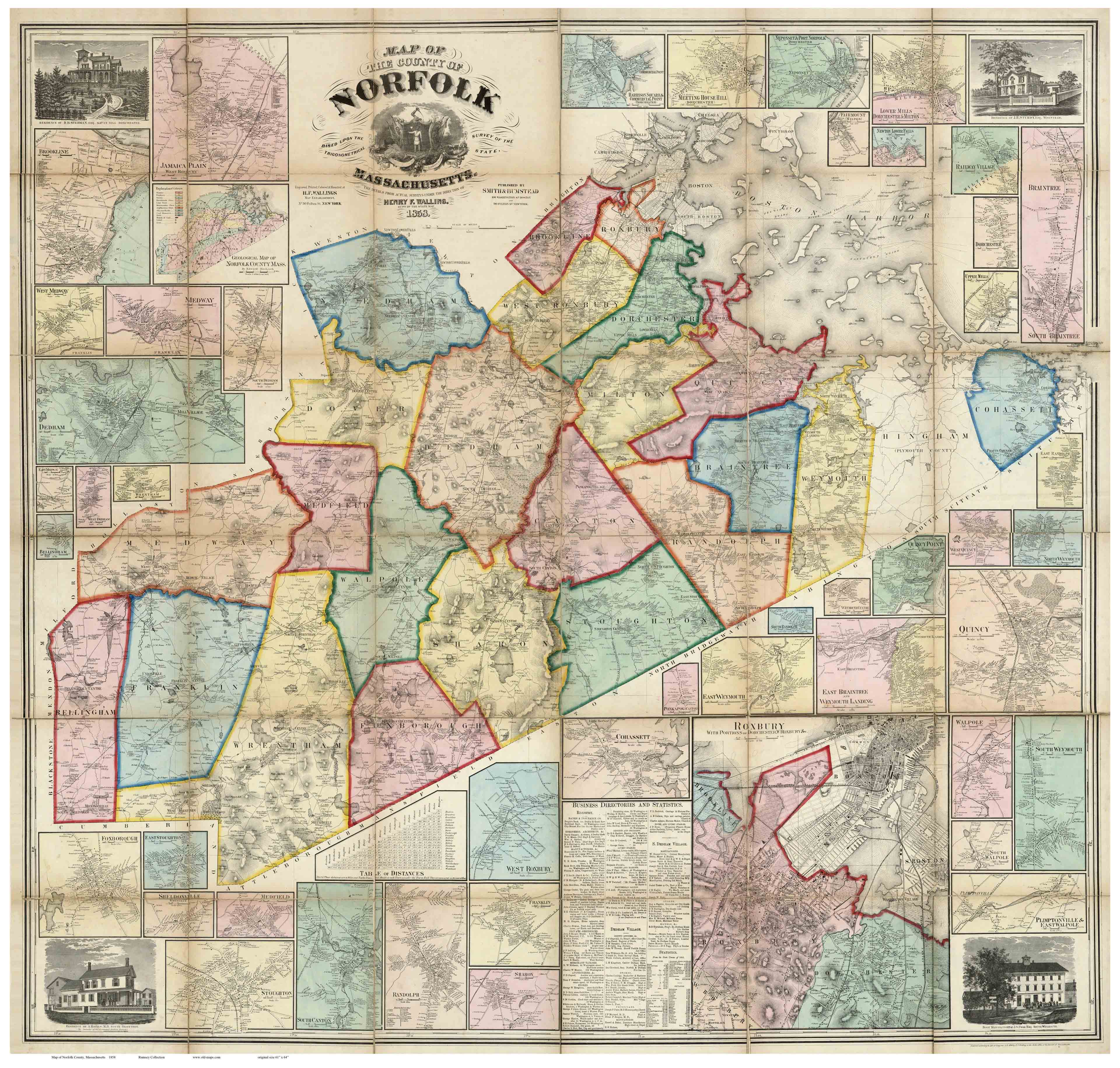
Norfolk County, Massachusetts 1858
Wall Map Reprint
NorfolkCo
CDROM
Town Prints |
|
The Map of Norfolk County, Massachusetts 1858, is now available
as a paper reprint. This magnificent wall map shows roads and identifies each house and business name. |
|
Click here
to purchase this map through our store at shop.old-maps.com |
|

The original 1858 "Map of Norfolk County" is a large
wall map, measuring 61" x 64".
Click Here
to see a low resolution copy of this map. (1 meg JPEG)
|
We offer reprints in several sizes. Some text will be hard to read
or illegible
at the smaller sizes, but the map still makes an
attractive wall display |
|
|
|
|
|