|


Masschusetts:
State Maps
Counties:
Barnstable, Dukes & Nantucket
Berkshire
Bristol
Essex
Franklin
Hampden
Hampshire
Middlesex
Norfolk
Suffolk
Plymouth
Worcester
|
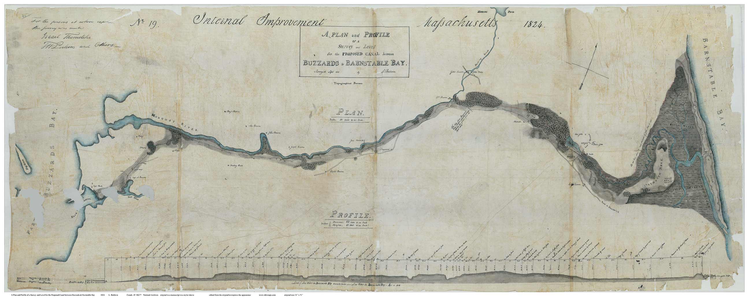
Old Map of the Cape Cod Canal
1824 Baldwin
Cape Cod Canal Maps |
|
Click here
to purchase this map through our store at shop.old-maps.com |
 |
1824 Baldwin
Original size 21" x 51"
See the two details below:
|
|
The surveying for this important early map was completed in 1818,
but the map was not drwan until 1824. Our image is from an
original scan made at the National Archives. We have done
minor editing to improve the appearsnce.
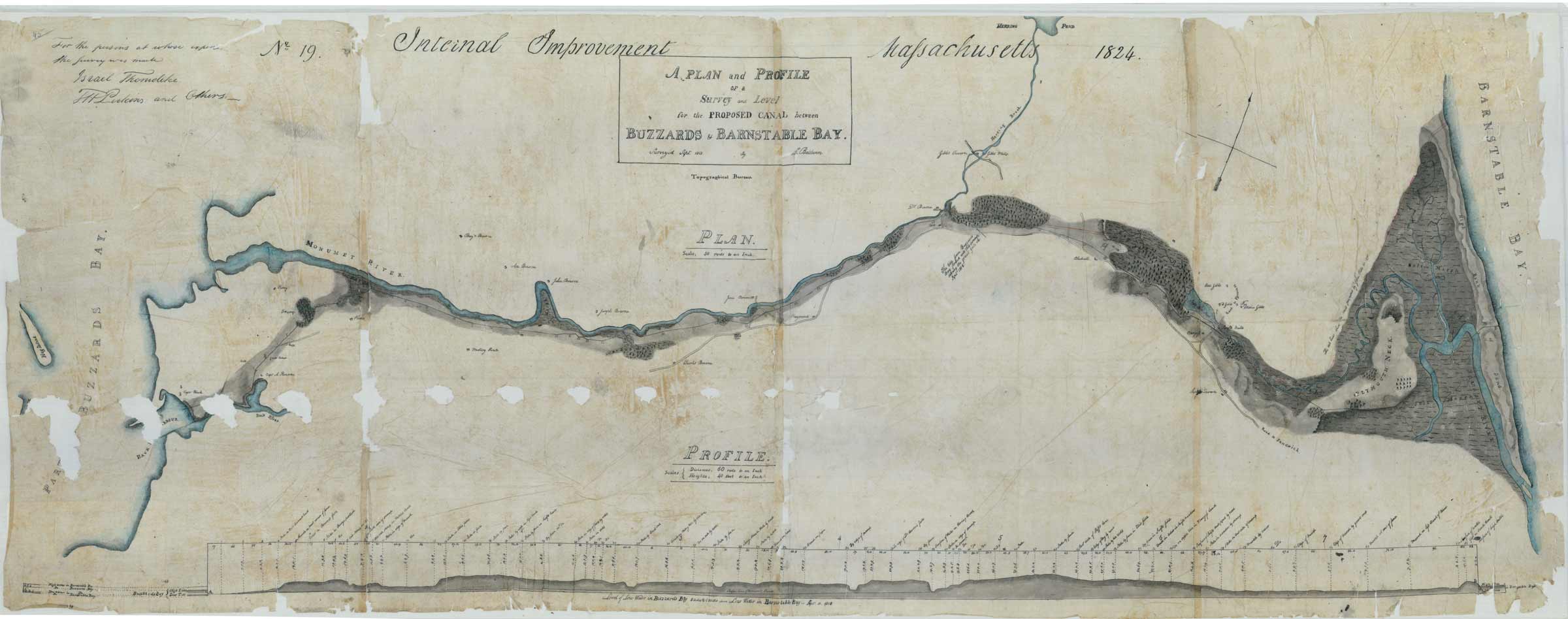
The
original 1824 Baldwin map from the Archives before editing (low
res.) |
 |
 |
Detail from the 1824 Canal
Route Map, showing a very old "Bourne Bridge".
This bridge looks to be a
private bridge (?) leading to the house of Dr. Bourne.
Manuscript from National Archives |
1824
Detail showing a mill pond and several houses on the "Road to Plymouth"
Manuscript from National Archives |
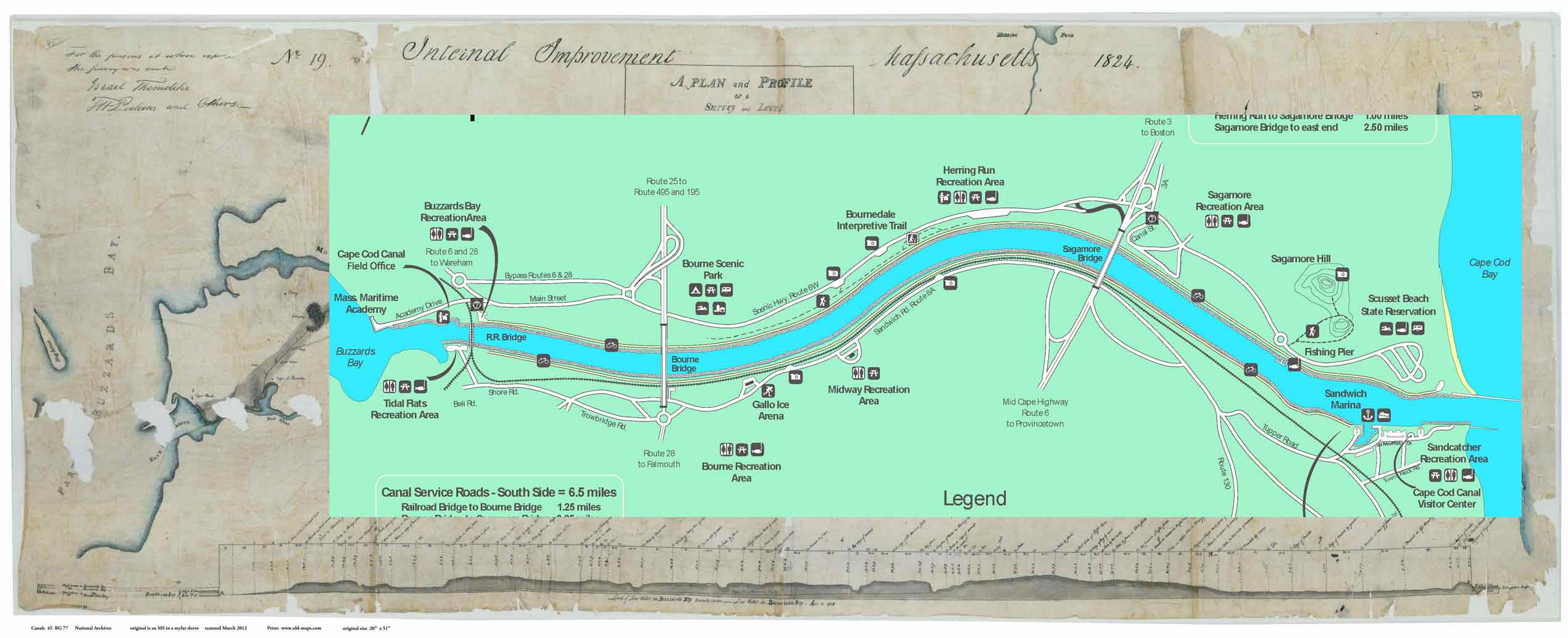 |
| Here is an overlay of a modern
recreational map of the Canal area |
| |
| |
|
|