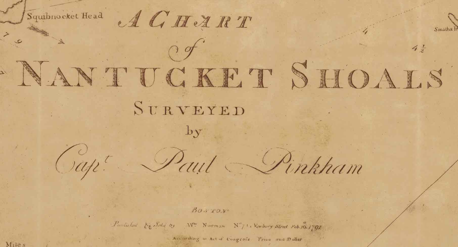
Below: "To all whom it may Concern" - which tells us
that Nantucket Shoals are "...a terror to all Navigators..."
and that this new map is very accurate (see transcript beneath the
original image) |
Below: A statement by the publisher that previous surveys of the
Nantucket Shoals were quite bad, and that this new map, based on surveys
using the new Nantucket Lighthouse, has been tested at sea, and found to
be very accuratre |
|
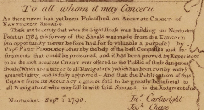
To all whom it may concern
As there never has yet been
Published an Accurate Chart of Nantucket Shoals.
These are to certify that
when the Light House was building on Nantucket Point in 1784 this survey
of the Shoals was made from the lantern (an opportunity never before had
for so valuable a purpose) by Capt. Paul Pinkham and others by the help
of the best Compasses and Instruments that could be procured, and it has
been proved by Experience to be the most accurate Chart ever offered to
the Public of those dangerous shoals,(Which are a terror to all
Navigators) which has been run by with the greatest safety, and is fully
approved and that the publication of this Chart from its Accuracy cannot
fail to be greatly beneficial to all navigators who may fall in with
said Shoals is the Judgement of us
Nantucket September 1, 1790
Jonathan Cartright
[and others]
|
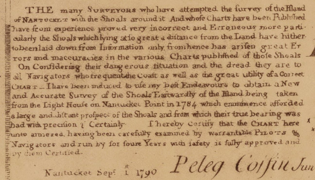
The many surveyors who have
attempted the survey of the Island of Nantucket with the Shoals around
it And whose charts have been published, have from experience proved
very incorrect and Erroneous more particularly The shoals which lying at
to great a distance from the land have hitherto been laid down from
information only from hence has arisen great errors and inaccuracies in
the various Charts published of those goals.
In considering their
dangerous situation and the dread they are to all Navigators who
frequent the coast as well as the great utility of a Correct Chart
–
I have been induced to use my best Endeavors to obtain a New and
Accurate Survey of the Shoals Easterly of the Island being taken from
the Light House on Nantucket Point in 1784 which emminence affortded a
large and ______ prospect of the Shoals and from which their true
bearing was had with precision and certainty. I hereby certify that the
Chart hereunto armored? have been carefully examined by warrantable
Pilots & Navigators and run by for four years with safety is fully
approved and by them Certified.
Nantucket September 1, 1790
Peleg Coffen Junior
|