|


Masschusetts:
State Maps
Counties:
Barnstable, Dukes & Nantucket
Berkshire
Bristol
Essex
Franklin
Hampden
Hampshire
Middlesex
Norfolk
Suffolk
Plymouth
Worcester
|
|
|
Middlesex County
- Marlborough - Framingham Area
Reproductions of old maps on paper & CDROM.
Prints for resale
are sold with rigid
cardboard backing in clear plastic sleeves.
See a text
list of Marlborough Area Maps |
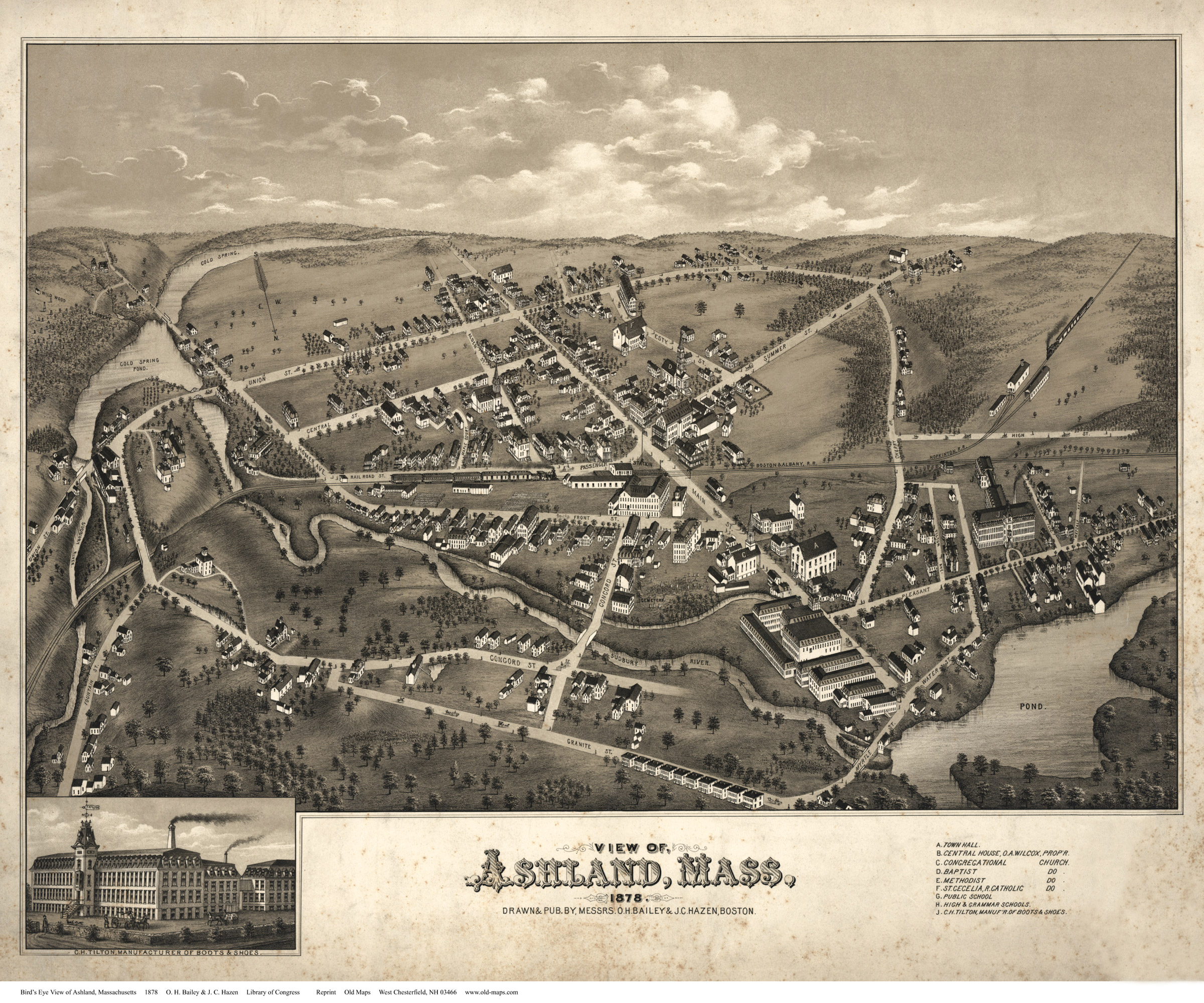
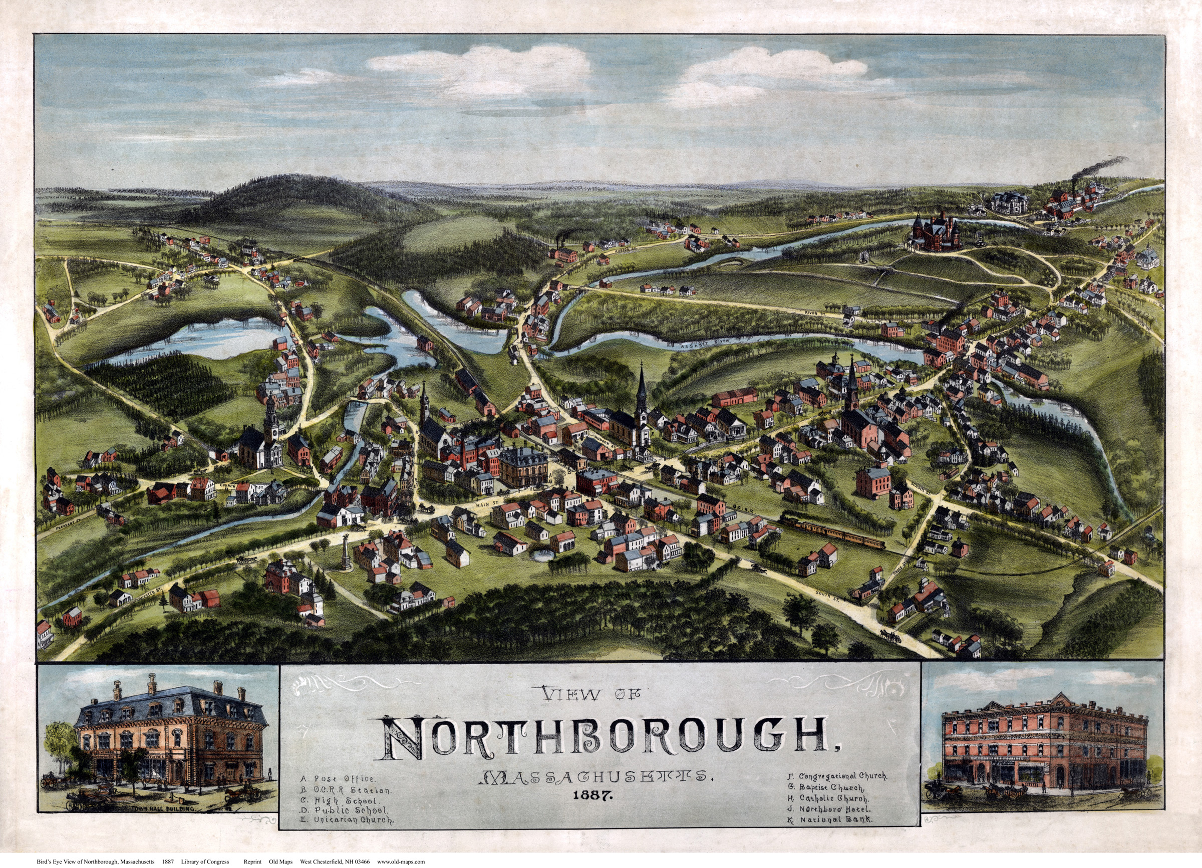
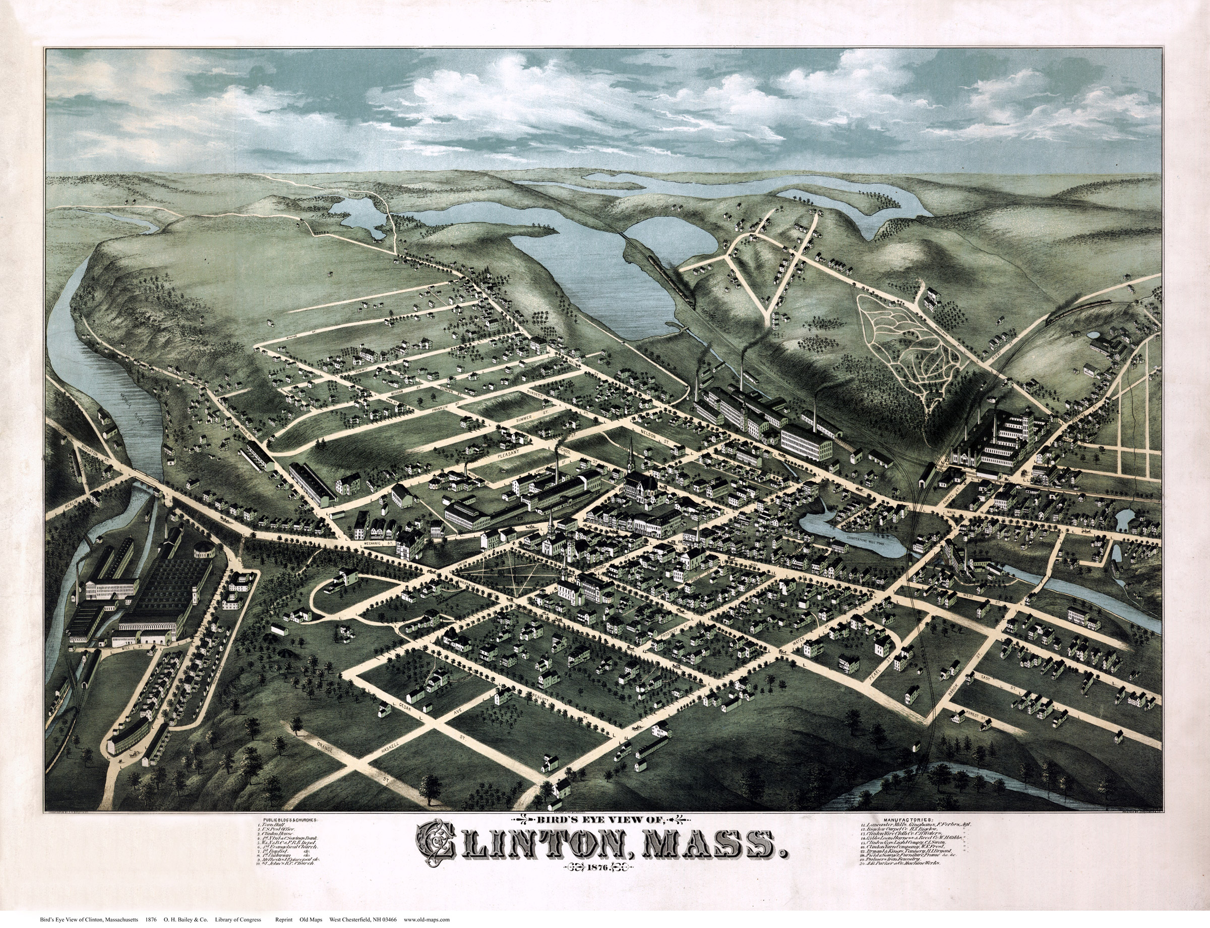
Birds Eyes
18"x24" $20
24"x36" $30
11"x17" $10 (small)
|
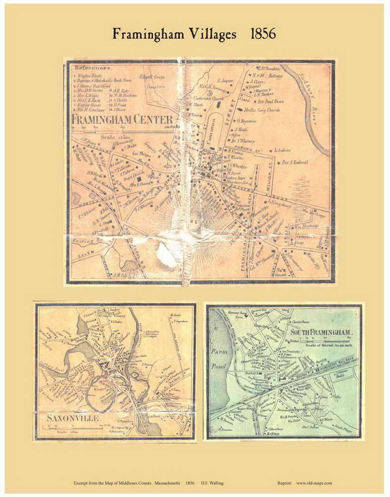
Town and Village Maps
Every house shown and named -
a few samples below
11"x14"
$10
18" x 24" $20
(or 16x20)
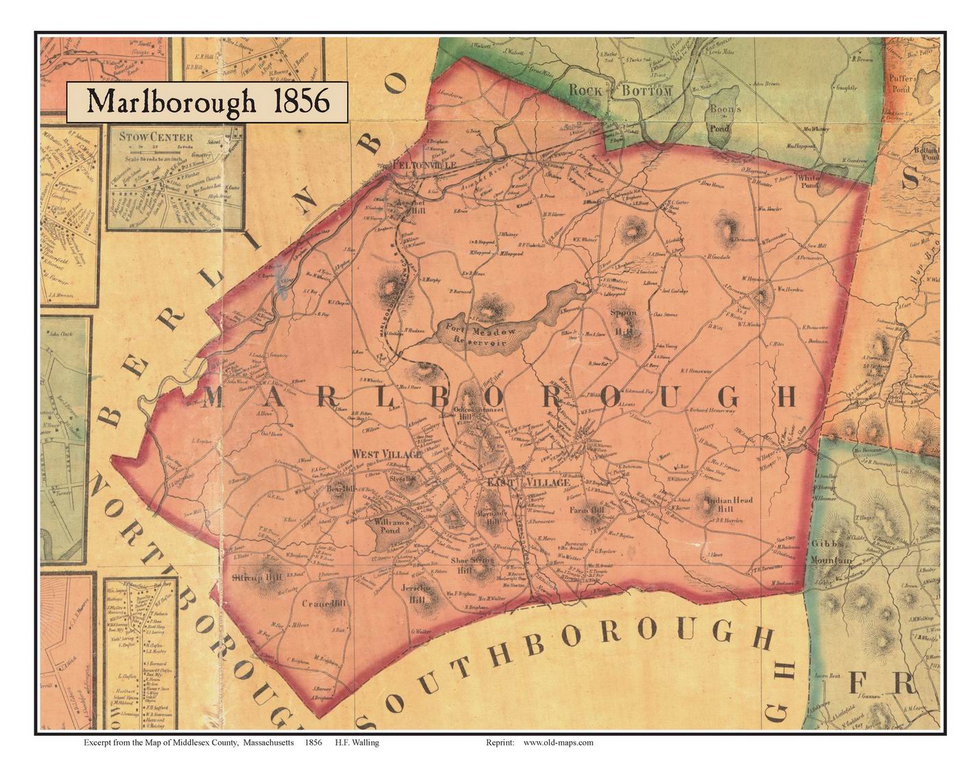
MARLBOROUGH_1856
|

Marlborough_villages
|

FRAMINGHAM_1856 |

Framingham_Vils
|
|

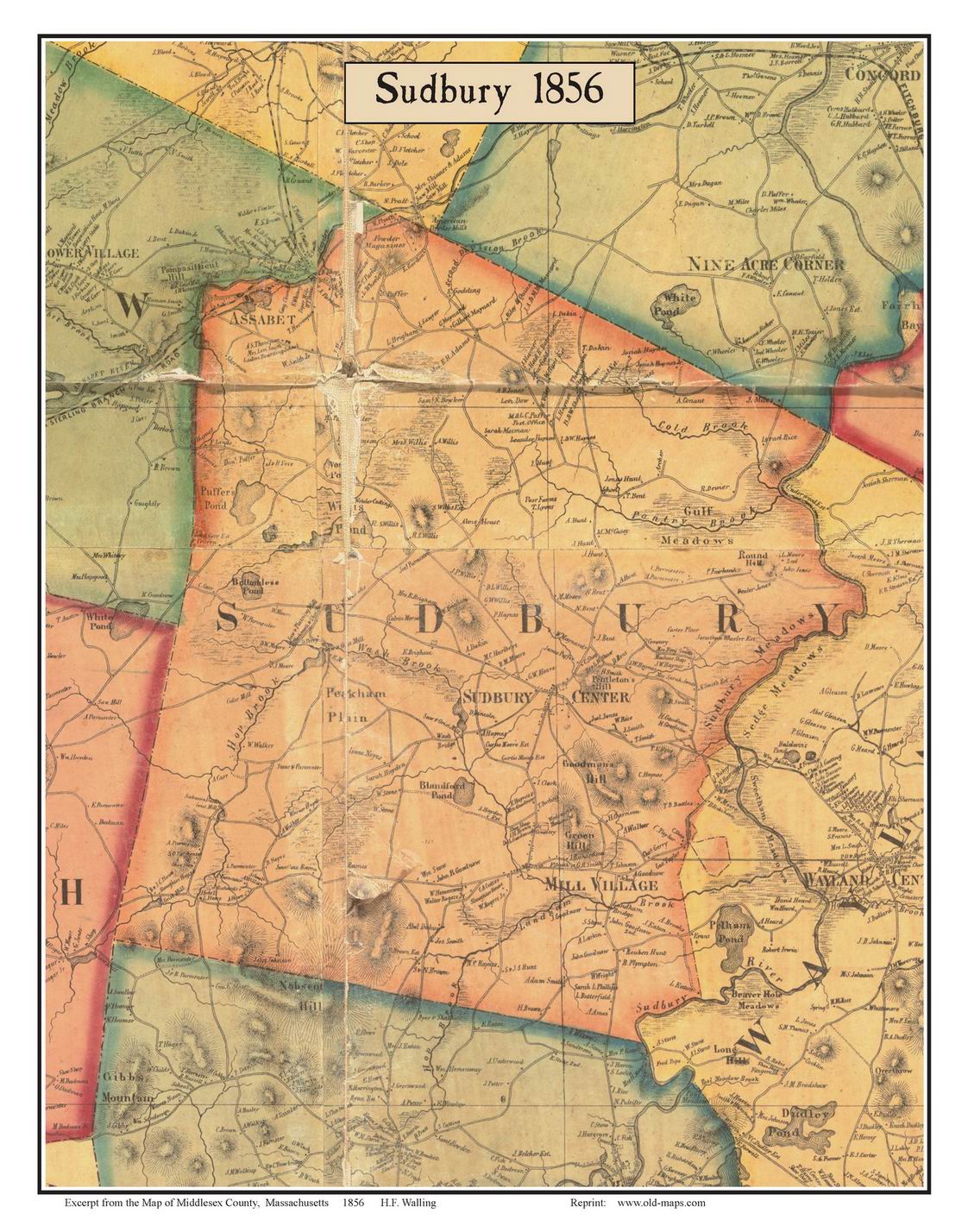
SUDBURY_1856 |
|
|
|
|

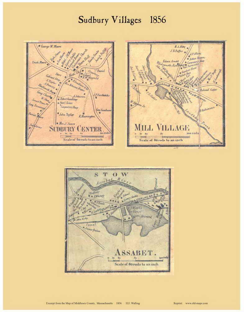
Sudbury_vils_1856 |

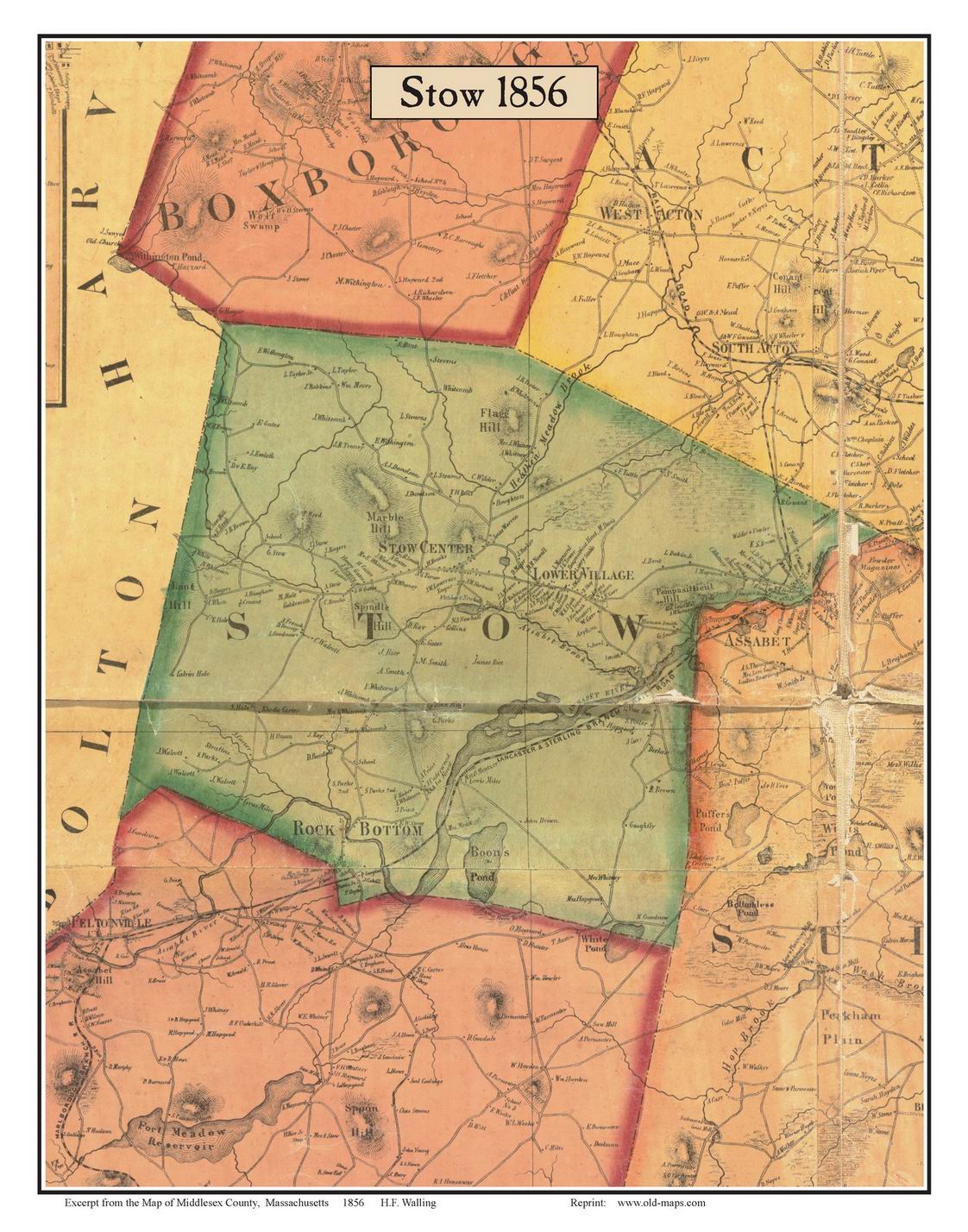
STOW_1856
|
|

Stow_vils_1856 |
Click
here for more Town Maps
|
Middlesex County Maps
/ CD
CD with
121 Town & village maps in a clickable PDF file
(from 1856 wall map) |
1856 Wall Map
All
of Middlesex County on a large wall map.
(see
also the CDROM
and the Town Maps)
|
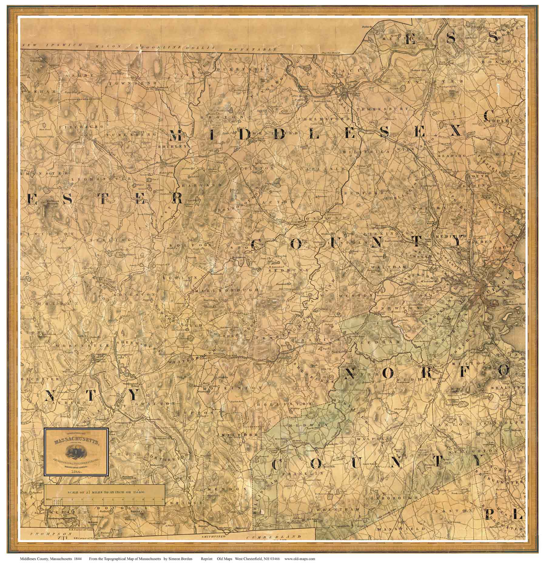
1844 Borden
State Map
All the old roads, mills, etc.
From rare state map |
 |
 |
 |
| $30 |
3' x 3' $40 |
18" x 24" $20 |
|
State Maps
11" x 14" / 11" x 17" $10
|
New England Maps
11"x14" $10

NE Paper Map Reprints
$10 11" x14"

NE
CDROM
with 30 maps |
|
|
|