Old-Maps

Vermont
Massachusetts
New Hampshire
Maine
Connecticut
New York
Rhode Island
New England
About Us
News Coverage
Contact Us
Order Form
FAQ

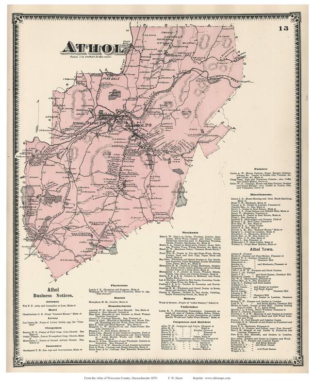
Masschusetts:
State Maps
Counties:
Barnstable, Dukes & Nantucket
Berkshire
Bristol
Essex
Franklin

Hampden
Hampshire
Middlesex
Norfolk
Suffolk
Plymouth
Worcester


1870 Town & Village Map Prints
Worcester County, Massachusetts
from the Beers Atlas


This list shows the available maps, which can be seen as thumbnails below. Click to see a low res preview image.
01_Worcester_County_1870 Dudley_1870 Mendon_1870 Spencer_1870
AshburnhamVillage_1870 EastDouglasVillage_1870 MilburyVillage_1870 Sterling_1870
Ashburnham_1870 EastTempleton_1870 MilfordVillage_1870 Sturbridge_Southbridge_1870
AtholDepot_1870_11x17 FairmountVil_Etc_1870 Milford_1870 Sutton_1870
Athol_1870 FiskdaleVillage_1870 NewBraintree_Oakham_1870 TempletonCtr_Phillips_Petersham_1870
Auburn_1870 FitchburgVillage_1870_11x17 NortboroughVillage_1870 Upton_1870
BarreVillage_1870 Fitchburg_1870 Northborough_Westborough_1870 Upton_Hopedale_1870
Barre_1870 GardnerCtr_1870 Northbridge_1870 Uxbridge_1870
BlackstonVillage_1870 Gardner_Gilbertville_1870 NorthBrookfieldVillage_1870_11x17 Warren_WestBrookfield_1870_11x17
Blackston_1870 GlobeVillage_SouthbridgeVillage_1870_11x17 NorthBrookfield_1870 WebsterVillages_1870_11x17
Bolton_Berlin_1870 GraftonVillage_1870 Oxford_1870 Webster_1870
Boylston_WestBoylston_1870 Grafton_1870 Paxton_1870 WestboroughVillage_1870
Bramanville_1870 Hardwick_1870 Phillipston_Templeton_1870 WestBoylston_Oakdale_1870
BrookfieldVillage_1870 Harvard_1870 Princeton_1870 WestBrookfieldVillage_1870
Brookfield_1870 Holden_1870 Royalston_1870 WestFitchburg_1870
Charlton_1870 Hubbardston_1870 Rutland_1870 Westminster_1870
ClintonVillage_1870_11x17 Lancaster_1870 Shrewsbury_1870 WinchendonVillage_1870_11x17
Clinton_1870 LeoministerVillage_1870 Southborough_1870 Winchendon_1870
Dana_Petersham_1870 Leominister_1870 SouthGardner_1870 Winchendon_Waterville_1870
Douglas_1870 Lunenburg_1870 SouthLancaster_etc_1870 WorcesterVillage_1870
     Worcester_1870

Type the map name and total price in the boxes below and then click "Add to Cart" to order by credit card
Questions? Contact us by email

Item Name: 

Type the name of the map you want (from above) and size:
(eg: "Webster 1870  11x17")

Total Price ($) Including shipping:

($14 is the charge for one small map + shipping
change this to $28 if you want a large map)
Additional description or instruction:

Prices
11"x14" (or 11"x17")   Color Print -    $10 per map + $4 s/h
18"x24" (sometimes 16"x24")    Color Print -      $20 per map + $8 s/h
24"x36"        Color Print -      $30 per map + $8 s/h

We offer these maps at 11" x 14"(or 11"x17")  and enlarged at 18 x24.  The enlarged size makes it easy for you and your guests to enjoy the maps as a group.  All names are legible on the smaller size. NOTE:  Several of the maps are 2-page spreads.  We recommend the 18" x 24" size for best legibility.

Large prints are shipped rolled in a tube, Priority Mail.  11"x14"(or 17") prints are shipped flat, 1st Class Mail.

If you want more than one map, the shipping is 1/2  extra ($2 or $4) for each additional map shipped.  Type in the extra maps in the Additional Description box, or just send us an email with details.


Revised: 08/12/11
Copyright © 2005 [Old Maps]. All rights reserved.