|
Massachusetts State Maps
Walling Map 1861
Color Reproduction
of the large state map
--AND-- --- Click here for smaller County Prints --- |
|

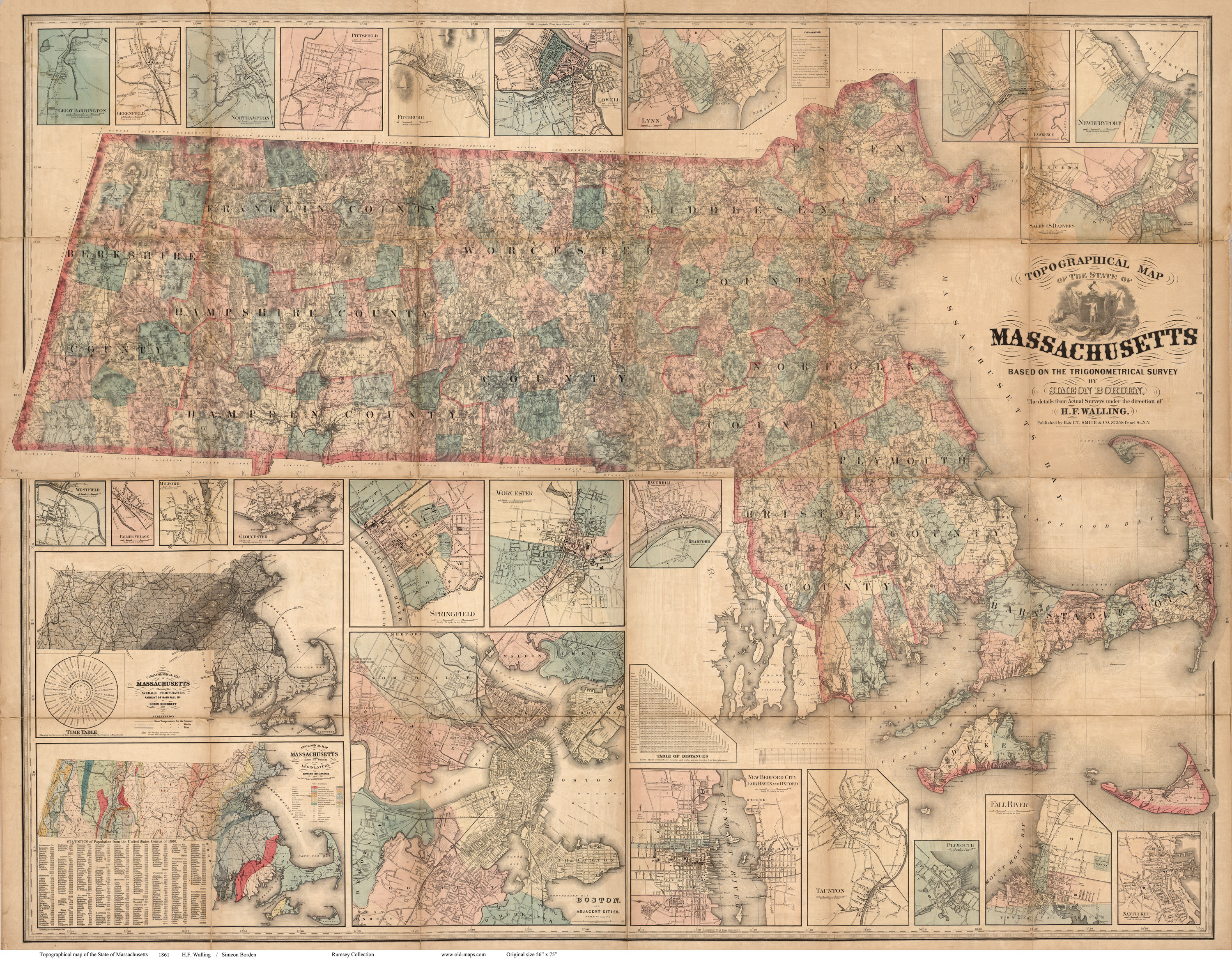
Click on the map to see a low-resolution image of the
entire
map. The image you see will be reduced in quality for easy
web access, but you can see the extent of the detail in your
area.
|
 |
A close-up view of a section of the map, the
Concord area.
The map was compiled from the very detailed county maps made by
H.F. Walling in the 1850s. It appears to show the location
of every house in rural Massachusetts. The map is very
accurate, as it was based on the high quality surveying done 20
years earlier by Simeon Borden. |

Above: one of many village inset maps from the margins of
the large state map. |
|
Topographical Map of Massachusetts 1861
H.F. Walling
original size: 57" x 75" |
|
This map is listed here as a reprint in two sizes. The
smallest text is
legible at the reduced size. (Special Orders are
available, such as county map excerpts.
Send us an email with your interest |
Walling Map of Massachusetts
1861
reduced size 36" x 46"
$40.00 + $8 s/h
|
|
|
(Map shipped in tube,
Priority Mail) |
|
Walling Map of Massachusetts
1861 Full
Size 2 sheets $80.00 + $8 s/h
(lettering is a bit weak - 150 dpi scan)
|
|
|
(Map shipped in tube,
Priority Mail) |
|