Old-Maps

Vermont
Massachusetts
New Hampshire
Maine
Connecticut
New York
Rhode Island
New England
About Us
News Coverage
Contact Us
Order Form
FAQ

Masschusetts:
State Maps
Counties:
Barnstable, Dukes & Nantucket
Berkshire
Bristol
Essex
Franklin

Hampden
Hampshire
Middlesex
Norfolk
Suffolk
Plymouth
Worcester


Cape Cod & the Islands - 1903
Scarborough

Click here to purchase this map!
1903 Map of Cape Cod Scarborough

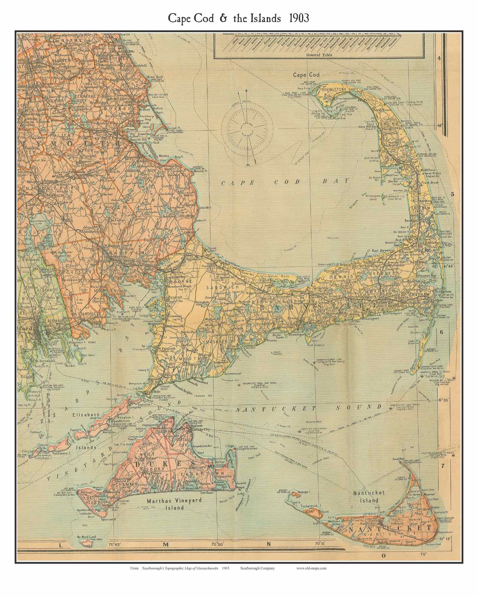
This map is an excerpt from "Scarborough's Topographic Map of Massachusetts", a large folding map printed in 1903.

Cape Cod, Martha's Vineyard and Nantucket are quite developed now, so we see roads throughout every town, even though automobiles were not yet common.

It is notable that this map shows the routes of several steamship lines serving Cape Cod and the islands, and railroads extending to Chatham and Provincetown.

 
Detail from Scarborough map

To see a more detailed copy of the map click on the map above. The image you will see is low-resolution for web viewing, but you can see the extent of the map


Revised: 08/22/17
Copyright © 2005 [Old Maps]. All rights reserved.