Old
Maps of Maine
Large State Maps
Home
Small State Maps |
|
Click here to
view and purchase these and more Maps of Maine! |
 |
 |
 |
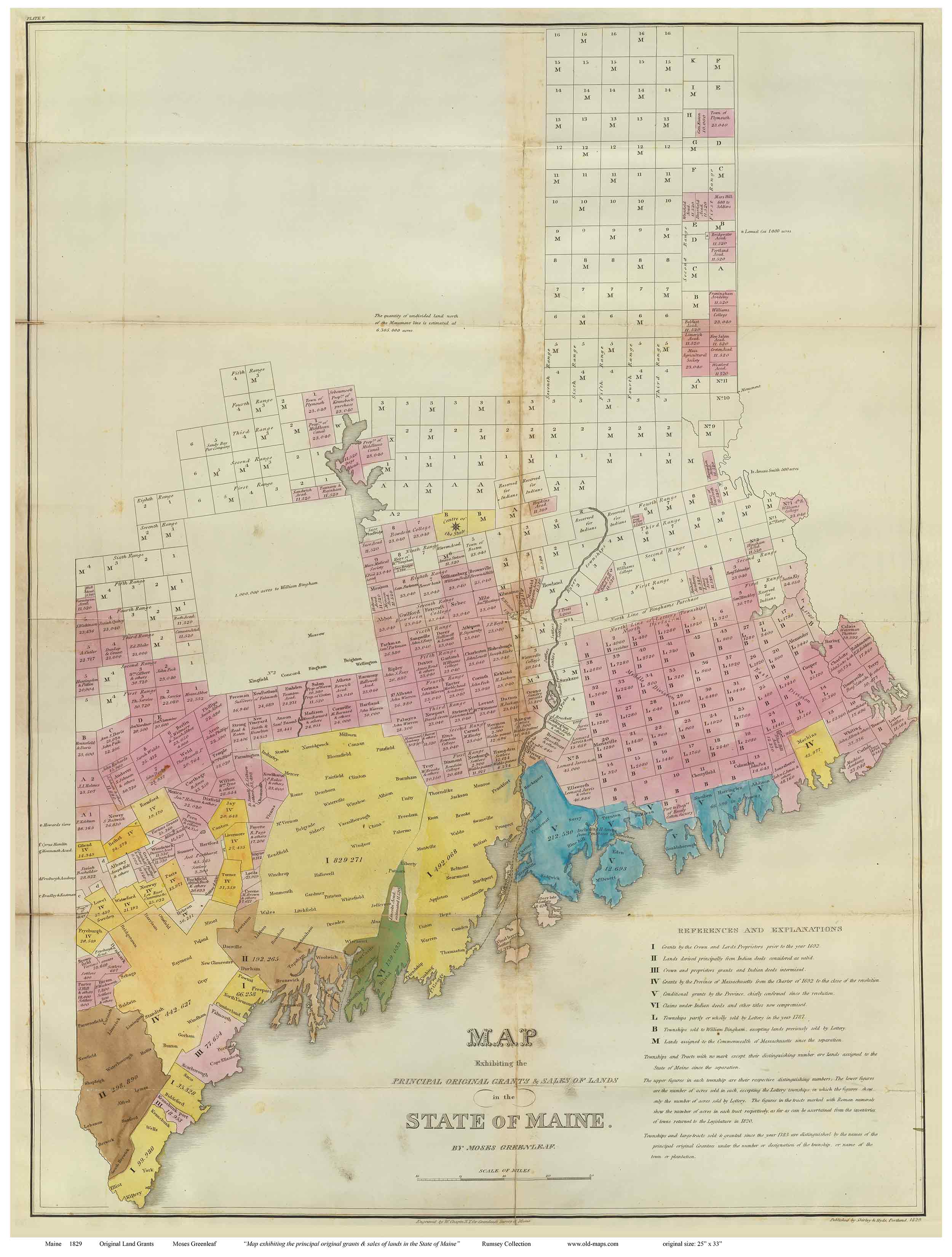
1829 Greenleaf
Showing
original land grants
Original size: 25" x 33" - $30
18" x 24" - $20 |
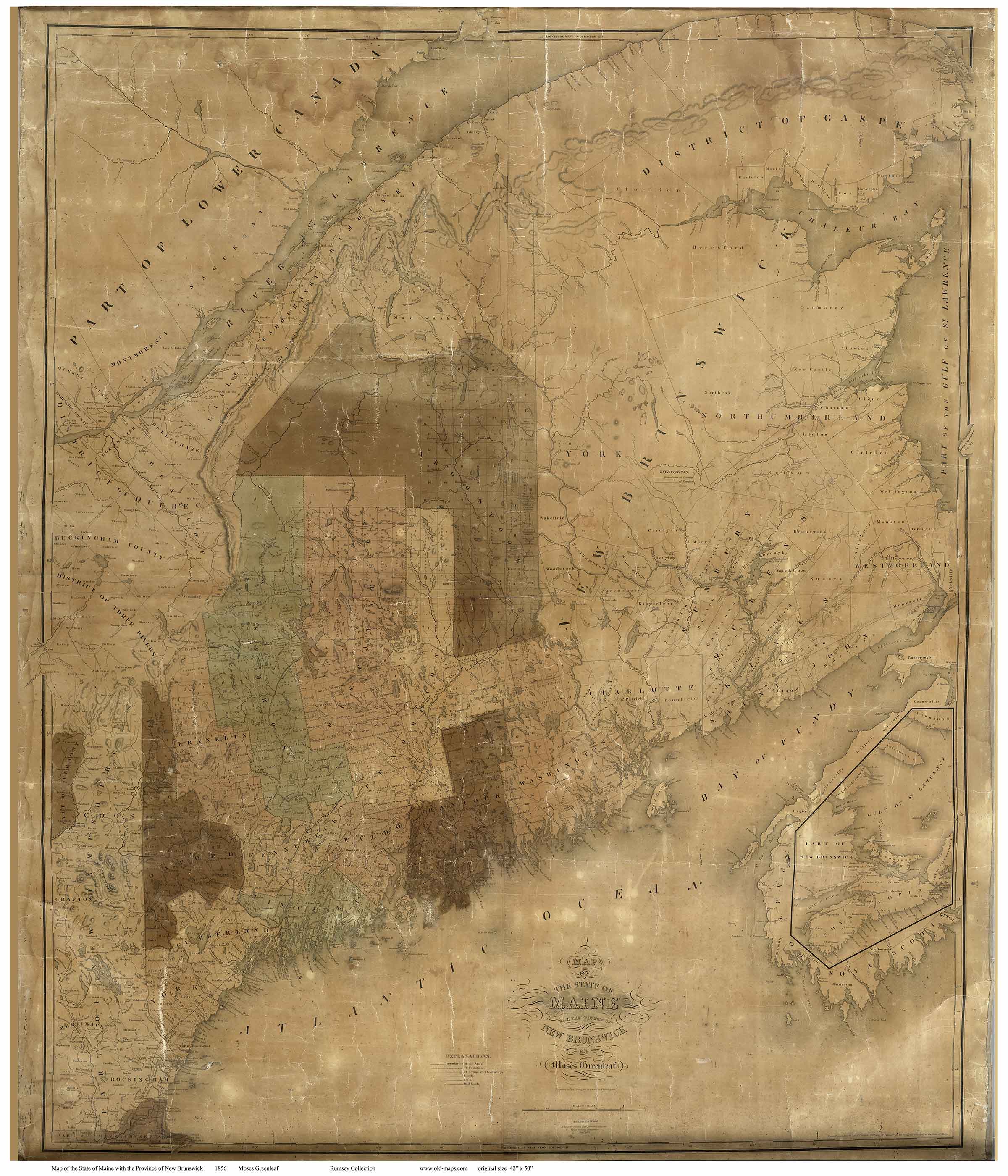
1846 Greenleaf
Original
size: 42" x 50"
36" x 43" - $50
24" x 28" -
$30 |
1862 Walling & Chace
Original size: 62" x 62" - huge!
See separate web page |
| |
|
|
 |
 |
 |
1887 Colby
Original from the
1887 Colby Atlas
24" x 32" - $30
18" x 24" -
$20 |
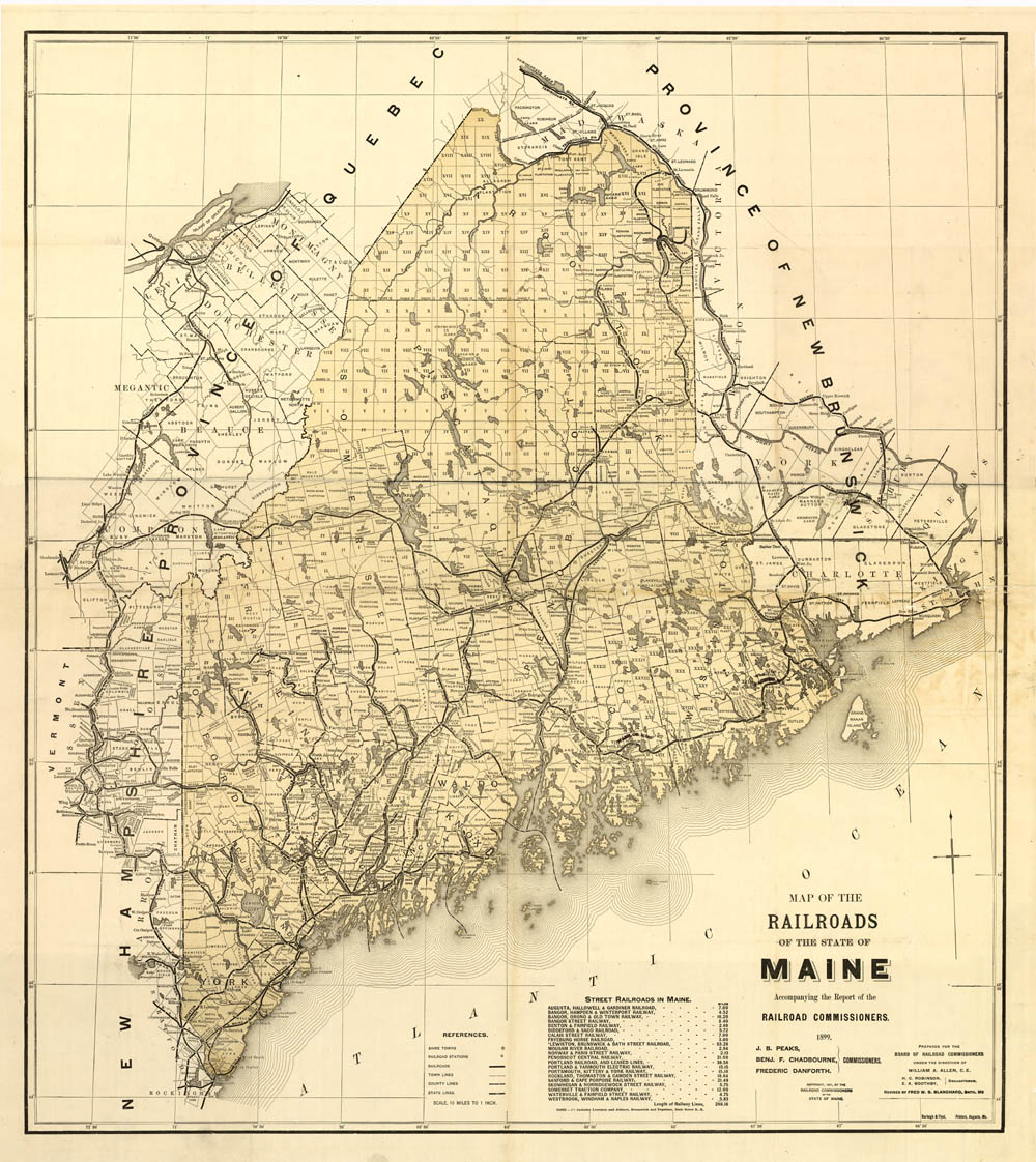
1899 Railroad map
Original
size: 32" x 36" - $40
24" x 30" -
$30
18" x 21" - $20 |
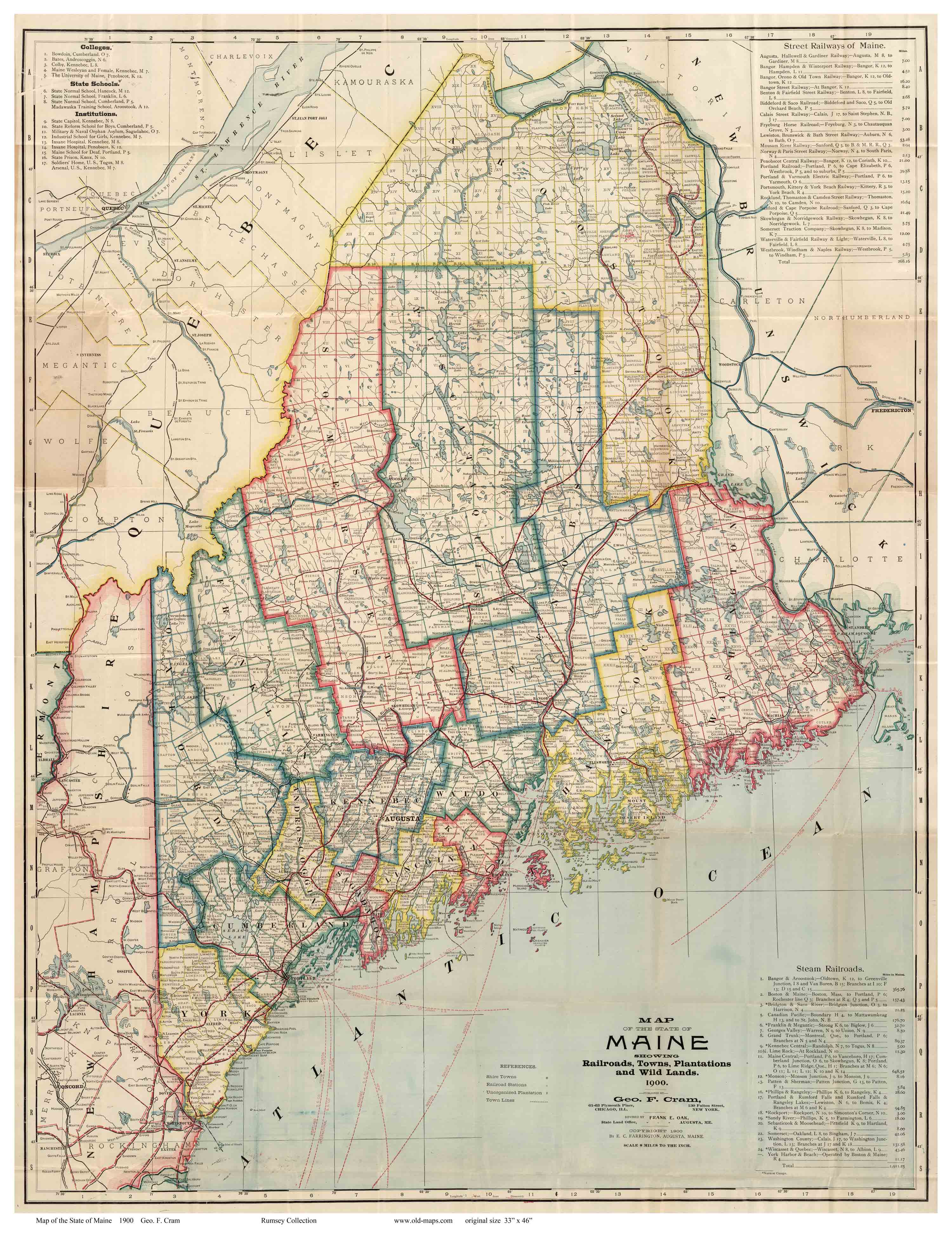
1900 Cram
Original size:
33" x 46" - $50
24" x 31" - $30
18" x
24" - $20 |
| |