Old-Maps

Vermont
New Hampshire
Massachusetts
Maine
Connecticut
Rhode Island
New England

New York
New Jersey
Pennsylvania
Delaware
Maryland
Washington DC


Background
News Coverage
Contact Us
Order Form
FAQ

E-mail


Maine:
Washington County
Hancock County

Penobscot County
Lincoln County
Sagadahoc County
Waldo County

Bird's Eye View Reprint
Maine State Map Prints
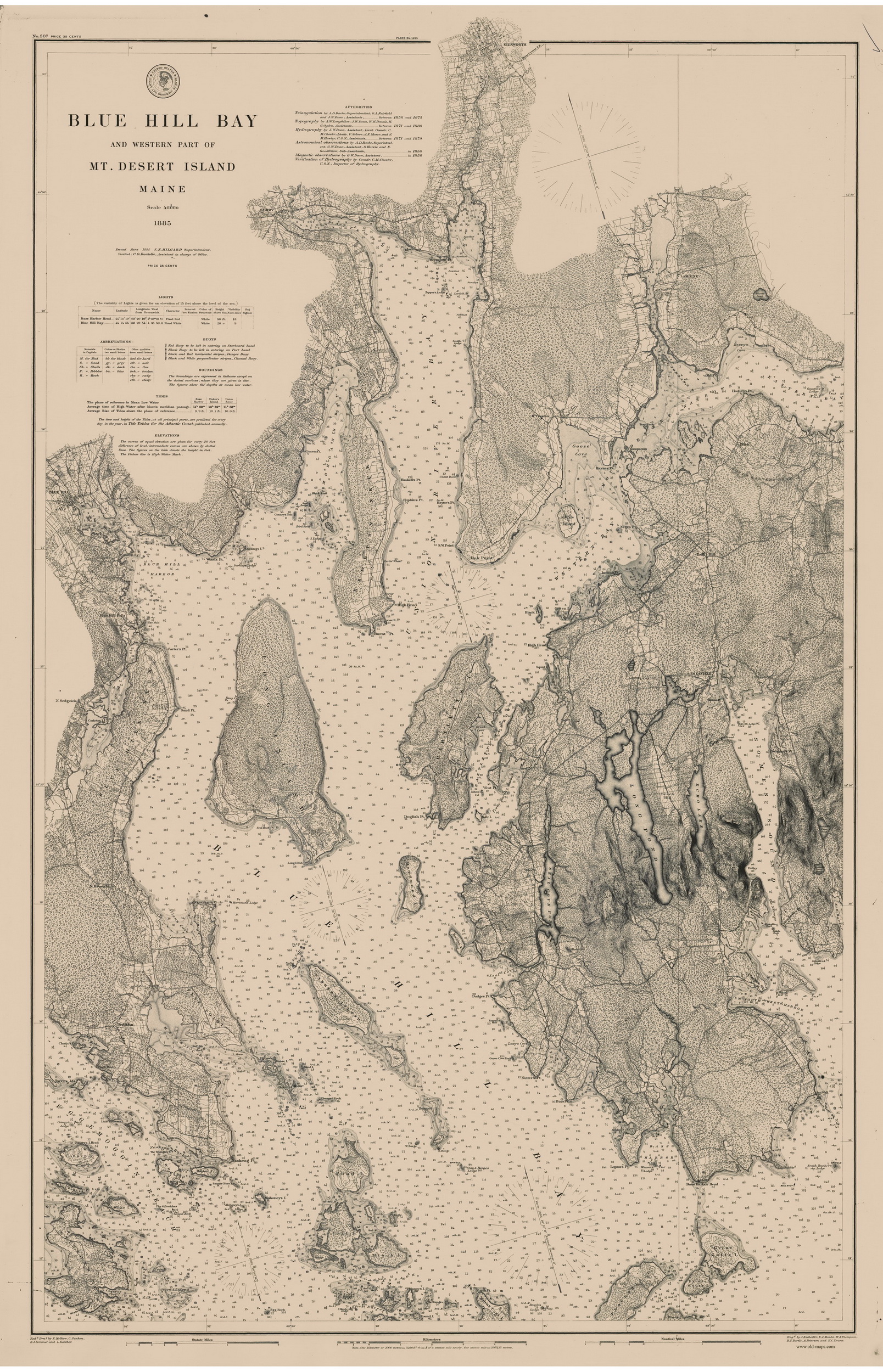
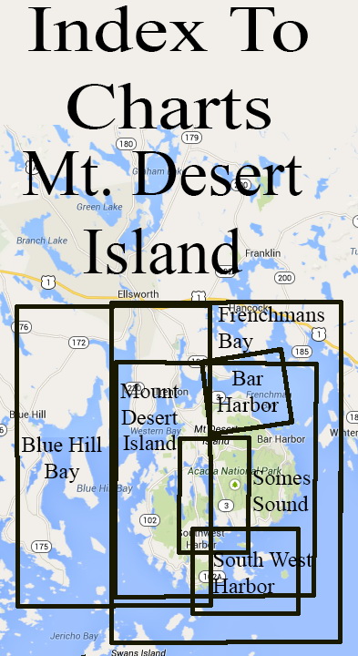
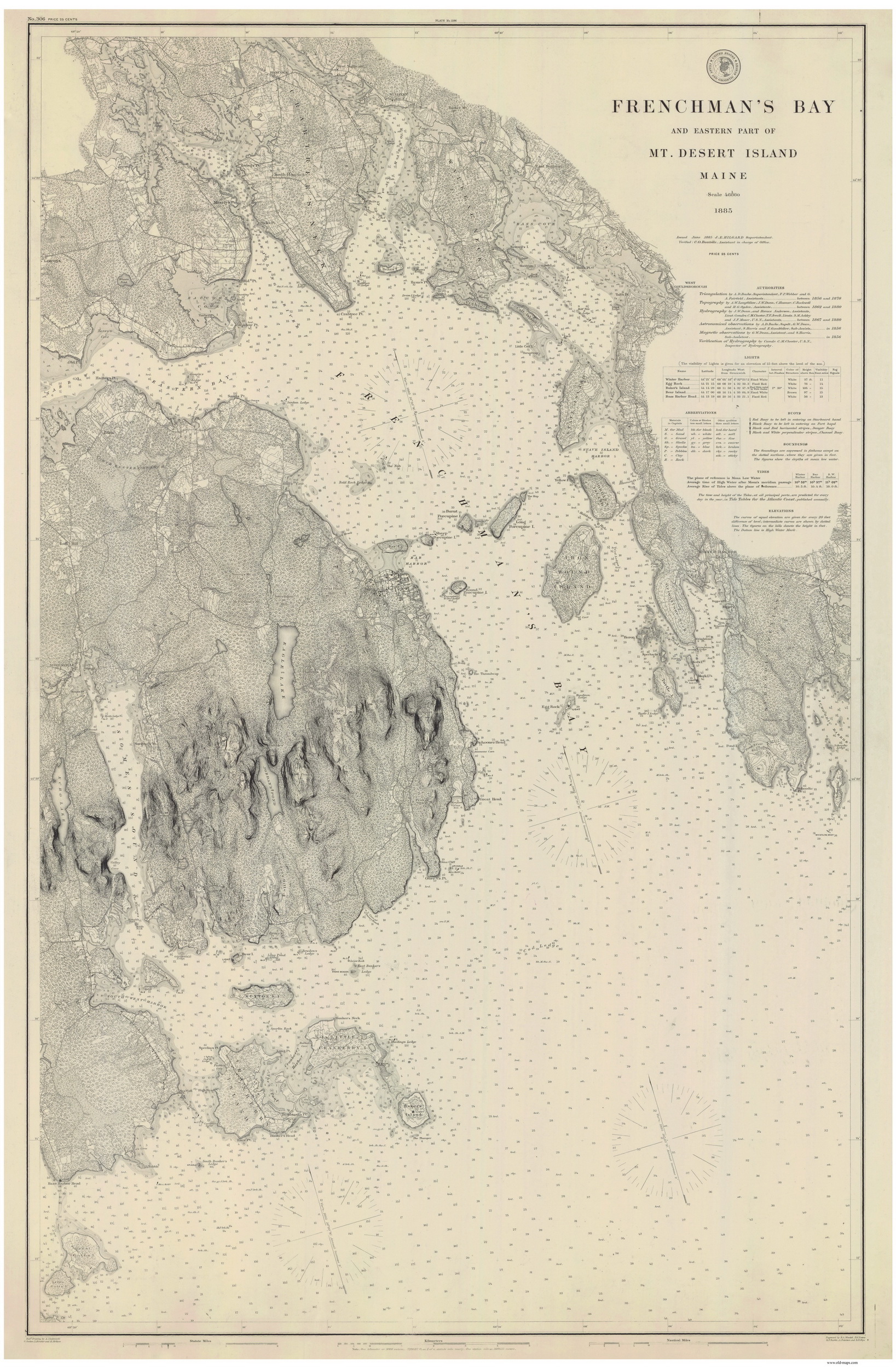
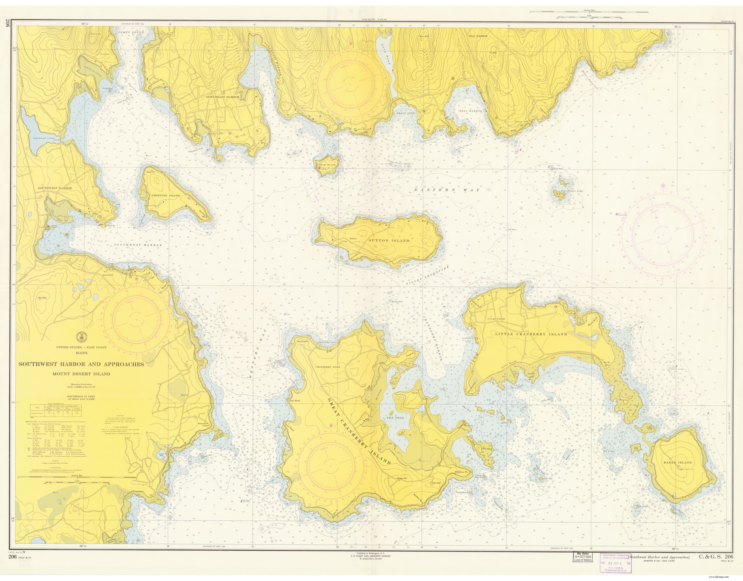
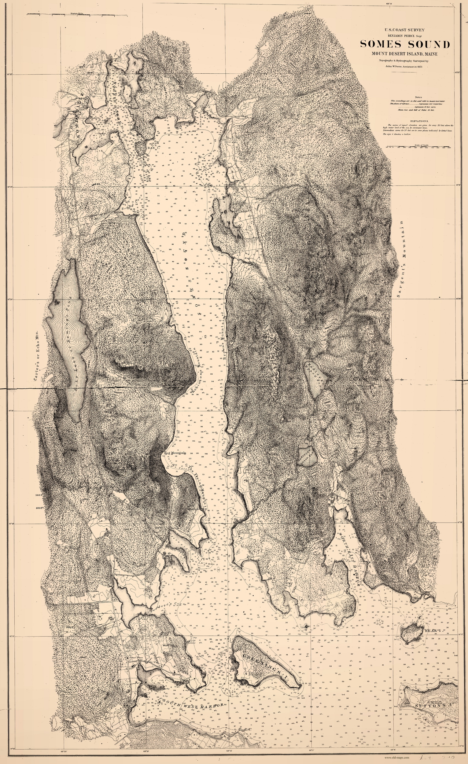
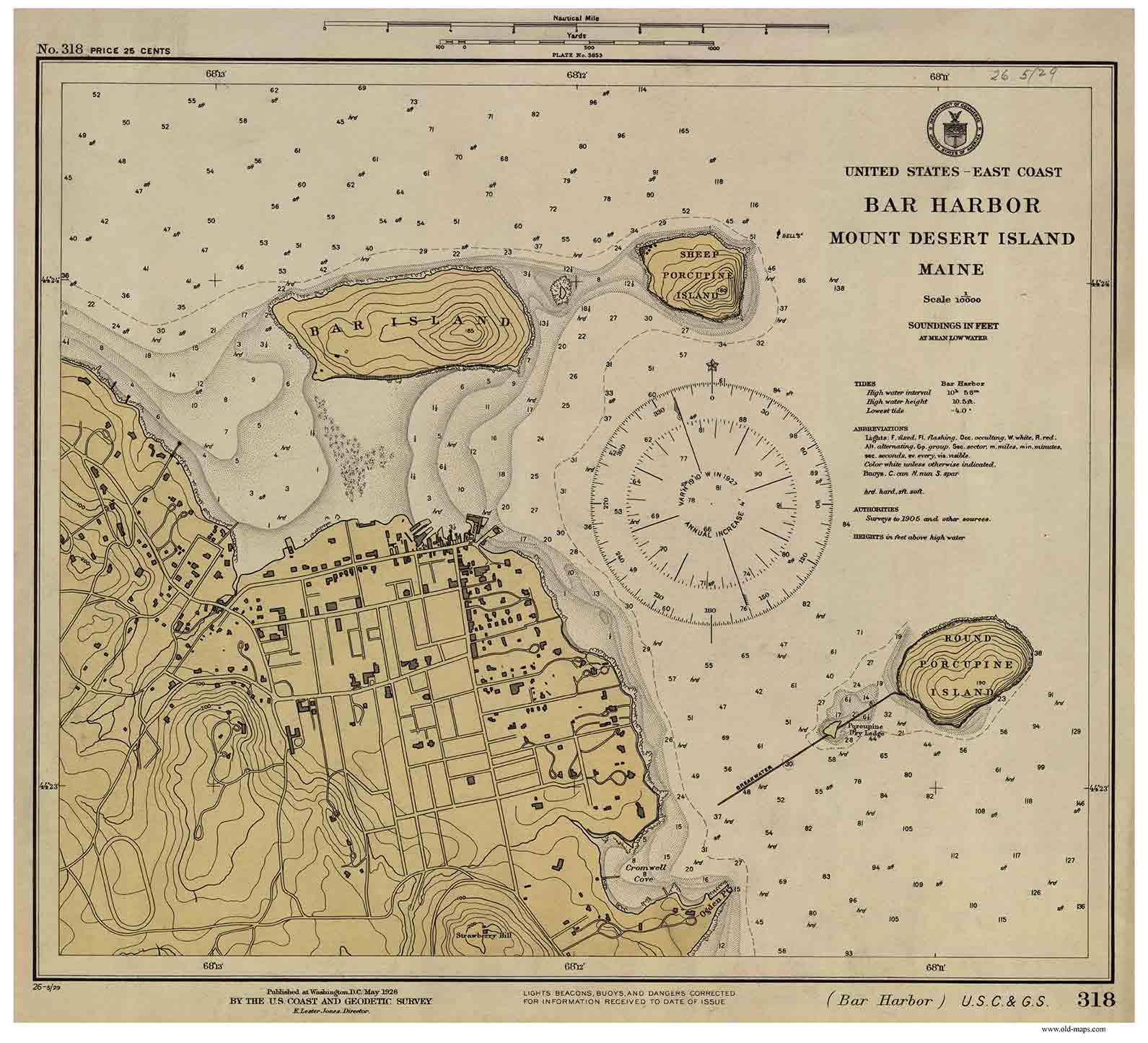
 

Historical Nautical Charts of Maine
Harbor Charts
Area 4 - Mt. Desert Island

Maine Home


Example Charts from each category are shown below.  Click here to order.

Blue Hill Bay 1885

 
Frenchmans Bay 1885 - Harbors 306
 
Mount Desert Island 1882
 

South West Harbor and Approaches 1956 - Harbors 206

South West Harbor and Somes Sound 1872

Somes Sound 1871

Bar Harbor 1926
 
Mount Deset Island & Frenchmans Bay 1776
From the Atlantic Neptune Atlas
See Page on New Website
 
Mount Desert Island 1776
From the Atlantic Neptune Atlas
See Page on New Website


Copyright © 2010 [Old Maps]. All rights reserved.