Vermont
Massachusetts
New Hampshire
Maine
Connecticut
New York
New England
Background
News Coverage
Contact Us
Order Form
FAQ

E-mail


Colonial Maps Reprints
Champlain's 1613 Map of New France
"Carte Geographique de la Novvelle Franse"
Samuel de Champlain


1613 Champlain map
Click on the image to review / download this map to print your own copy.
 Map image from the Gutenberg Project.


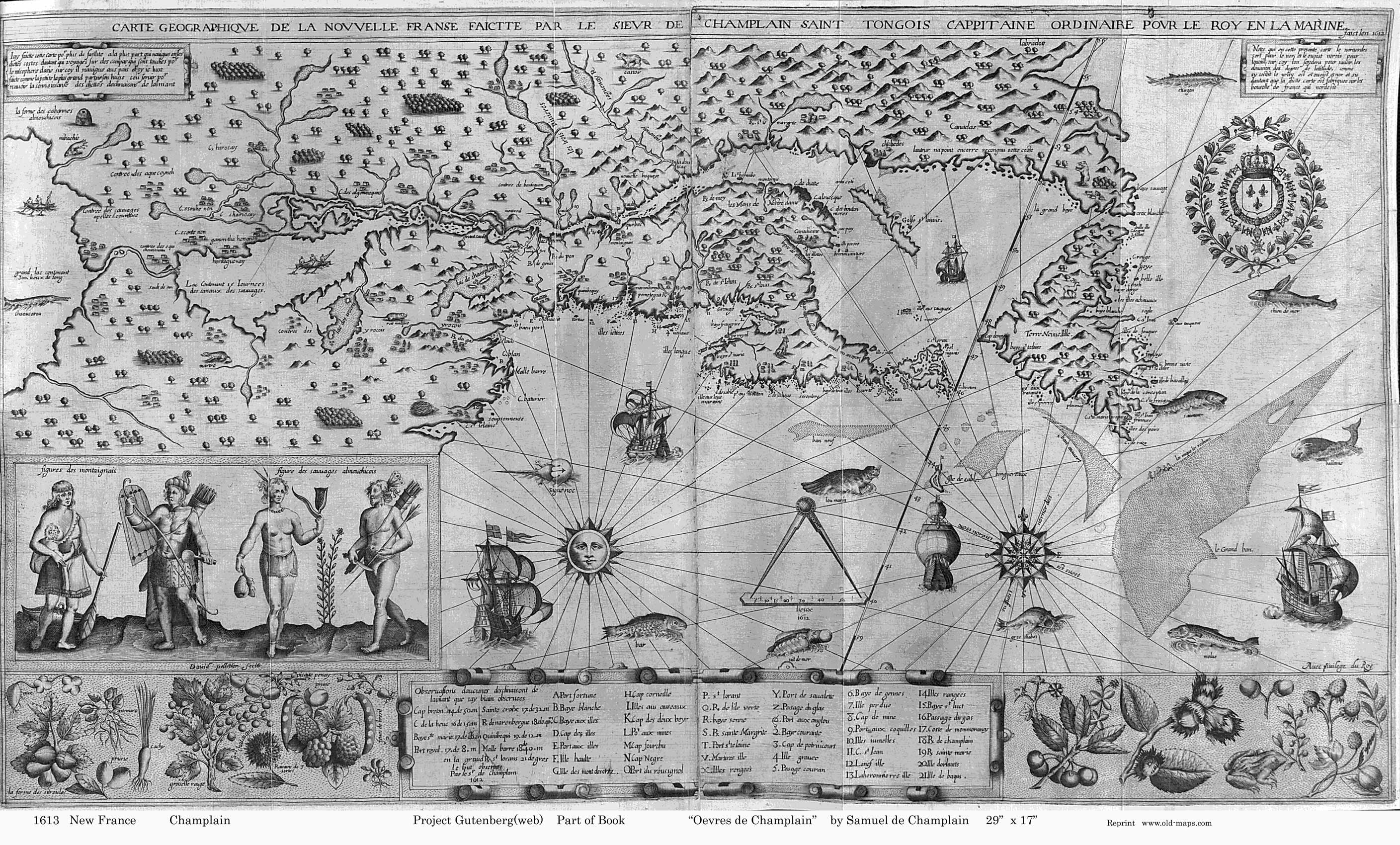
This important early map was drawn by the noted explorer Samuel de Champlain. The "Carte Geographique" shows the New England coastline and the lands of the St Lawrence River from the Atlantic to the Great Lakes.


ONLINE ORDER:  Click on one of these icons to pay by Credit Card
Champlain's  1613  Map of New France      18" x 24"      $20 + $6 s/h
 
Champlain's  1613   Map of New France       11" x 17"       $10 + $4 s/h
Printed on glossy paper. suitable for framing.


MAIL ORDER:  To order a copy, print out a copy of this page and mail it with your check or money order to: 
  Old Maps  PO Box 54  West Chesterfield, NH  03466.


Revised: 08/12/09
Copyright © 2005 [Old Maps]. All rights reserved.