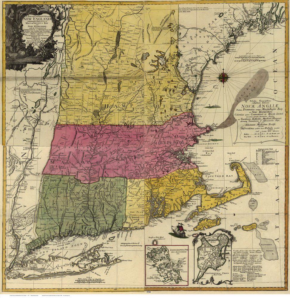
Vermont
Massachusetts
New Hampshire
Maine
Connecticut
New York
New England
Background
News Coverage
Contact Us
Order Form
FAQ

E-mail

Colonial
New England:

NE CDROM
NE Reprints

Reprint Information:
1570 World Ortelius
1680 World Map
1690 Americas
1680 Novi Belgii
1702 Morden
1753 New Engelland
1755 Douglass
1759 Nova Anglia
1771 Bowles
1776 Seat of War
1779 NE Probst


Colonial Maps Reprints
 New England
Probst - 1779
Click on the image to view/download a more legible version of this map. The image you will see is low resolution for easy web access, but it does show the areas covered and the visual charm of the old map.

 
Click on map to see more

 Shows town throughout Southern New England. The political features are similar to those shown on the Jeffreys/Bowles series of maps, with the addition of some nice graphic features, such as the two detail maps of Boston, the "White Hills" (White Mountains) and the large north arrow.

The map is brightly colored. We have retouched the scanned image from Library of Congress and adjusted the coloring to make a pleasing wall map

36" x 36", rolled in a tube. Inkjet ink reprint.

 
Probst Map of New England   1779   $40 + $6 s/h
 
 
ONLINE ORDER:  Click on one of these icons to pay by Credit Card.

MAIL ORDER:  To order a copy, print out a copy of this page and mail it with your check or money order to:   Old Maps  PO Box 54  West Chesterfield, NH  03466.


Revised: 01/11/10
Copyright © 2005 [Old Maps]. All rights reserved.