kee_fir1902_00-web.jpg
kee_fir1902_00-web.jpg
kee_fir1902_01-web.jpg

kee_fir1902_02-web.jpg

kee_fir1902_03-web.jpg
kee_fir1902_04-web.jpg

kee_fir1902_05-web.jpg

kee_fir1902_06-web.jpg

kee_fir1902_07-web.jpg

kee_fir1902_08-web.jpg
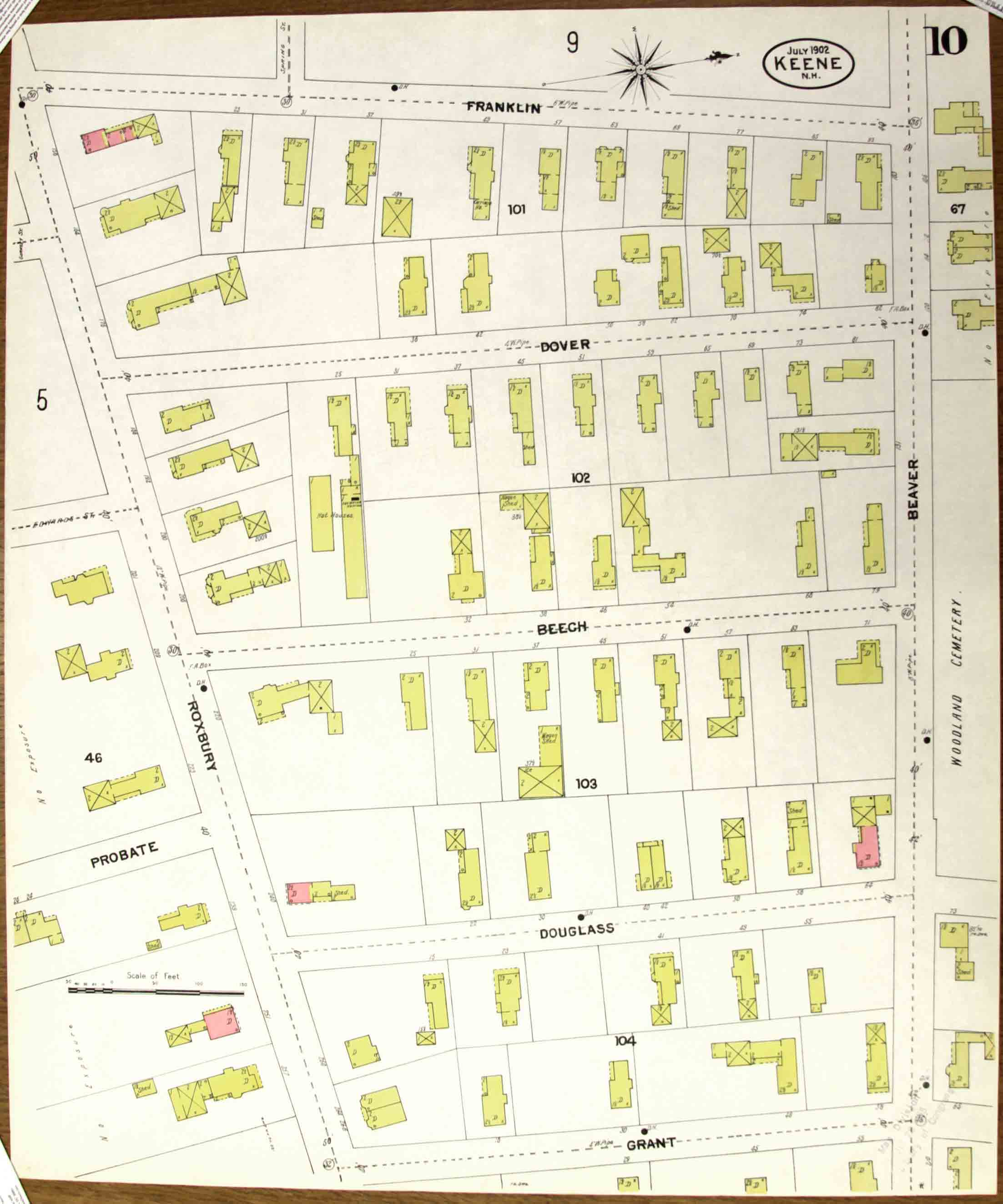
kee_fir1902_09-web.jpg
kee_fir1902_10-web.jpg
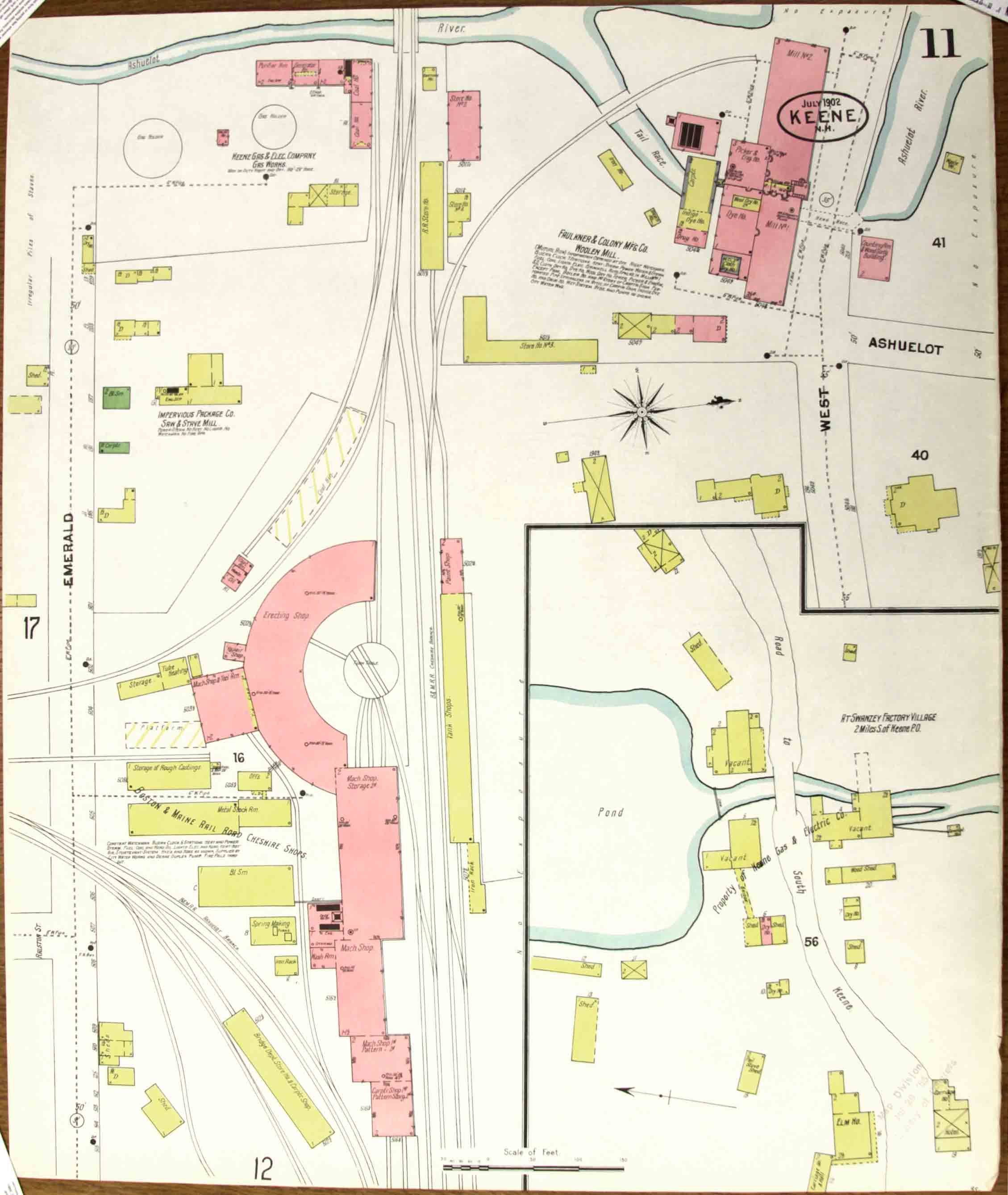
kee_fir1902_11-web.jpg
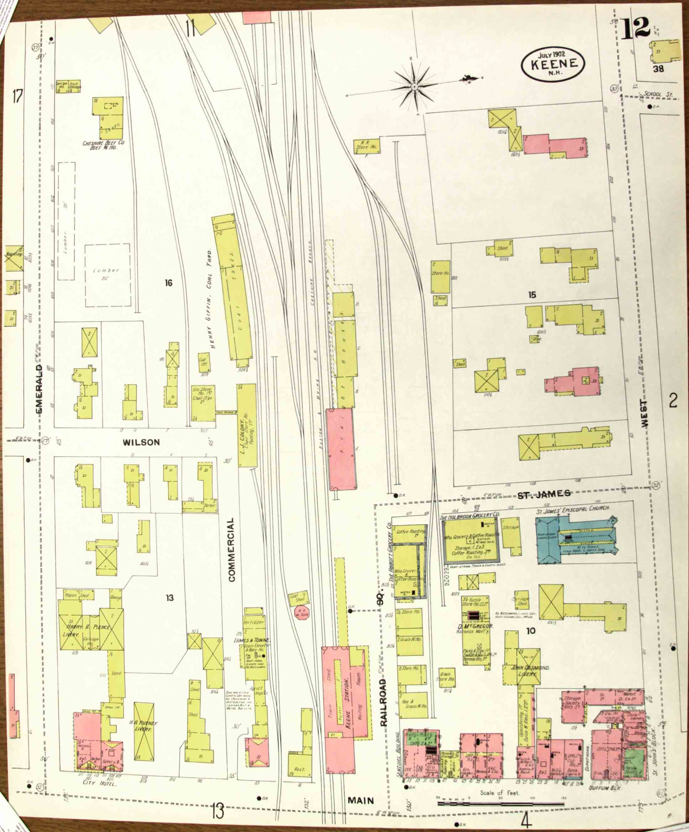
kee_fir1902_12-web.jpg

kee_fir1902_13-web.jpg
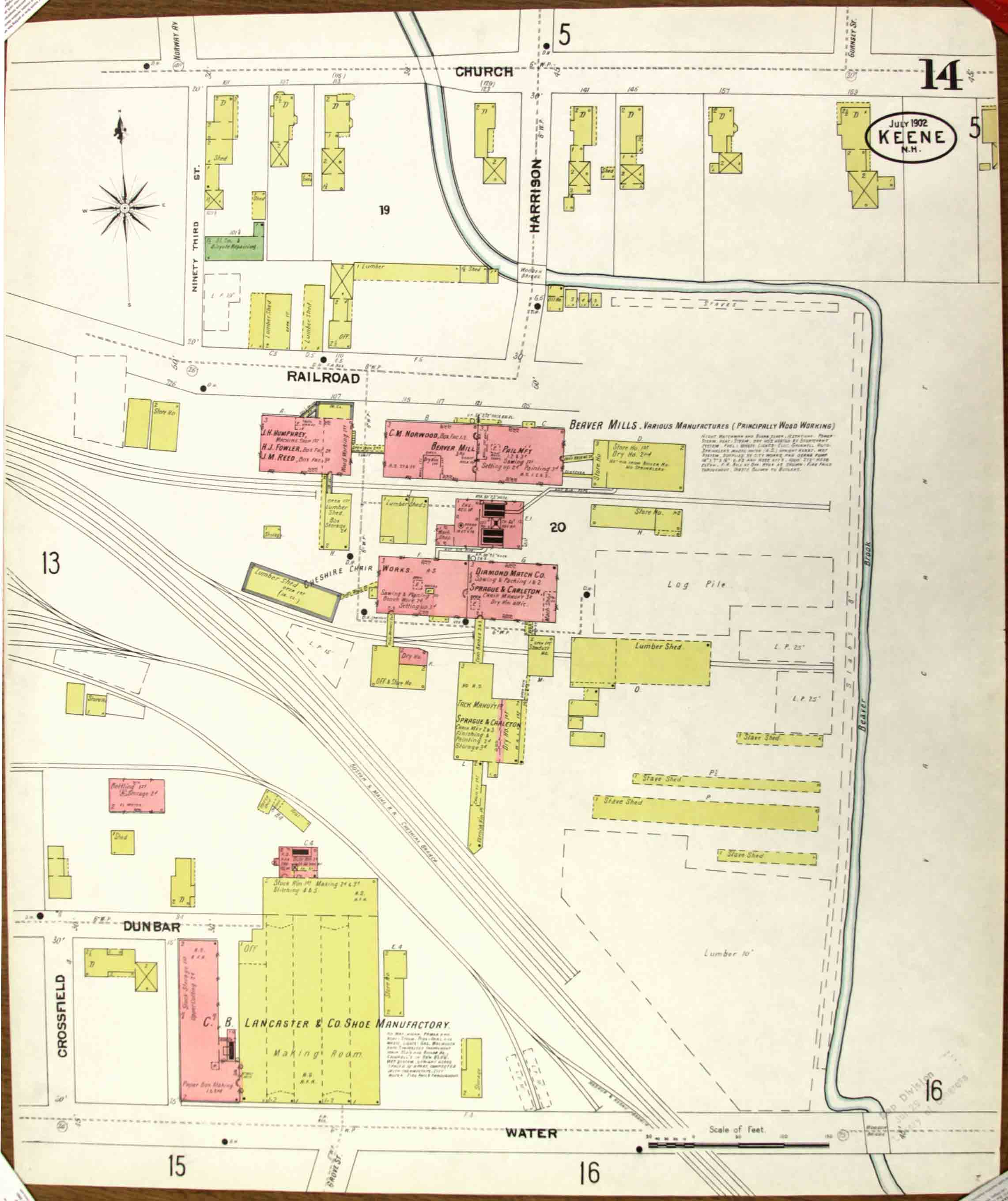
kee_fir1902_14-web.jpg
kee_fir1902_15-web.jpg
kee_fir1902_16-web.jpg

kee_fir1902_17-web.jpg

kee_fir1902_18-web.jpg