|
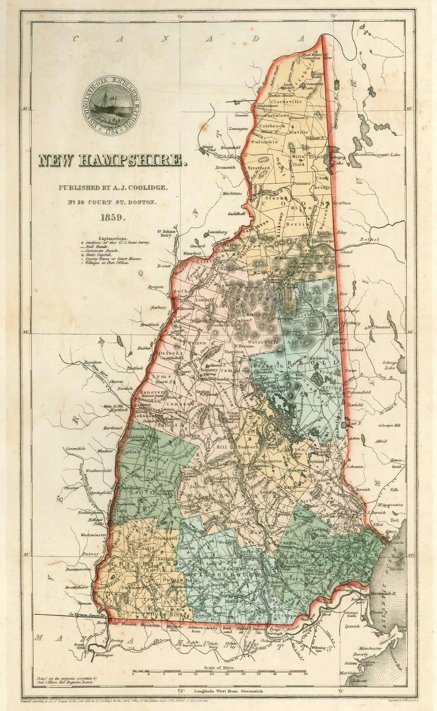
New
Hampshire State Maps
Coolidge Map 1859
Color Reprint |
|

Click on the map to see a low-resolution image of the entire
map. The image you see will be reduced in quality for easy web
access, but you can see the extent of the detail in your area. |

Below: a close-up view of a section of the map
 |
|
New Hampshire 1859
original size: 9" x 15" |
|
A nice mid-19th century map is available as a reprint in two
sizes. The 11"x14" size is slightly reduced from the original
size. The large size is more useful for public places such as
offices, as the text is easier to read. The map shows
details throughout the state in the midst of the railroad era. |
|
New Hampshire Coolidge Map
1859 10" x 16"
$10.00 + $4 s/h
(US Mail)
|
|
New Hampshire Coolidge Map 1859
15" x 24" enlarged size
$20.00 + $8 s/h
(Priority Mail)
|