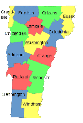
Vermont: State Maps Counties: Addison Bennington Caledonia Chittenden Franklin & Grand Isle Orleans LamoilleEssex Orange Rutland Washington Windham Windsor Town/County Index Bookstores Press Releases Articles/Research
1850s Vermont County Maps CDROM & Paper *
During the 1850s Vermont's 14 Counties were mapped on 11 individual wall maps. (*some Paper Booklet Printouts and Wall Map Reprints are available - see the individual county pages)
Not sure which county your town is in? See our Vermont Towns / Counties Index.
Adobe PDF format
Revised: 01/11/23 Copyright © 2005 [Old Maps]. All rights reserved.