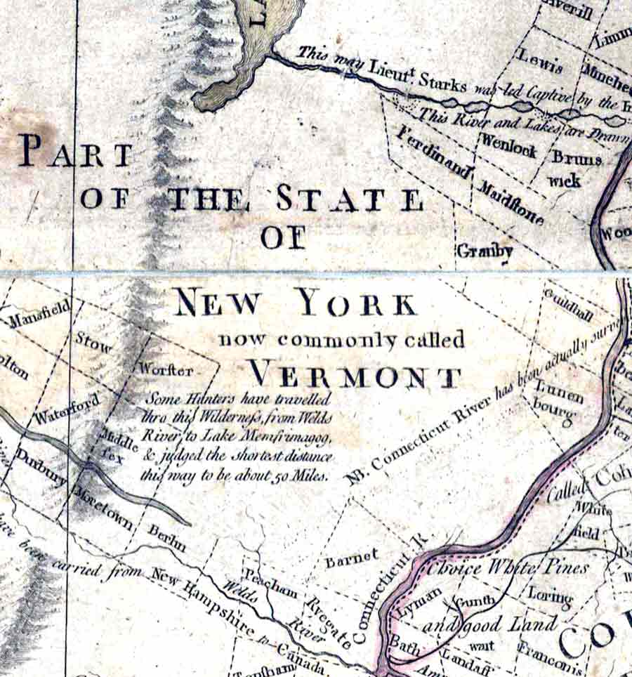
1784 Vermont as part of New York. This excerpt from the
Sawyer map shows the area from Ryegate to the Canadian border. This
map shows the extent of township grants just after the American
Revolution. Compare this map with the 1761 version (right).
1761 An earlier version of same map when this is part of New
Hampshire shows no townships, and a badly misplaced Connecticut
River. Vermont was a foreboding wilderness - and dangerous - in the
mid 1700s. Note the entry "This way Captives have been
carried... to Canada". This route appears to follow the
Clyde and Nulhegan Rivers through Derby, Morgan, Brighton and
Bloomfield.
Old maps have lots of interesting placenames, such as "Ticklenaked
Pond", shown here on the 1796 Whitelaw map. It's a famous pond now
because of its unusual name. Our predecessors must have been
just as amused as we are.
Among them was the author of this map,
Vermont's Surveyor-General James Whitelaw, whose house is located
just south of the pond.