Vermont:
State Maps
Counties:
Addison
Bennington
Caledonia
Chittenden
Franklin & Grand Isle
Orleans
Lamoille
Essex
Orange
Rutland
Washington
Windham
Windsor
Town/County Index
Bookstores
Press Releases
Articles/Research |
|
|
VT
State Maps
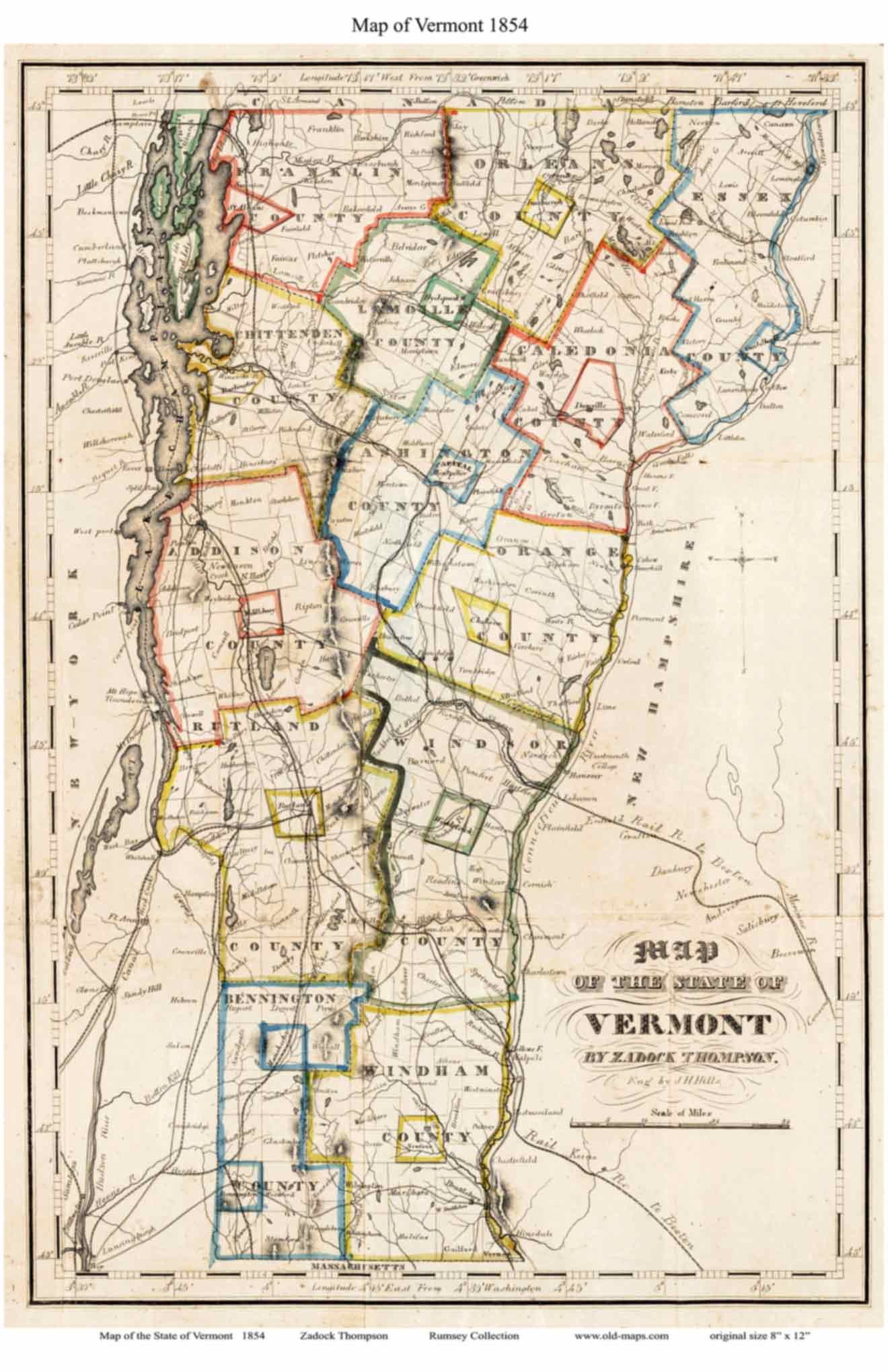
Thompson Map of
Vermont 1854 |
| Home
State Maps
1842 Thompson Map |
Click here to purchase this VT State Map |
 |

An updated version of Zadock Thompson's
1842 Map of Vermont, which first
appeared in the second edition of his book; "History of Vermont,
Natural Civil and Statistical."
Zadock Thompson himself is
one of the best-remembered early Vermont historians, widely
respected during his lifetime for his observations and chronicles of
Vermont's Natural History. See a photograph of him below. |
|
|
Click on the map above to see a more detailed copy.
Original size: 8" x 12" |
The images below show
the level of detail on this map |
|
|
|
 |
 |
 |
| |
|
|
Revised:
08/21/17
Copyright © 2005 [Old Maps]. All rights reserved.
|