Old-Maps

Vermont
Massachusetts
New Hampshire
Maine
Connecticut
New York
Rhode Island
New England
Background
News Coverage
Contact Us
Order Form
FAQ

Vermont:
State Maps
Counties:
Addison
Bennington
Caledonia
Chittenden
Franklin & Grand Isle
Orleans
Lamoille
Essex
Orange
Rutland
Washington
Windham
Windsor

Town/County Index

Bookstores
Press Releases
Articles/Research


1890 Hopkins Map
Burlington, VT
Burlington Maps

Click here to purchase this map or any of the excerpts from it at shop.old-maps.com

A complete reproduction of the large city map.

Map of Burlington Vermont 1890

original size 60" x 61"

source:  University of Vermont Special Collections (Bailey Library)


We have edited the UVM scan to improve legibility and its appearance.


see also the separate map prints made from this large map:

City of Burlington Only  1890
Burlington Downtown 1890 - Horizontal view
Burlington Downtown 1890 - Vertical view
Burlington Waterfront to UVM 1890


We offer the whole map and each excerpt in several sizes, click here to purchase!
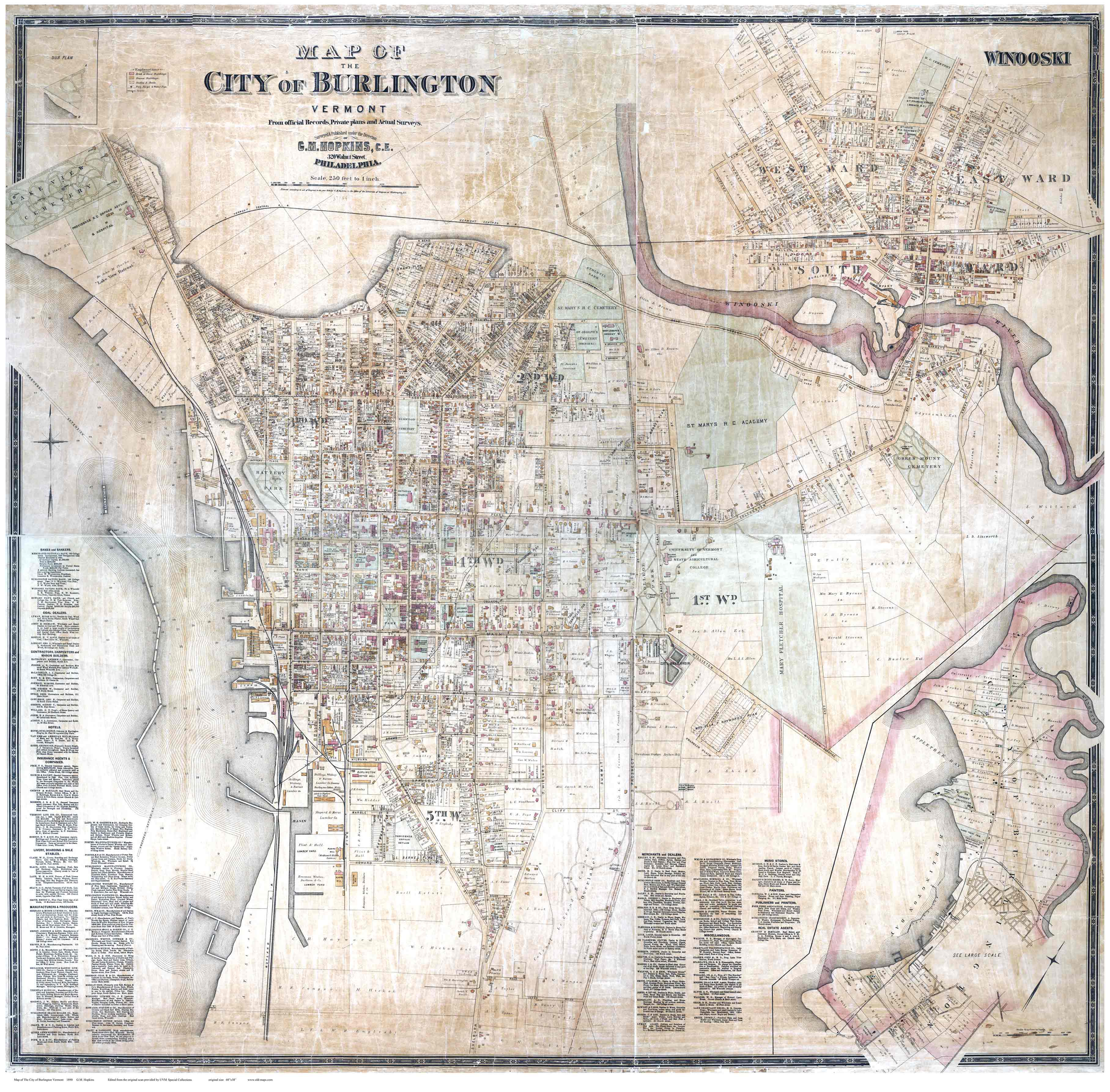
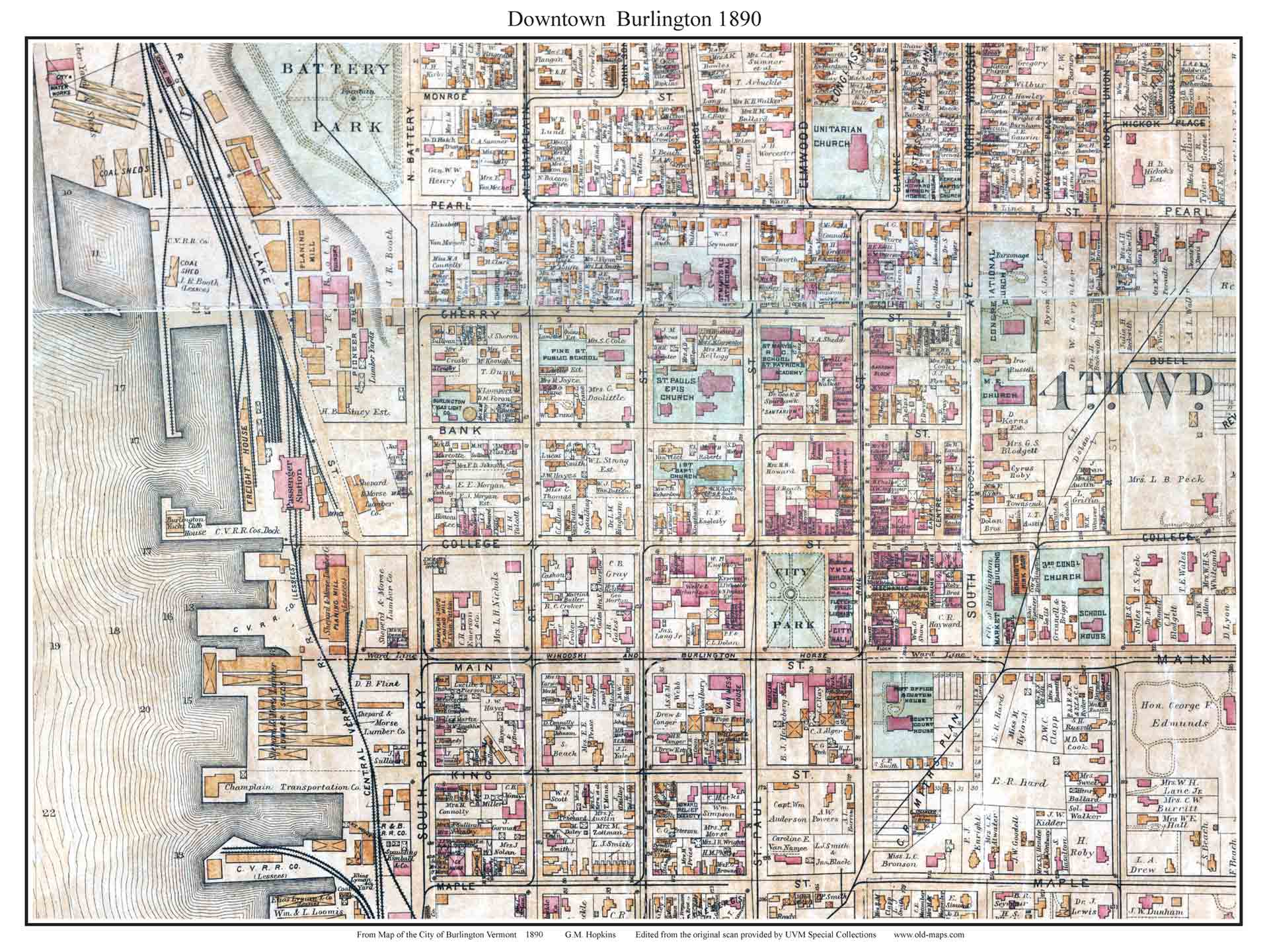
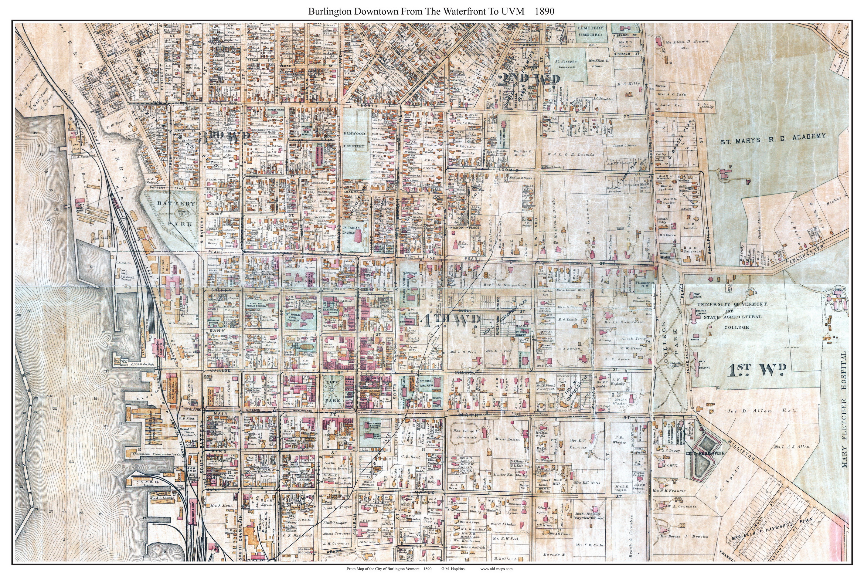
 Detail on Church Street between Cherry Street(top) and Bank Street. The dashed line on Church street indicates the trolley line. The solid lines may indicate sewer lines.

The red colored buildings are stone or brick buildings.

The excerpts below give you more sense of the detail on this remarkable old map,


Revised: 07/14/22
Copyright © 2005 [Old Maps]. All rights reserved.