Old-Maps

Vermont
Massachusetts
New Hampshire
Maine
Connecticut
New York
Rhode Island
New England
Background
News Coverage
Contact Us
Order Form
FAQ

Vermont:
State Maps
Counties:
Addison
Bennington
Caledonia
Chittenden
Franklin & Grand Isle
Orleans
Lamoille
Essex
Orange
Rutland
Washington
Windham
Windsor

Town/County Index

Bookstores
Press Releases
Articles/Research

 
ca. 1860
Brattleboro & Vicinity
C. H. Grau Map
Click here to purchase this map through our store at shop.old-maps.com

Brattleboro & Vicinity
C.H. Grau
24" x 26" original size

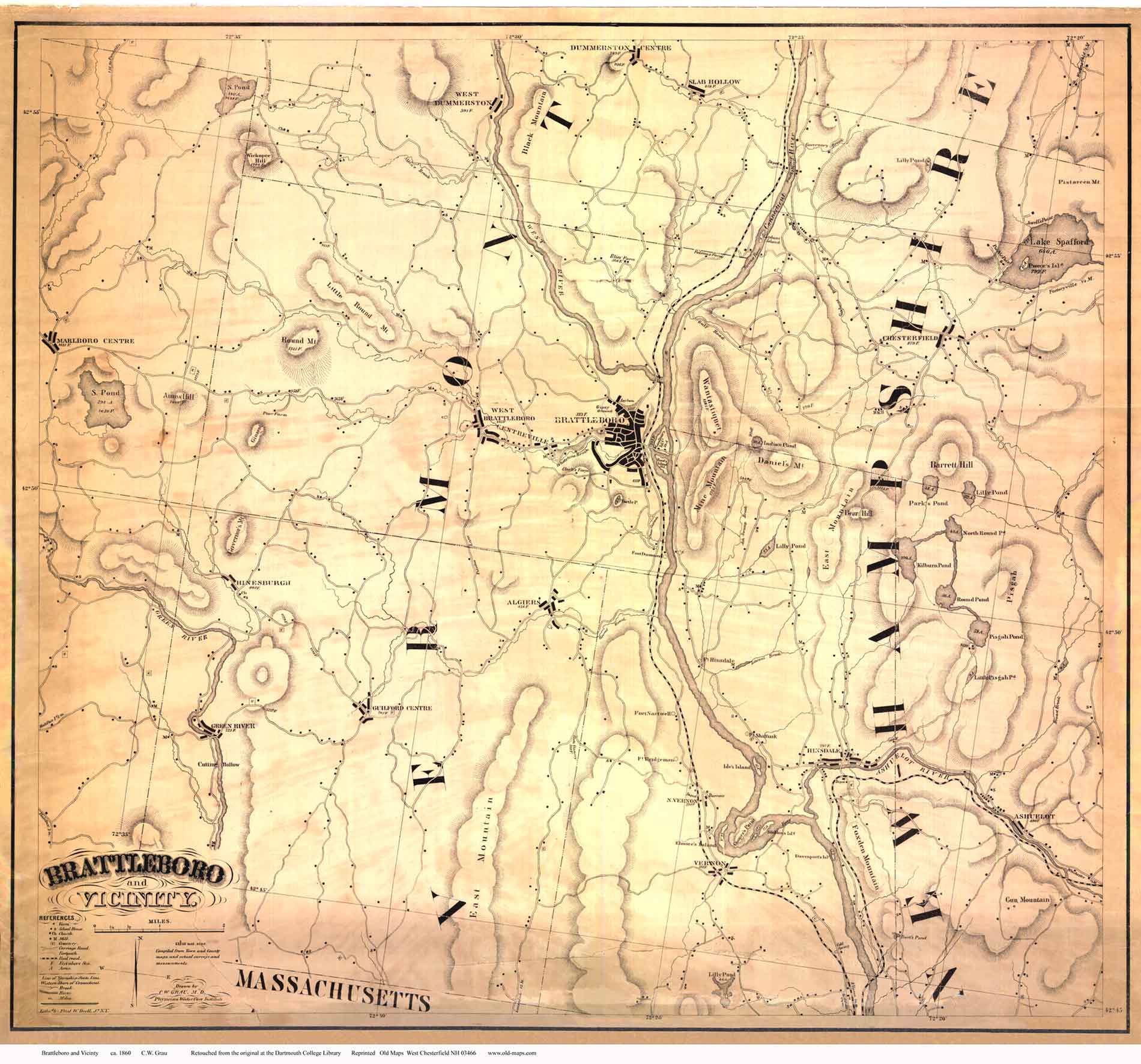
Every rural road and house site in Brattleboro, Guilford, and Hinsdale, New Hampshire, as well as large sections of the adjoining towns. To see / download a low-resolution copy of this map, click here.  You will not be able to read all the text but you will be able to see the areas covered and the level of detail.

This map and many other maps of Brattleboro are discussed  in the booklet "Early Maps of Brattleboro".

Our reprints are slightly reduced from the original maps.


Revised: 08/21/17
Copyright © 2005 [Old Maps]. All rights reserved.