RI:
State Maps
Birds Eye Views
Counties:
Newport
Providence
|
|
|
|
Old
USGS Maps
Rhode Island
Home
RI Special USGS Maps
|
The 1891 USGS Maps - Walker
Atlas |
To purchase these USGS Topo maps, see our store at shop.old-maps.com!
|
|
|
Follow the link above to purchase a map from this collection
Click on the Index Map to locate your town.
Click on a
Sheet below to see a preview. |

|

|
|

|
Sheet 1 -
Providence,
Pawtucket, Lincoln |
|
Sheet 2 -
Burrillivlle,
Glocester, Scituate |
Index Map |
|
|
|
|
|

|
|

|
|

|
Sheet 3 -
Bristol,
Barrington, Warren |
|
Sheet 4 -
Cranston,
Warwick, E. Greenwich |
|
Sheet 5 -
Exeter,
Coventry, W. Greenwich | |
|
|
|
|
|

|
|

|
|

|
Sheet 6 -
Portsmouth,
Tiverton, Middletown |
|
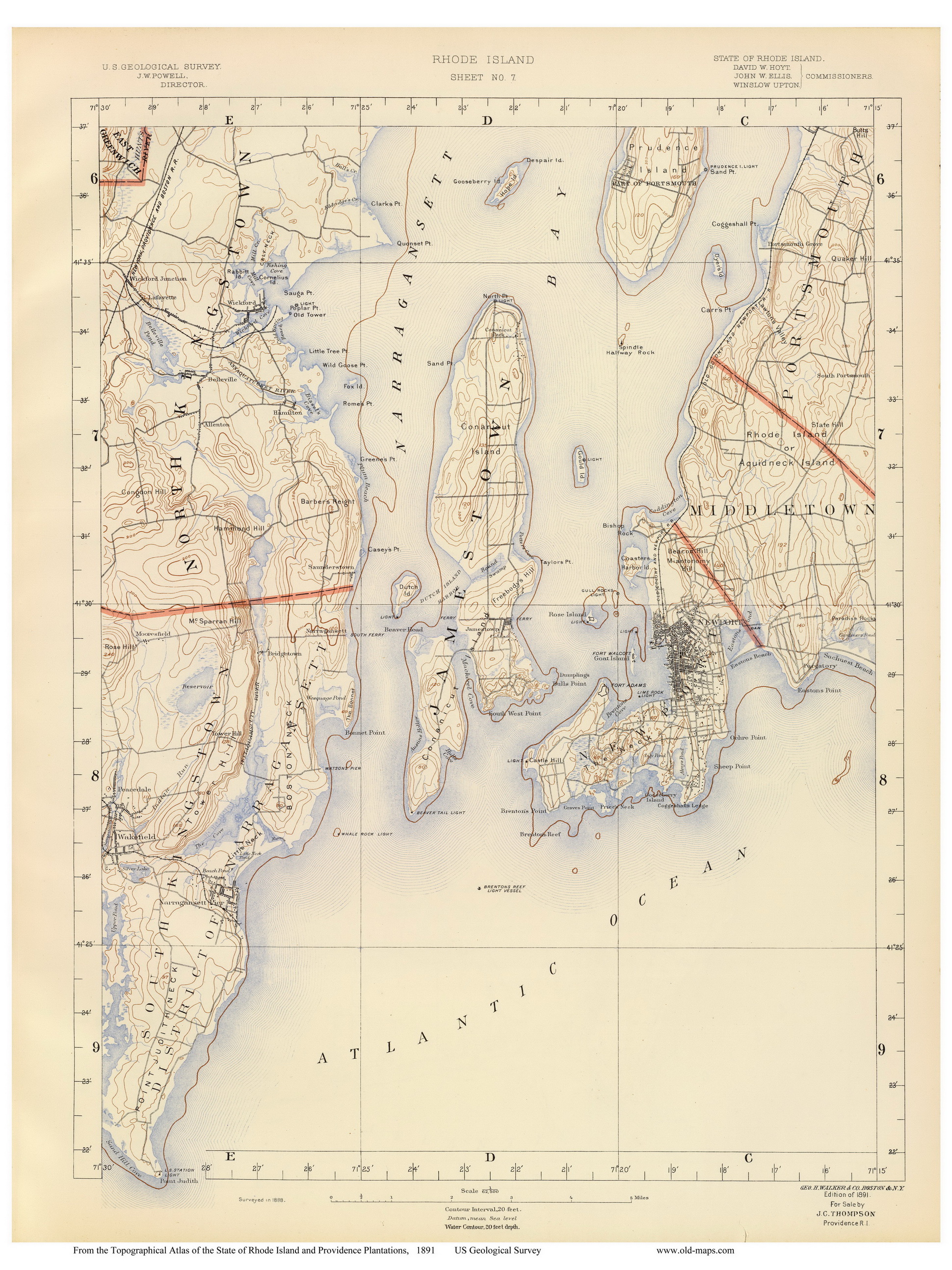
Sheet 7 -
Newport,
Jamestown, Rose Island |
|
Sheet 8 -
North and
South Kingstown, Point Judith |
|
|
|
|
|
|

|
|

|
|
|
Sheet 9 -
Westerly,
Hopkinton, Stonington |
|
Sheet 10
- Block Island,
New Shoreham, B.I. Sound |
|
|
|
|
Questions? Contact
us by email |
|
|
|