|


Masschusetts:
State Maps
Counties:
Barnstable, Dukes & Nantucket
Berkshire
Bristol
Essex
Franklin
Hampden
Hampshire
Middlesex
Norfolk
Suffolk
Plymouth
Worcester
|
|
|
|
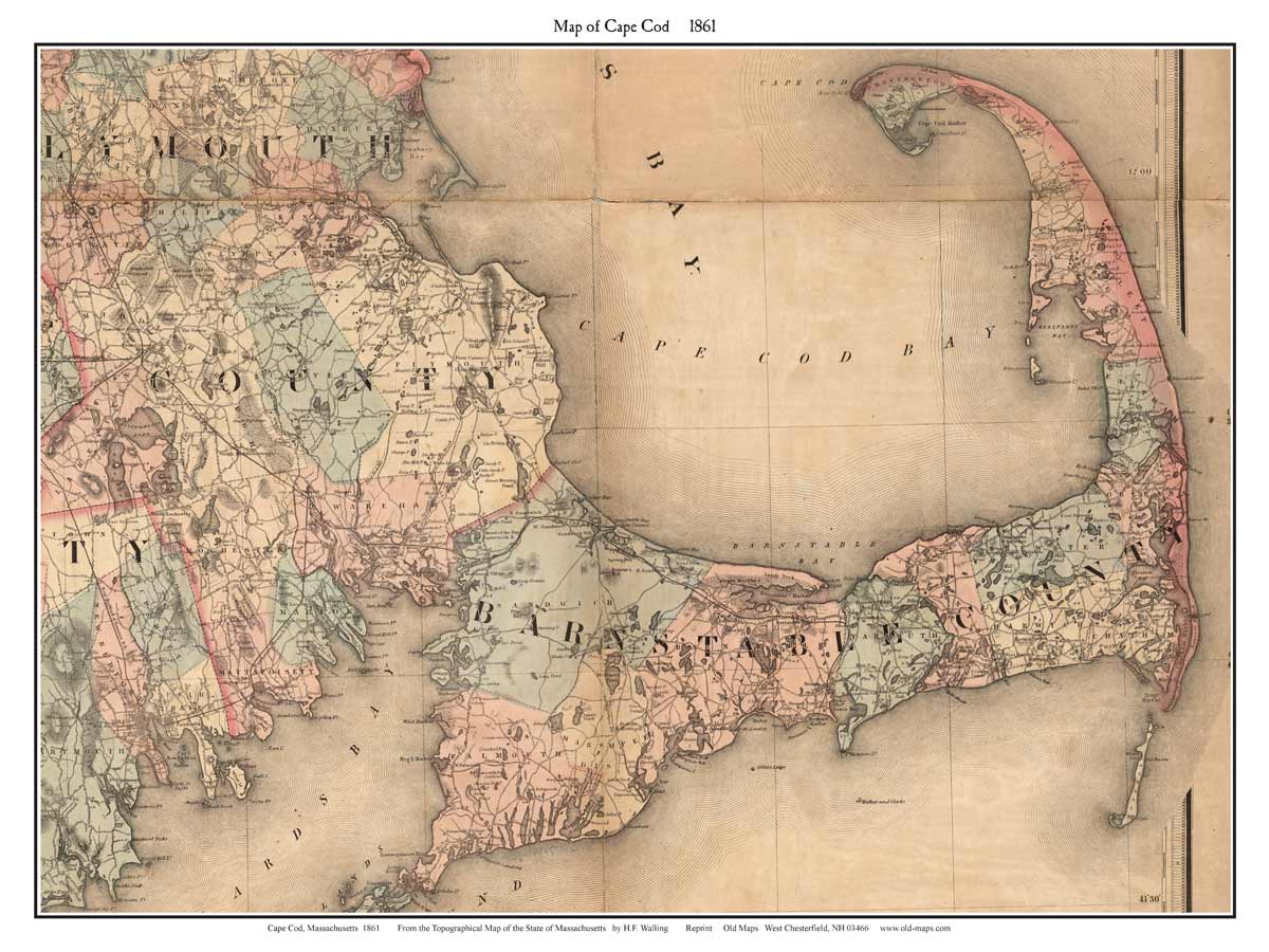
1861 Maps of Cape Cod
Prints from the detailed state map |
|
Roads, houses, placenames and principal features. A
hard-to-find early map. |
|
Click here to purchase this map |
Click here to purchase this map |

Cape Cod & Islands |

Cape Cod Only |
|
To see a more detailed copy of the map click on the maps above. The images you will see
are low-resolution for web
viewing, but you can see the extent of the road network in your town.
|
These maps were excerpted from the 1861 Topographical Map of
Massachusetts by H.F. Walling, An important road map of the Cape,
showing placenames. roads, rivers and every house.
The base map used by Walling was Simeon
Borden's 1844 map, a highly accurate survey map. Walling's map
is most valuable because of the addition of what appears to be every
house and business on the Cape. |
|
|
|
|
|