Maps of Westfield, Massachusetts for its 350th Anniversary
This year, Westfield, Massachusetts is celebrating 350 years since it’s founding. On our website, we have multiple maps of Westfield through the years.
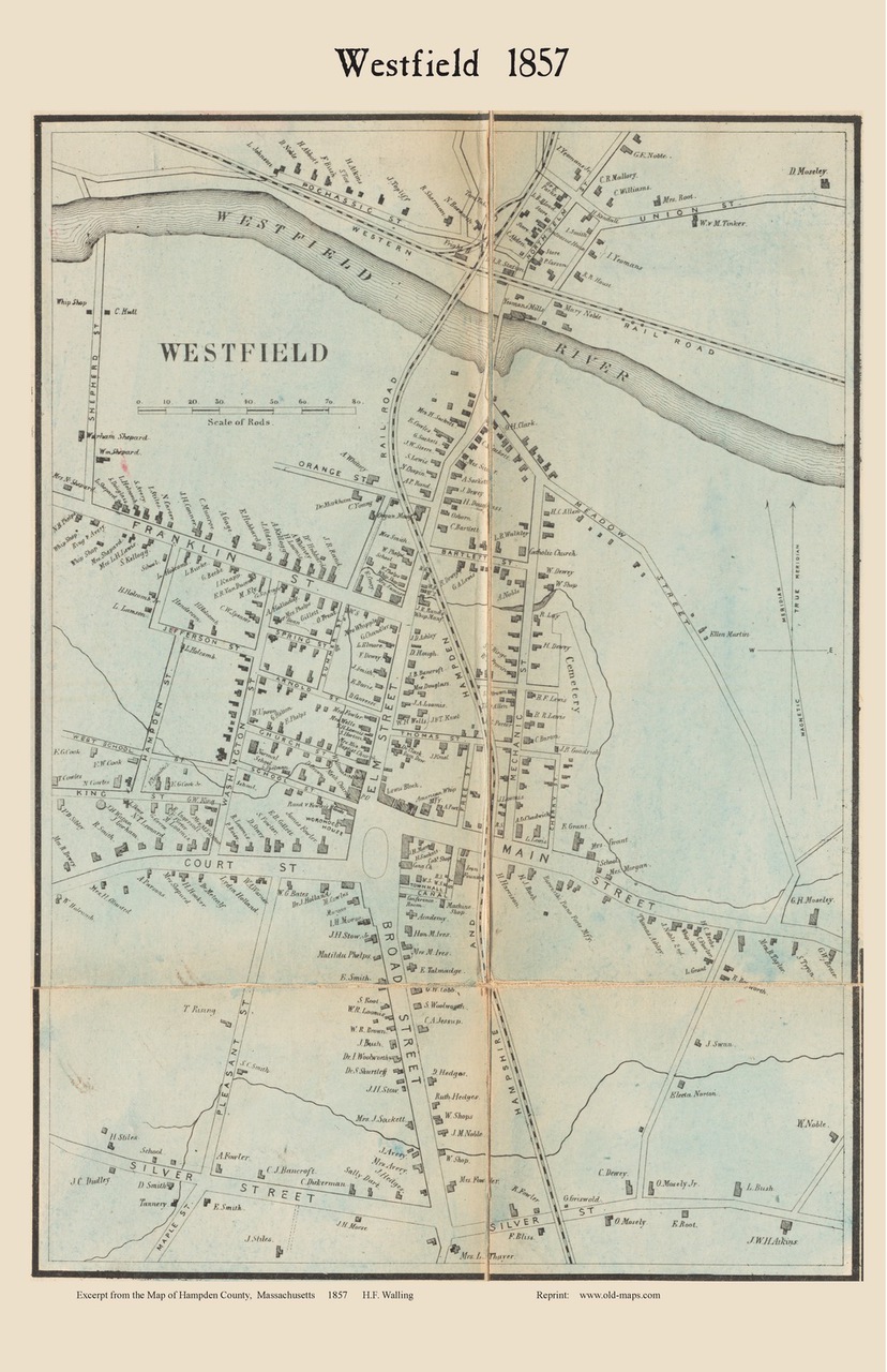
 One of our oldest maps of Westfield is this town map taken from the 1857 county wall map of Hampden County, Massachusetts by H.F. Walling. This is a detailed map that shows all the houses and homeowner names.

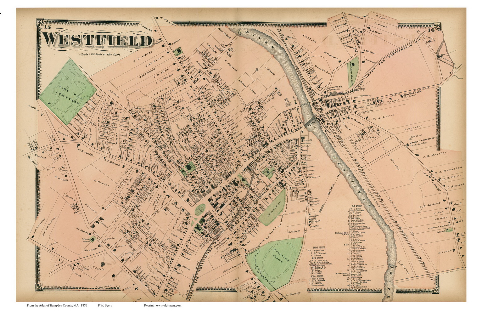
 We also have the map of Westfield Village, which was taken from the same county map.

A more detailed map of Downtown Westfield from the same atlas is also available.
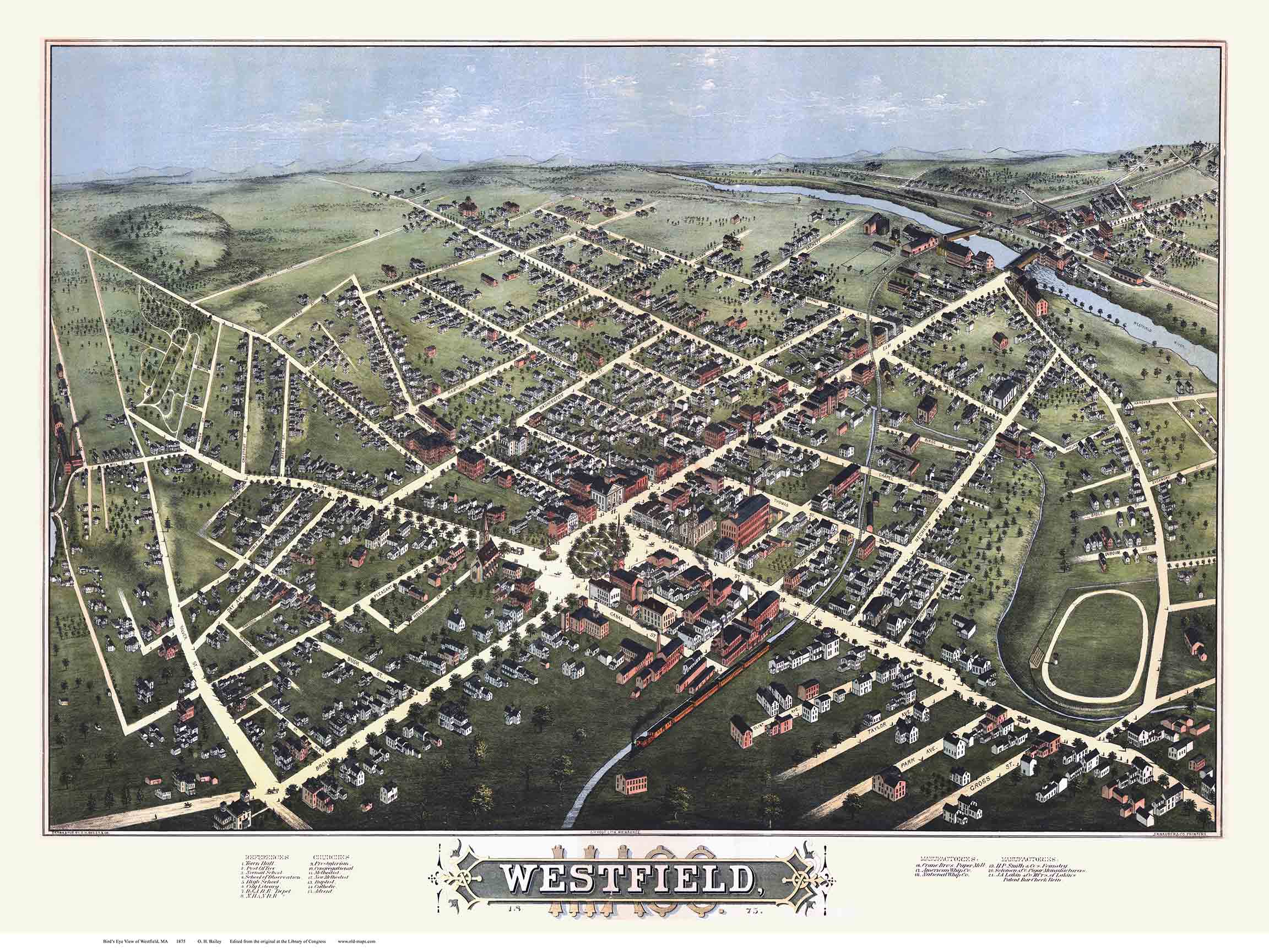
We also have this colorful bird’s eye view of Westfield from 1875 by O. H. Bailey & Co.


Prints of all of these maps of Westfield and more can be seen at our website shop.old-maps.com.