
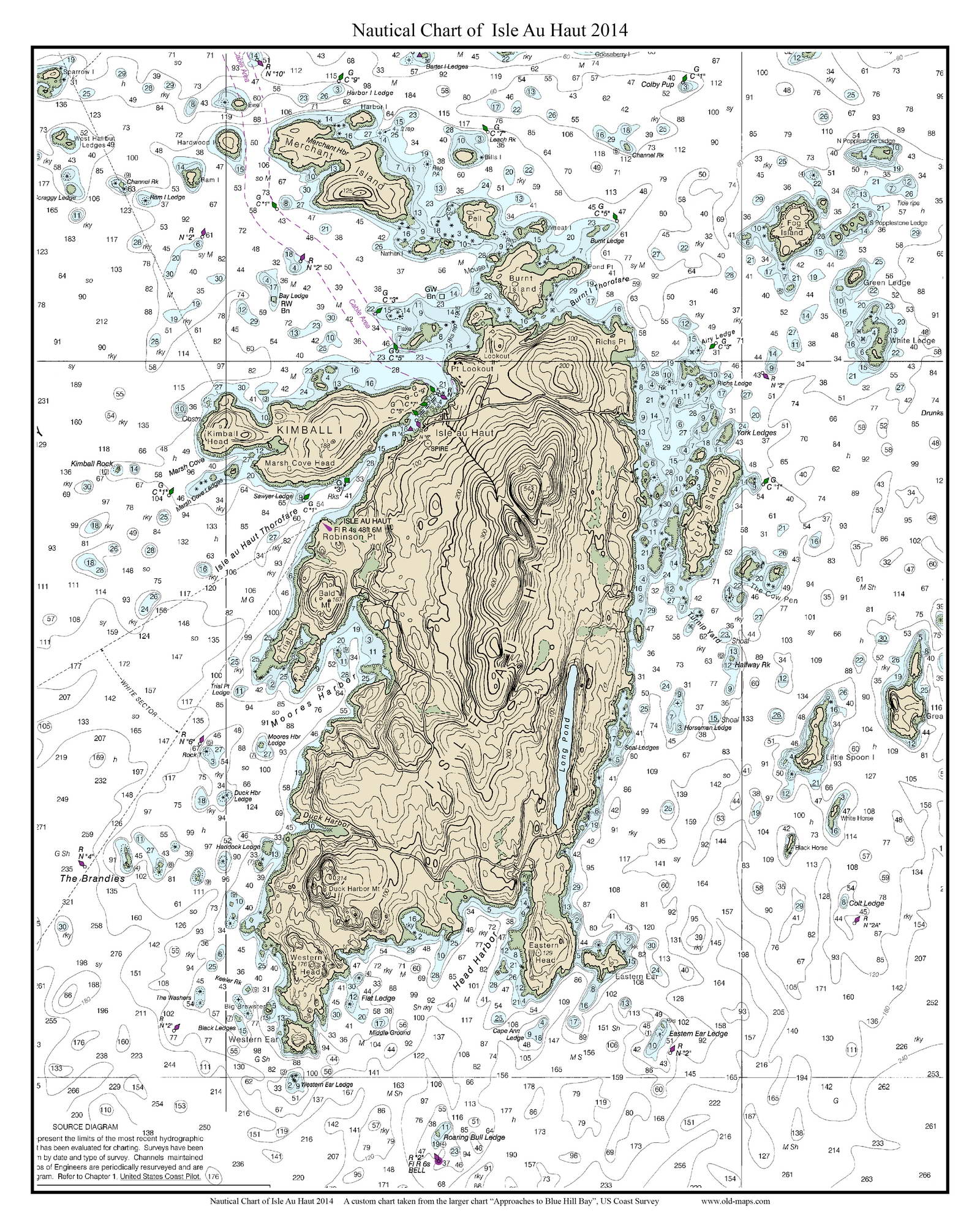
New Addition: Nautical Charts of Isle Au Haut in 2014
We have just created two “new” nautical charts of Isle Au Haut.
We took the original NOAA Nautical Chart “Approaces to Blue Hill Bay” from 2014 and cropped out Isle Au Haut and it’s surroundings to create two custom charts.

The first map is a close-up view of the island and it’s surroundings. making the details on this map very easy to see.

We have also created a second, slightly larger map of Isle Au Haut & Stonington, showing Stonington village, Isle Au Haut, and the islands inbetween.
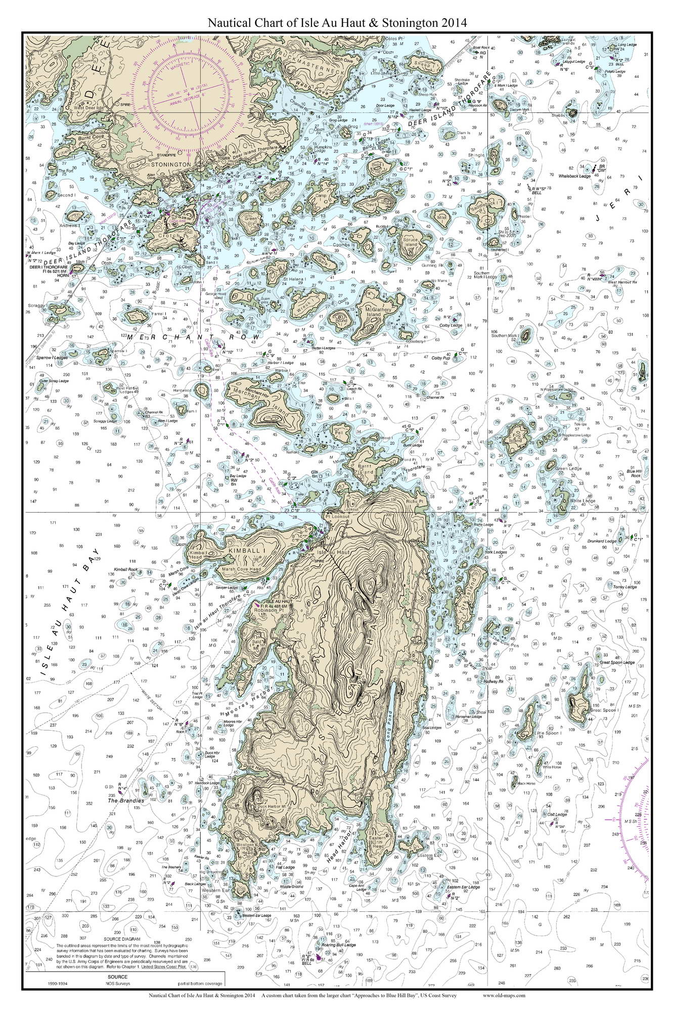

Prints of these charts and other Maine Nautical Charts can be purchased at our website shop.old-maps.com.