Yates County NY 1865 map – old-maps.com
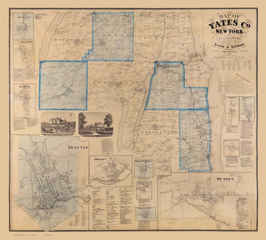
Yates County New York is situated in the Finger Lakes Region and it touches three of the lakes – Canandaigua, Keuka and Seneca. We recently acquired a copy of the 1865 county wall map , and after some significant editing now offer it as a wall map and as separate Town Prints. The wall map measures about 4 feet square. More about this map and the 1852, 1854 and 1855 maps below.
**** click on the map to see sizes available. At web page find “Click to view a large version…” ****
=====================================

We have “chopped up” the county wall map into separate town maps like the Jerusalem map to the left.
This map is 13″ x 17″ as shown and is offered at several sizes, starting at a slightly reduced 11″ x 14″.
!6″ x 20 ” is best size for legibility as the orignal text is quite small.
**** click on the map to see all sizes available. At web page find “Click to view a large version…” to zoom in... ****

The 1865 map shows every road and every house wit the owners name – a wonderful historical record today.
Note the “Grape Lands” on this closeup from Jerusalem.
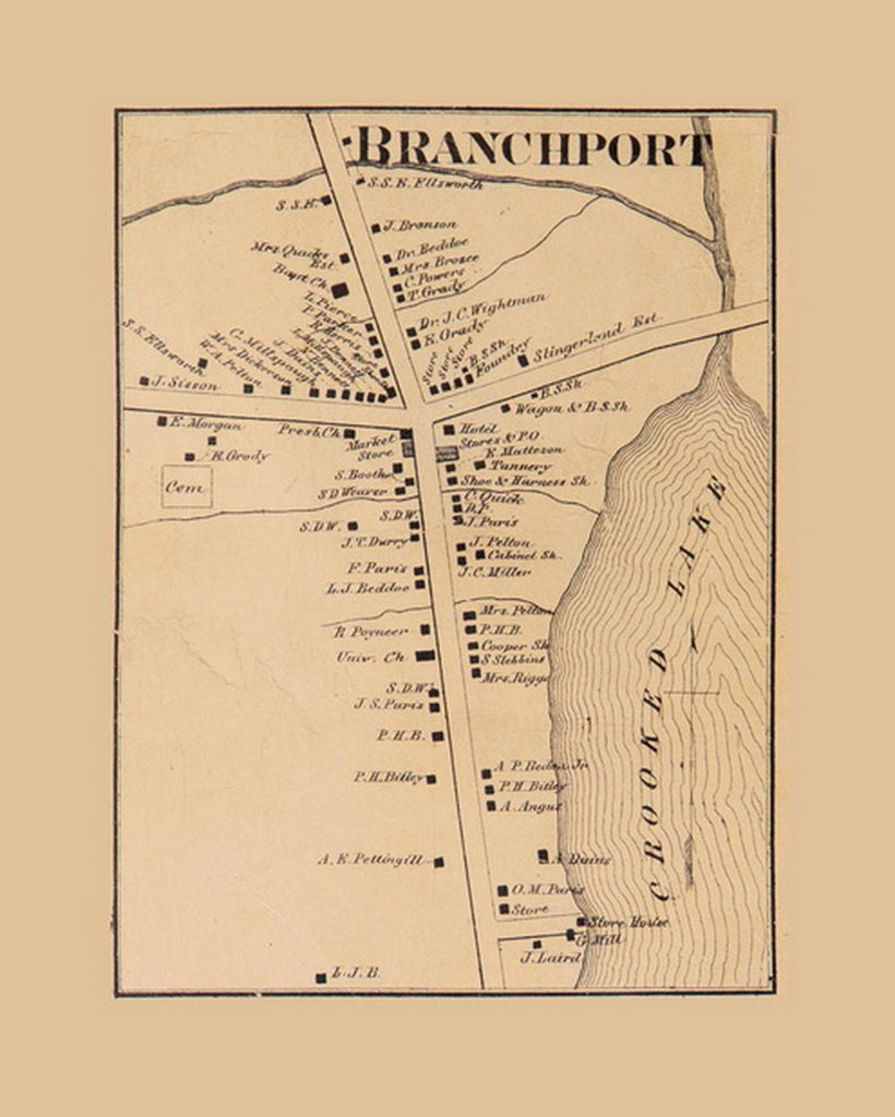
Branchport Village was (and is) the largest settlement in Jerusalem.
If you look at the wall map above, you will see this inset map in the upper left.
We have added some tone to enlarge the margins – we think this makes the map look a bit nicer.
Original size is 6″ x 7″ . Offered at 11×14 and 16×20.
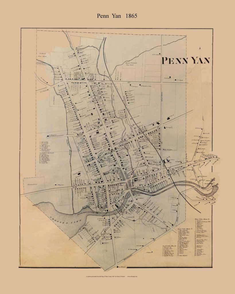
Penn Yan was the largest settlement in Yates County and it had an active railroad in 1865.
For our village print we cleaned up the edges, made the box outline a simple rectangle and added margins and a title.
The print is 19″ x 24 ” at the original scale, and is offered in different sizes starting at 16″ x 20″.
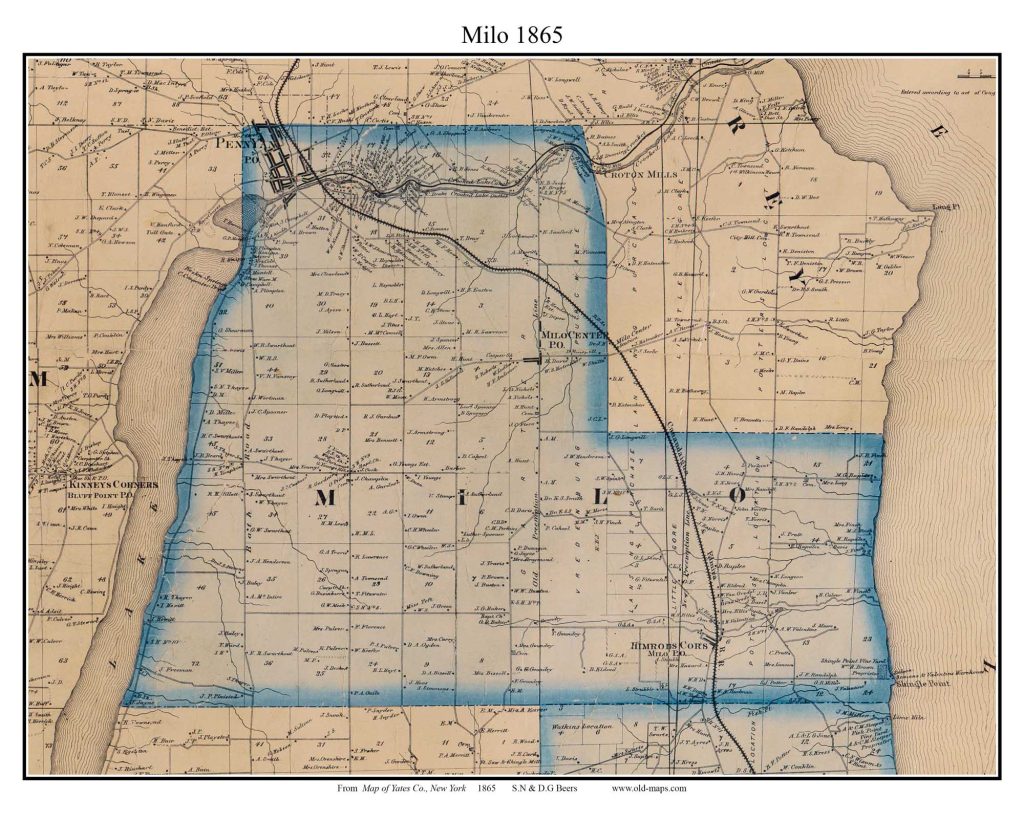
Penn Yan is in the Town of Milo on the 1865 map, with frontage (then and now) on Keuka Lake and Seneca Lake.
Note the railroad snaking through town.
This print is 13 x 17 at original size.

Milo Township includes the small village of Himrods Corners (now Himrods) where in 1862 Frederick Douglass gave a speech to 2000 people.
We made this special map with the village atop the town areas so you can see the site and the railroad line for context.
Some documents state that Douglass spoke in Starkey, but that is the next town south of Milo.
This print is an 11″ x 14″
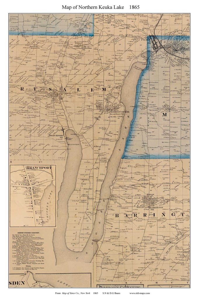
Because the lake is so important to this area, we made a special “Keuka Lake North” print that shows all the shoreline landowners in Yates County in 1865.
This is an 11″ x 17″ print.
But what about the rest of the lake?
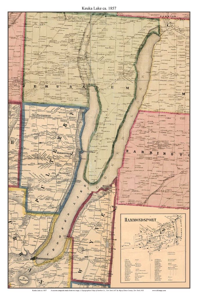
We made a special composite map of the entire Keuka Lake using the map above and the matching area from the Steuben County 1857 map.
We inserted the Hammondsport village map in lower right corner. Penn Yan, the other large village, is too large for this sheet.
The original size is 20 x 30. Prints are available at many sizes for this unique map which we expect will be quite popular.
We have 23 town and village extracts from the 1865 map.

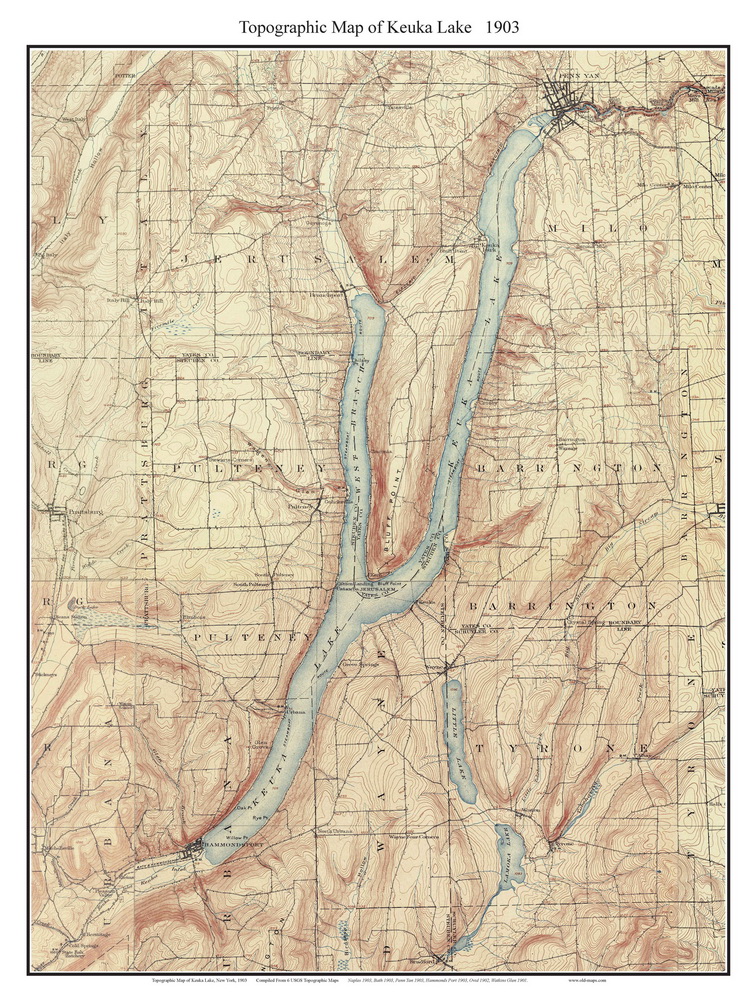
The Keuka Lake 1903 map was designed as an 18″ x 24″ print, and can be ordered as a 24×32 or larger.
This map is quite attractive because the oldest USGS maps are less detailed than modern ones ad thus less have a less clutterred appearance.
We also have a similar maps of Canandaigua Lake and Seneca Lake.


